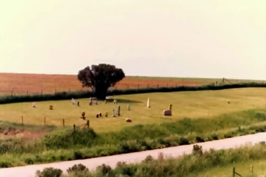
| Memorials | : | 2 |
| Location | : | Fennimore, Grant County, USA |
| Coordinate | : | 42.9675000, -90.6359000 |
| Description | : | Section 29, Township 6 North, Range 2 West, Fennimore Twp., Grant County Wisconsin. On the corner of McGhan Road (East/West) and Bronson Road/McGhan Road (North/South). McGhan Road (East/West) intersects Highway 61 south of Fennimore - Bronson Road/McGhan Road intersects Highway 18 East of Fennimore. From Highway 61, head East on McGhan Road. From Bronson Road/McGhan Road head due South at the Southwestern Wisconsin Technical College in Fennimore. Bronson Road seems to be the name at the intersection of Highway 18 to the North. Silas S. McGhan purchased his homestead from James Dow on 11 Jun... Read More |
frequently asked questions (FAQ):
-
Where is McGhan Cemetery?
McGhan Cemetery is located at Fennimore, Grant County ,Wisconsin ,USA.
-
McGhan Cemetery cemetery's updated grave count on graveviews.com?
2 memorials
-
Where are the coordinates of the McGhan Cemetery?
Latitude: 42.9675000
Longitude: -90.6359000
Nearby Cemetories:
1. Stitzer United Methodist Church Cemetery
Stitzer, Grant County, USA
Coordinate: 42.9326000, -90.6262000
2. Stitzer Presbyterian Cemetery
Stitzer, Grant County, USA
Coordinate: 42.9325100, -90.6261800
3. Switzer Cemetery
Fennimore, Grant County, USA
Coordinate: 43.0025400, -90.6261500
4. Prairie Cemetery
Fennimore, Grant County, USA
Coordinate: 42.9893990, -90.6753006
5. Saint Marys Catholic Church Cemetery
Fennimore, Grant County, USA
Coordinate: 42.9895500, -90.6763300
6. Shady Grove Mennonite Church Cemetery
Fennimore, Grant County, USA
Coordinate: 42.9518600, -90.5856500
7. Weaverland Conference Cemetery
Fennimore, Grant County, USA
Coordinate: 42.9918220, -90.5876210
8. Stitzer Lutheran Cemetery
Stitzer, Grant County, USA
Coordinate: 42.9231600, -90.6224500
9. German Cemetery
Fennimore, Grant County, USA
Coordinate: 43.0313988, -90.6213989
10. Dyer Cemetery
Fennimore, Grant County, USA
Coordinate: 42.9163600, -90.7082000
11. Ebenezer Cemetery
Annaton, Grant County, USA
Coordinate: 42.9516983, -90.5363998
12. Bethel Cemetery
Hickory Grove, Grant County, USA
Coordinate: 43.0393982, -90.6656036
13. Saint Pauls United Church of Christ Cemetery
Lancaster, Grant County, USA
Coordinate: 42.8890500, -90.6607270
14. Mount Zion Cemetery
Lancaster, Grant County, USA
Coordinate: 42.9420662, -90.7445374
15. Cass Hollow Cemetery
Wingville, Grant County, USA
Coordinate: 43.0018100, -90.5287600
16. Borah Cemetery
Mount Ida, Grant County, USA
Coordinate: 42.9606018, -90.7596970
17. Castle Rock Lutheran Cemetery
Hickory Grove, Grant County, USA
Coordinate: 43.0374900, -90.5520700
18. Mount Ida Cemetery
Mount Ida, Grant County, USA
Coordinate: 42.9744640, -90.7656100
19. Crown Hill Cemetery
Fennimore, Grant County, USA
Coordinate: 43.0393982, -90.7352982
20. Ellis - Harelson Cemetery
Lancaster, Grant County, USA
Coordinate: 42.8713990, -90.7033550
21. Homer Cemetery
Homer, Grant County, USA
Coordinate: 43.0863950, -90.6220580
22. Farview-Hake Cemetery
Union, Grant County, USA
Coordinate: 42.8638000, -90.5468400
23. Brechler Cemetery
Woodman, Grant County, USA
Coordinate: 43.0758018, -90.7332993
24. McKenzie-Day Cemetery
North Lancaster, Grant County, USA
Coordinate: 42.8944560, -90.7832250

