| Memorials | : | 8 |
| Location | : | Clyde, Nodaway County, USA |
| Coordinate | : | 40.2578468, -94.6635284 |
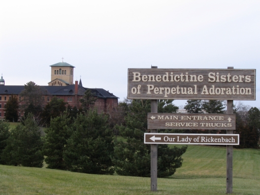
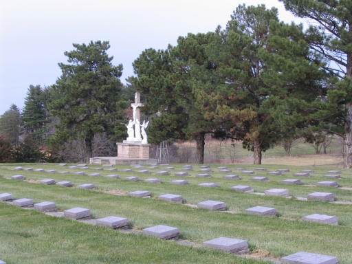
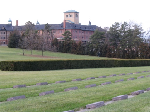
| Description | : | This cemetery is only used for the burial of nuns from the convent. |
frequently asked questions (FAQ):
-
Where is Mount Calvary Cemetery?
Mount Calvary Cemetery is located at Clyde, Nodaway County ,Missouri ,USA.
-
Mount Calvary Cemetery cemetery's updated grave count on graveviews.com?
8 memorials
-
Where are the coordinates of the Mount Calvary Cemetery?
Latitude: 40.2578468
Longitude: -94.6635284
Nearby Cemetories:
1. Dom Lukas Etlin Gravesite
Clyde, Nodaway County, USA
Coordinate: 40.2584100, -94.6668300
2. Saint Columba Cemetery
Conception, Nodaway County, USA
Coordinate: 40.2431107, -94.6842957
3. Robinson
Ravenwood, Nodaway County, USA
Coordinate: 40.3110800, -94.7029640
4. Swinford Cemetery
Barnard, Nodaway County, USA
Coordinate: 40.2570190, -94.7569427
5. Monroe Cemetery
Ravenwood, Nodaway County, USA
Coordinate: 40.3292007, -94.6055984
6. Sharp Cemetery
Barnard, Nodaway County, USA
Coordinate: 40.2176190, -94.7630450
7. Mount Calvary Cemetery
Stanberry, Gentry County, USA
Coordinate: 40.2273788, -94.5459137
8. High Ridge Cemetery
Stanberry, Gentry County, USA
Coordinate: 40.2267500, -94.5457500
9. Graves Cemetery
Guilford, Nodaway County, USA
Coordinate: 40.1730995, -94.7276764
10. Liggett Cemetery
Gentry County, USA
Coordinate: 40.2892500, -94.5405900
11. Weathermon Cemetery
Guilford, Nodaway County, USA
Coordinate: 40.1683998, -94.7240829
12. Oak Lawn Cemetery
Ravenwood, Nodaway County, USA
Coordinate: 40.3605690, -94.6688232
13. Sweet Home Cemetery
Ravenwood, Nodaway County, USA
Coordinate: 40.3671989, -94.6438980
14. Groves Cemetery
Guilford, Nodaway County, USA
Coordinate: 40.1567001, -94.7221985
15. Cooper Cemetery
Stanberry, Gentry County, USA
Coordinate: 40.1885986, -94.5492020
16. Finders Cemetery
Gentry County, USA
Coordinate: 40.3436012, -94.5616989
17. Lafayette Cemetery
Guilford, Nodaway County, USA
Coordinate: 40.1478806, -94.6112366
18. Depriest Cemetery
Stanberry, Gentry County, USA
Coordinate: 40.2275200, -94.5146900
19. Meeker Cemetery
Gentry County, USA
Coordinate: 40.1481018, -94.5969009
20. Jennings Cemetery
Alanthus Grove, Gentry County, USA
Coordinate: 40.3174240, -94.5246290
21. Pleasant Hill Cemetery
Enyart, Gentry County, USA
Coordinate: 40.3343506, -94.5382233
22. Grantham Cemetery
Alanthus Grove, Gentry County, USA
Coordinate: 40.3658300, -94.5832300
23. Oak Hill East Cemetery
Maryville, Nodaway County, USA
Coordinate: 40.3447609, -94.7835464
24. Hussey Cemetery
Gentry County, USA
Coordinate: 40.2200012, -94.4996567


