| Memorials | : | 9 |
| Location | : | Frome, Mendip District, England |
| Coordinate | : | 51.1957520, -2.3012529 |
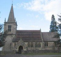
| Description | : | General Information The church was built and paid for by Longleat between 1711 and 1714 and was consecrated in 1811. There was significant 'restoration' work in the 1870's by the architect John Loughborough Pearson. Regular services are held on the first and third Sunday of each month. First Sunday is usually Holy Communion (Common Worship) and the third Sunday is Morning Service. On the last Sunday in August there is a 'Songs of Praise' format service. Cream Teas are served in the adjacent Village Hall on Sunday afternoons in August. A week of music hall is held each year in the Village Hall. |
frequently asked questions (FAQ):
-
Where is St. Katherine's Churchyard?
St. Katherine's Churchyard is located at Frome, Mendip District ,Somerset ,England.
-
St. Katherine's Churchyard cemetery's updated grave count on graveviews.com?
9 memorials
-
Where are the coordinates of the St. Katherine's Churchyard?
Latitude: 51.1957520
Longitude: -2.3012529
Nearby Cemetories:
1. St Leonard Church
Marston Magna, South Somerset District, England
Coordinate: 51.2058070, -2.3488020
2. East Hill
Frome St Quintin, West Dorset District, England
Coordinate: 51.2272132, -2.3024896
3. East Hill Cemetery
Frome, Mendip District, England
Coordinate: 51.2275940, -2.3030250
4. St. Leonard's Churchyard
Mendip District, England
Coordinate: 51.2033660, -2.3512620
5. All Saints Churchyard
Rodden, Mendip District, England
Coordinate: 51.2283600, -2.2892740
6. St. John the Baptist Churchyard
Frome, Mendip District, England
Coordinate: 51.2296780, -2.3209480
7. Christ Church Churchyard
Frome, Mendip District, England
Coordinate: 51.2295340, -2.3260130
8. Sheppards Barton Meeting House Burial Ground
Frome, Mendip District, England
Coordinate: 51.2300570, -2.3247620
9. Frome Dissenters' Cemetery
Frome, Mendip District, England
Coordinate: 51.2317000, -2.3215000
10. St. Margaret Churchyard Extension
Corsley, Wiltshire Unitary Authority, England
Coordinate: 51.2191491, -2.2469419
11. Holy Trinity Church
Frome, Mendip District, England
Coordinate: 51.2341720, -2.3275820
12. Byfields Cemetery
Nunney, Mendip District, England
Coordinate: 51.2077210, -2.3722630
13. St Mary's Church
Witham Friary, Mendip District, England
Coordinate: 51.1686850, -2.3676100
14. All Saints Churchyard
Nunney, Mendip District, England
Coordinate: 51.2098694, -2.3772340
15. St. Mary's Berkley
Berkley, Mendip District, England
Coordinate: 51.2435080, -2.2720990
16. St. Mary's Churchyard
Mendip District, England
Coordinate: 51.1942400, -2.3928700
17. St George's Churchyard
Whatley, Mendip District, England
Coordinate: 51.2270030, -2.3822140
18. Saint Mary Magdalene Churchyard
Great Elm, Mendip District, England
Coordinate: 51.2426040, -2.3647230
19. St Mary the Virgin Churchyard
Orchardleigh, Mendip District, England
Coordinate: 51.2576210, -2.3259440
20. Beckington Baptist Chapel Burial Ground
Beckington, Mendip District, England
Coordinate: 51.2610760, -2.2897000
21. St George Churchyard
Beckington, Mendip District, England
Coordinate: 51.2635260, -2.2856810
22. All Saints Churchyard
Lullington, Mendip District, England
Coordinate: 51.2661940, -2.3121800
23. Saint Michael & All Angels Churchyard
Buckland Dinham, Mendip District, England
Coordinate: 51.2600540, -2.3522580
24. St Andrew Churchyard
Mells, Mendip District, England
Coordinate: 51.2420710, -2.3912060

