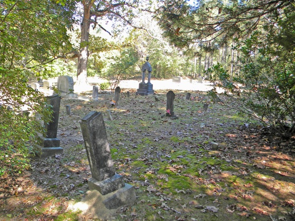
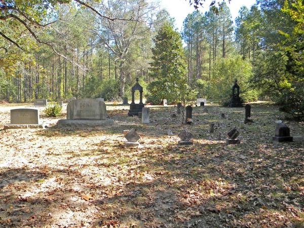
| Memorials | : | 0 |
| Location | : | Chesterfield, Chesterfield County, USA |
| Coordinate | : | 34.7583530, -80.0463330 |
| Description | : | WARNING **** WARNING **** WARNING : When visiting this cemetery be sure to have a friend and a cell phone with you. In the summer of 2009 a Teal Family descendant was attacked by a wild dog while visiting this cemetery! Directions: From the intersection of Page Street (aka Hwy. 145) and Main Street in Chesterfield, travel east on Main Street to the Chesterfield Baptist Chruch on the left. Turn left onto Craig Street. Travel on Craig Street, which later turns into Buchanan Bridge Road, to the Intersection of Jackson Road. Turn left onto Jackson Road and then take the next... Read More |
frequently asked questions (FAQ):
-
Where is Teal Family Cemetery?
Teal Family Cemetery is located at Intersection of Teal Cemetery Road and Eddins Road Chesterfield, Chesterfield County ,South Carolina ,USA.
-
Teal Family Cemetery cemetery's updated grave count on graveviews.com?
0 memorials
-
Where are the coordinates of the Teal Family Cemetery?
Latitude: 34.7583530
Longitude: -80.0463330
Nearby Cemetories:
1. Davis Cemetery
Chesterfield, Chesterfield County, USA
Coordinate: 34.7676600, -80.0456570
2. Rivers Family Cemetery
Chesterfield, Chesterfield County, USA
Coordinate: 34.7484950, -80.0539370
3. Rivers Cemetery
Chesterfield, Chesterfield County, USA
Coordinate: 34.7433100, -80.0484090
4. Zoar United Methodist Church Cemetery
Brocks Mill, Chesterfield County, USA
Coordinate: 34.7648277, -80.0217819
5. Privett Family Cemetery
Chesterfield, Chesterfield County, USA
Coordinate: 34.7658230, -80.0220910
6. Davis Family Cemetery
Chesterfield, Chesterfield County, USA
Coordinate: 34.7402992, -80.0605774
7. Pine Grove Baptist Church Cemetery
Chesterfield County, USA
Coordinate: 34.7366982, -80.0500031
8. Pleasant Grove AME Zion Church Cemetery
Chesterfield, Chesterfield County, USA
Coordinate: 34.7587490, -80.0172040
9. Confederate Soldier Burial Ground
Chesterfield, Chesterfield County, USA
Coordinate: 34.7300670, -80.0416230
10. Bittle Family Cemetery
Chesterfield, Chesterfield County, USA
Coordinate: 34.7535050, -80.0828380
11. Friendship United Methodist Church Cemetery
Chesterfield, Chesterfield County, USA
Coordinate: 34.7655983, -80.0883026
12. Southern Grace Church
Chesterfield, Chesterfield County, USA
Coordinate: 34.7234820, -80.0300720
13. Sellers Cemetery
Brocks Mill, Chesterfield County, USA
Coordinate: 34.7604070, -79.9992870
14. Dred Cemetery
Chesterfield, Chesterfield County, USA
Coordinate: 34.7821920, -80.0837230
15. Smith Cemetery
Chesterfield, Chesterfield County, USA
Coordinate: 34.7974840, -80.0480710
16. Sowell Cemetery
Chesterfield, Chesterfield County, USA
Coordinate: 34.7654220, -80.0933680
17. Craig Family Cemetery
Chesterfield County, USA
Coordinate: 34.7349520, -80.0847960
18. Westfield Creek Baptist Church Cemetery
Chesterfield County, USA
Coordinate: 34.7888985, -80.0108032
19. Chesterfield Cemetery
Chesterfield, Chesterfield County, USA
Coordinate: 34.7338982, -80.0911026
20. Stroud Family Cemetery
Chesterfield, Chesterfield County, USA
Coordinate: 34.7919380, -80.0813360
21. Brocks Mill Baptist Church Cemetery Annex
Brocks Mill, Chesterfield County, USA
Coordinate: 34.7578990, -79.9919590
22. Brocks Mill Baptist Church Cemetery
Chesterfield, Chesterfield County, USA
Coordinate: 34.7582730, -79.9917660
23. Short Family Cemetery
Chesterfield County, USA
Coordinate: 34.7931670, -80.0118550
24. Chesterfield Community Cemetery
Chesterfield, Chesterfield County, USA
Coordinate: 34.7245210, -80.0822480


