| Memorials | : | 0 |
| Location | : | Upper Freestone, Southern Downs Region, Australia |
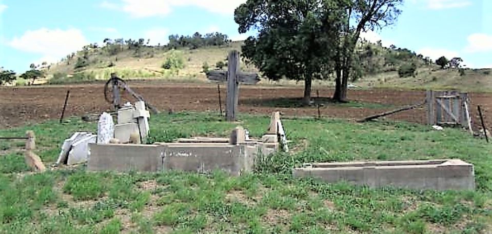
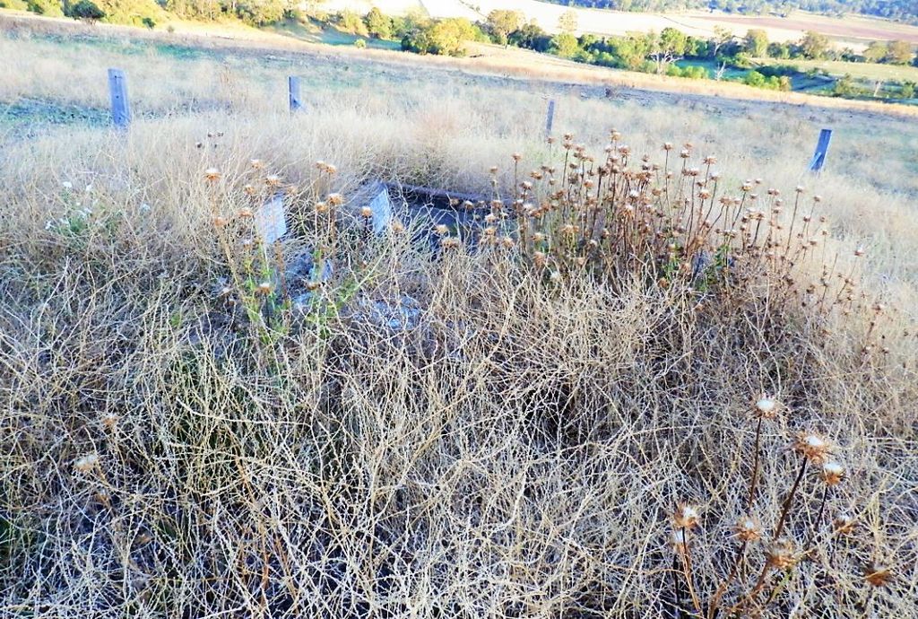
| Description | : | The township of Freestone was a station on the now disassembled Warwick to Maryvale trail line. There is what appears to be an ex-church (possibly Catholic) now a house in town near where the train station and line crossing would have been. There is an operating Anglican church on the road to Upper Freestone. The Upper Freestone cemetery is literally in the middle of a plowed field. The remaining graves are mostly from the O'Dempsey family. |
frequently asked questions (FAQ):
-
Where is Upper Freestone Cemetery?
Upper Freestone Cemetery is located at No GPS information available Add GPSMcMasters Road Upper Freestone, Southern Downs Region ,Queensland , 4370Australia.
-
Upper Freestone Cemetery cemetery's updated grave count on graveviews.com?
0 memorials
Nearby Cemetories:
1. Killarney Lawn Cemetery
Killarney, Southern Downs Region, Australia
Coordinate: -28.2229690, 152.0031130
2. John Doro
Stanthorpe, Southern Downs Region, Australia
Coordinate: -28.1027016, 152.0585067
3. Stanthorpe Cemetery
Stanthorpe, Southern Downs Region, Australia
Coordinate: -28.2316590, 151.9833180
4. Yangan Presbyterian Church Cemetery
Yangan, Southern Downs Region, Australia
Coordinate: -28.0669430, 152.2405230
5. Dalveen-Mitchell Family Homestead Cemetery
Dalveen, Southern Downs Region, Australia
Coordinate: -28.2161000, 152.0347600
6. Strath Elbess Cemetery
Dalveen, Southern Downs Region, Australia
Coordinate: -28.2100890, 152.0044080
7. Sylvandale Cemetery
Dalveen, Southern Downs Region, Australia
Coordinate: -28.2106310, 152.0039087
8. Southern Downs Region - Lone Graves
Southern Downs Region, Australia
Coordinate: -28.2089620, 152.0033530
9. Swan Creek Anglican Cemetery
Swan Creek, Southern Downs Region, Australia
Coordinate: -28.1258400, 152.0395700
10. Ballandean Station Cemetery
Ballandean, Southern Downs Region, Australia
Coordinate: -28.0199230, 151.9750720
11. Pratten Cemetery
Pratten, Southern Downs Region, Australia
Coordinate: -27.9037210, 152.0020290
12. Maryvale Cemetery
Maryvale, Southern Downs Region, Australia
Coordinate: -28.0085654, 151.5913366
13. Eden Gardens Memorial Park
Warwick, Southern Downs Region, Australia
Coordinate: -28.2229690, 152.0031130
14. Glengallan Station
Warwick, Southern Downs Region, Australia
Coordinate: -28.1027016, 152.0585067
15. Lone Grave Warwick
Warwick, Southern Downs Region, Australia
Coordinate: -28.2316590, 151.9833180
16. Maryvale Homestead Cemetery
Warwick, Southern Downs Region, Australia
Coordinate: -28.0669430, 152.2405230
17. St Marks Anglican Church Columbarium Wall
Warwick, Southern Downs Region, Australia
Coordinate: -28.2161000, 152.0347600
18. Warwick General Cemetery
Warwick, Southern Downs Region, Australia
Coordinate: -28.2100890, 152.0044080
19. Warwick General Lawn Cemetery
Warwick, Southern Downs Region, Australia
Coordinate: -28.2106310, 152.0039087
20. Warwick War Cemetery
Warwick, Southern Downs Region, Australia
Coordinate: -28.2089620, 152.0033530
21. Warwick-Conway Family Homestead Cemetery
Warwick, Southern Downs Region, Australia
Coordinate: -28.1258400, 152.0395700
22. Allora Cemetery
Allora, Southern Downs Region, Australia
Coordinate: -28.0199230, 151.9750720
23. Headington Hill Lutheran Cemetery
Allora, Southern Downs Region, Australia
Coordinate: -27.9037210, 152.0020290
24. Leyburn Cemetery
Leyburn, Southern Downs Region, Australia
Coordinate: -28.0085654, 151.5913366


