
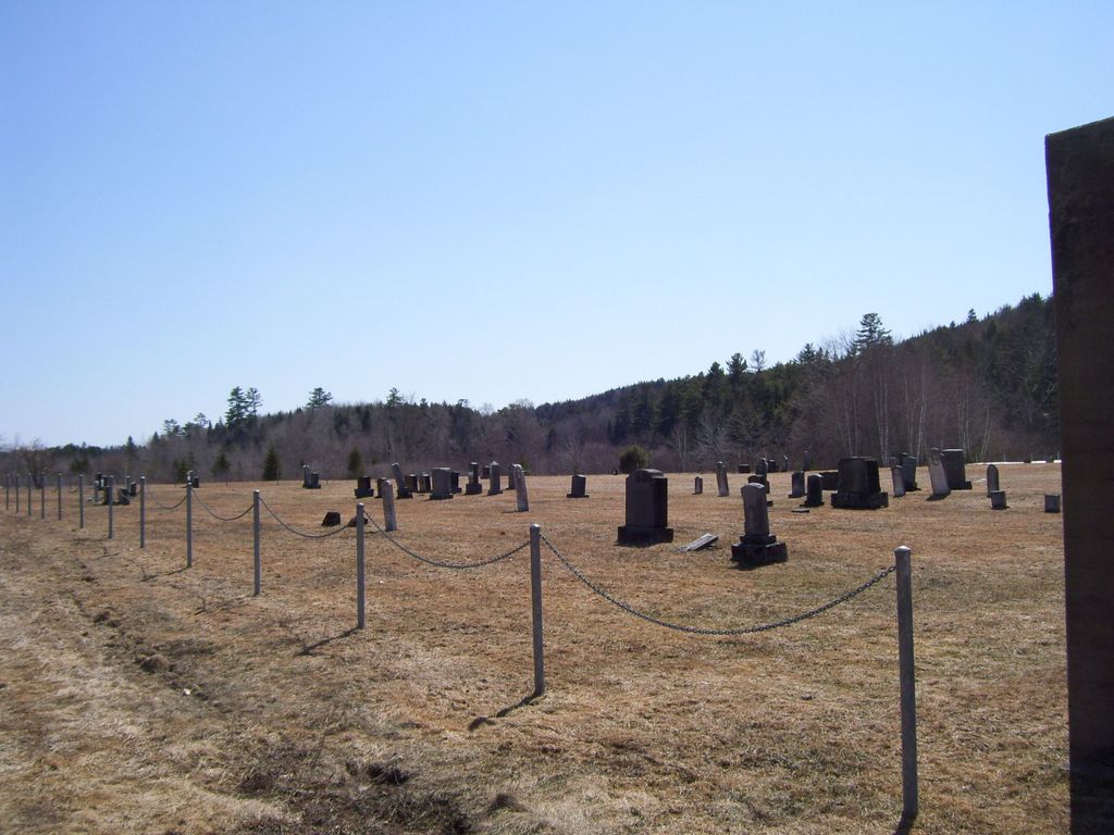
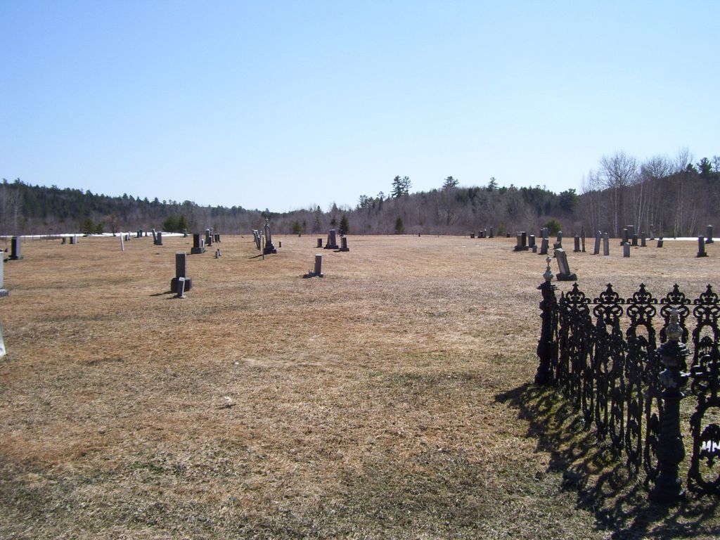
| Memorials | : | 435 |
| Location | : | Nashwaak Bridge, York County, Canada |
| Coordinate | : | 46.2124510, -66.6136600 |
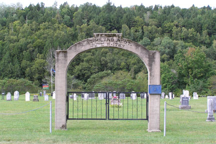
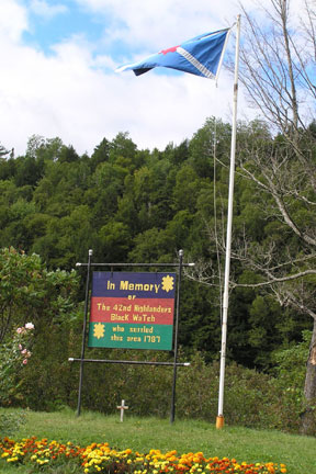
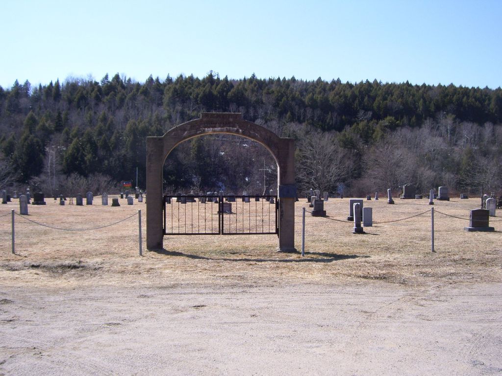
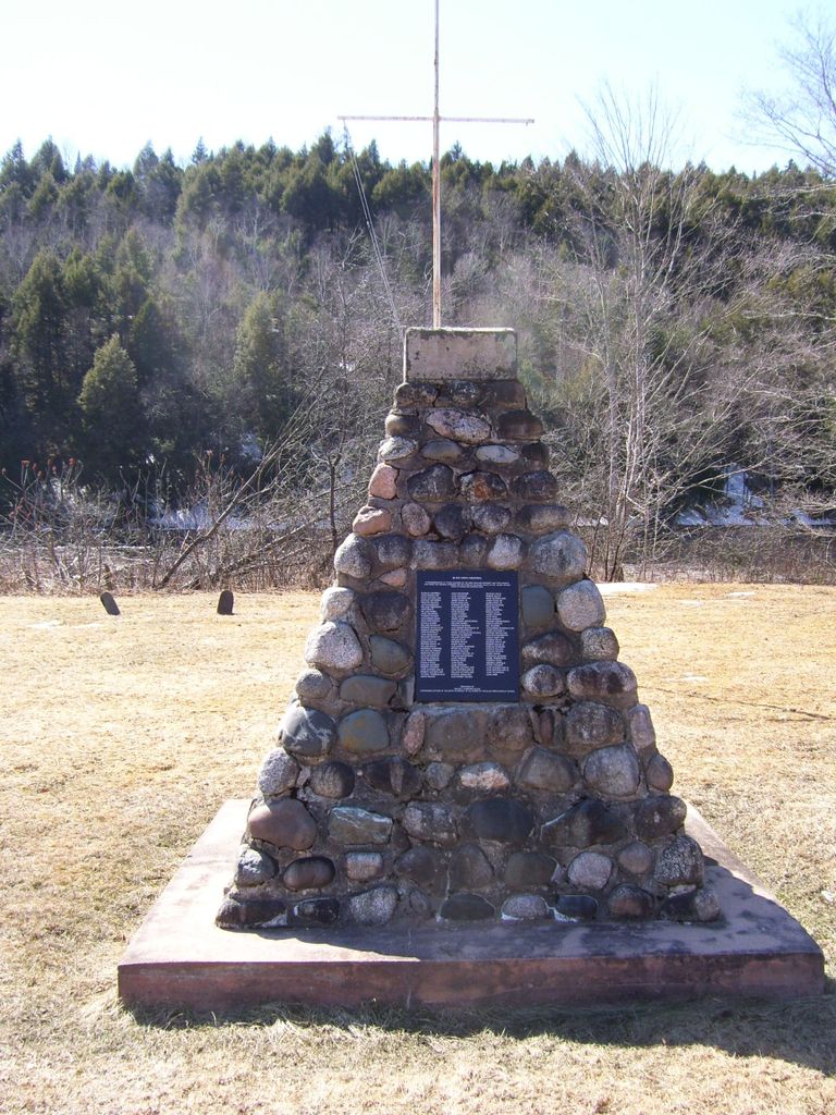
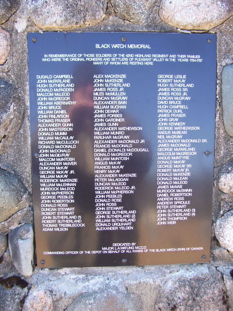
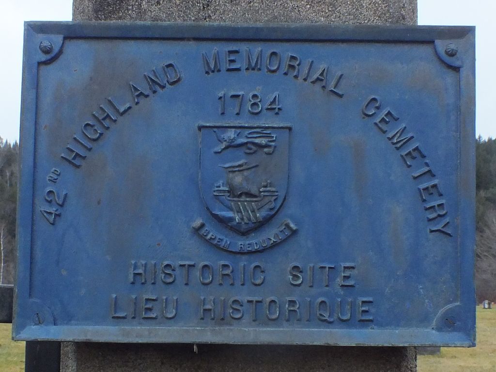
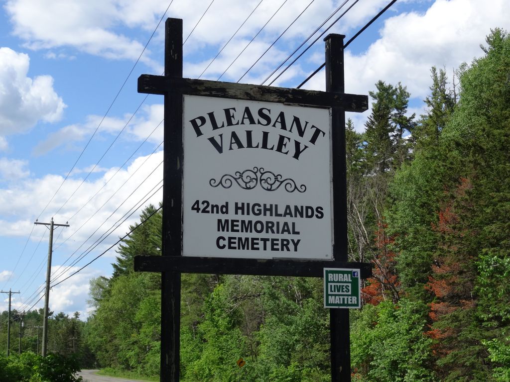
| Description | : | Directions to the 42nd Highland Memorial Cemetery: Route 8 cross the Nashwaak Bridge go about three miles and on the left look for a sign stating Pleasant Valley Black Watch Cemetery. This cemetery is a designated Provincial Historic site, established in 1784 The 42nd ( Black Watch) Regiment was granted land on the Nashwaak River after service in the Revolutionary War. This section of the Nashwaak Valley was known as Pleasant Valley, and is the final resting place for a number of veterans of the 42nd Regiment. |
frequently asked questions (FAQ):
-
Where is 42nd Highland Memorial Cemetery?
42nd Highland Memorial Cemetery is located at Highway 148 Nashwaak Bridge, York County ,New Brunswick ,Canada.
-
42nd Highland Memorial Cemetery cemetery's updated grave count on graveviews.com?
433 memorials
-
Where are the coordinates of the 42nd Highland Memorial Cemetery?
Latitude: 46.2124510
Longitude: -66.6136600
Nearby Cemetories:
1. Nashwaak Valley Pentecostal Church Cemetery
Taymouth, York County, Canada
Coordinate: 46.1919390, -66.6087720
2. Nashwaak Bridge Community Cemetery
Nashwaak Bridge, York County, Canada
Coordinate: 46.2400100, -66.6050900
3. Taymouth Donald Ross original Property
Taymouth, York County, Canada
Coordinate: 46.1828700, -66.6173500
4. Taymouth Urquhart Property
Taymouth, York County, Canada
Coordinate: 46.1822600, -66.6078500
5. Taymouth Bell Property Cemetery
Taymouth, York County, Canada
Coordinate: 46.1814600, -66.6194200
6. Taymouth Community Cemetery
Taymouth, York County, Canada
Coordinate: 46.1796480, -66.6123310
7. Zionville Cemetery
Zionville, York County, Canada
Coordinate: 46.2030300, -66.5371900
8. Saint Peter's Anglican Church Cemetery
Nashwaak, York County, Canada
Coordinate: 46.1229968, -66.6101600
9. Lower Durham Memorial Church Cemetery
Lower Durham, York County, Canada
Coordinate: 46.1259900, -66.5579100
10. Nashwaak Centennial United Church Cemetery
Nashwaak, York County, Canada
Coordinate: 46.1064200, -66.6153400
11. Saint Peter's Presbyterian Cemetery
Stanley, York County, Canada
Coordinate: 46.2737100, -66.7431400
12. Woodland Community Cemetery
Woodlands, York County, Canada
Coordinate: 46.1804680, -66.7667470
13. Old Catholic Cemetery
Stanley, York County, Canada
Coordinate: 46.2810800, -66.7410000
14. St. Patrick’s Roman Catholic Cemetery
Stanley, York County, Canada
Coordinate: 46.2883540, -66.7340490
15. Hillcrest United Church Cemetery
Stanley, York County, Canada
Coordinate: 46.2954581, -66.7315725
16. Cross Creek Baptist Cemetery
Cross Creek, York County, Canada
Coordinate: 46.2965570, -66.7302099
17. Cardigan United Church Cemetery
Cardigan, York County, Canada
Coordinate: 46.1579400, -66.7887300
18. St. Joseph’s Roman Catholic Church Cemetery
Tay Creek, York County, Canada
Coordinate: 46.2082498, -66.8063516
19. Cardigan Welsh Heritage Cemetery
Cardigan, York County, Canada
Coordinate: 46.1462400, -66.7841800
20. Sterling United Church Cemetery
Tay Creek, York County, Canada
Coordinate: 46.2464250, -66.8202667
21. St. James Anglican Church Cemetery
Tay Creek, York County, Canada
Coordinate: 46.2458250, -66.8206984
22. McGivney Community Cemetery
McGivney, York County, Canada
Coordinate: 46.3599900, -66.5568900
23. Penniac United Church Cemetery
Penniac, York County, Canada
Coordinate: 46.0476550, -66.5408610
24. Williamsburg Community Cemetery
Williamsburg, York County, Canada
Coordinate: 46.3383868, -66.7883562