
| Memorials | : | 0 |
| Location | : | Tielt, Arrondissement Tielt, Belgium |
| Coordinate | : | 50.9981460, 3.4176920 |
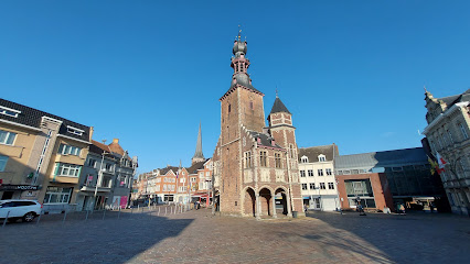
| Description | : | The village of Aarsele is located east of the town of Tielt on the N35 which runs between Tielt and Deinze. Driving into the village towards Deinze take the first turning left into Julesvanooststraat, then take the first turning left into Schoolstraat and the cemetery is on the right. The war graves plot is located at the rear of the cemetery looking in from Schoolstraat. Walking up the central path to the rear it is on the left at the end. There is also a single grave at the front of the cemetery in the front left hand corner, in... Read More |
frequently asked questions (FAQ):
-
Where is Aarsele Communal Cemetery?
Aarsele Communal Cemetery is located at Schoolstraat Tielt, Arrondissement Tielt ,West Flanders (West-Vlaanderen) , 8700Belgium.
-
Aarsele Communal Cemetery cemetery's updated grave count on graveviews.com?
0 memorials
-
Where are the coordinates of the Aarsele Communal Cemetery?
Latitude: 50.9981460
Longitude: 3.4176920
Nearby Cemetories:
1. Kanegem begraafplaats
Tielt, Arrondissement Tielt, Belgium
Coordinate: 51.0142860, 3.4014260
2. Dentergem Communal Cemetery
Dentergem, Arrondissement Tielt, Belgium
Coordinate: 50.9662900, 3.4215700
3. Vinkt Communal Cemetery
Deinze, Arrondissement Gent, Belgium
Coordinate: 51.0077800, 3.4805100
4. Gottem Kerkhof
Deinze, Arrondissement Gent, Belgium
Coordinate: 50.9641500, 3.4635600
5. Ruiselede Communal Cemetery
Ruiselede, Arrondissement Tielt, Belgium
Coordinate: 51.0424100, 3.4016800
6. Poeke
Aalter, Arrondissement Gent, Belgium
Coordinate: 51.0414440, 3.4439830
7. Machelen aan de Leie Churchyard
Zulte, Arrondissement Gent, Belgium
Coordinate: 50.9596400, 3.4842700
8. Lotenhulle Cemetery
Aalter, Arrondissement Gent, Belgium
Coordinate: 51.0506500, 3.4535300
9. Machelen aan de Leie Communal Cemetery
Zulte, Arrondissement Gent, Belgium
Coordinate: 50.9556500, 3.4813900
10. Tielt Communal Cemetery
Tielt, Arrondissement Tielt, Belgium
Coordinate: 51.0009600, 3.3221500
11. Machelen French Military Cemetery
Zulte, Arrondissement Gent, Belgium
Coordinate: 50.9582510, 3.4902030
12. Marialoop Churchyard
Marialoop, Arrondissement Tielt, Belgium
Coordinate: 50.9634434, 3.3288317
13. Schuiferskapelle Communal Cemetery
Tielt, Arrondissement Tielt, Belgium
Coordinate: 51.0353604, 3.3305885
14. Wakken Communal Cemetery
Dentergem, Arrondissement Tielt, Belgium
Coordinate: 50.9300620, 3.3985950
15. Deinze Communal Cemetery
Deinze, Arrondissement Gent, Belgium
Coordinate: 50.9876930, 3.5281990
16. Zulte Communal Cemetery
Zulte, Arrondissement Gent, Belgium
Coordinate: 50.9282400, 3.4389600
17. Poesele Kerkhof
Nevele, Arrondissement Gent, Belgium
Coordinate: 51.0338100, 3.5163800
18. Doomkerke Churchyard
Doomkerke, Arrondissement Tielt, Belgium
Coordinate: 51.0703816, 3.3568957
19. Aalter Communal Cemetery
Aalter, Arrondissement Gent, Belgium
Coordinate: 51.0827140, 3.4463170
20. Sint Eloois Vijve Communal Cemetery
Waregem, Arrondissement Kortrijk, Belgium
Coordinate: 50.9100100, 3.4178600
21. Sint-Baafs-Vijve Churchyard
Wielsbeke, Arrondissement Tielt, Belgium
Coordinate: 50.9089100, 3.3910800
22. Oostrozebeke Communal Cemetery
Oostrozebeke, Arrondissement Tielt, Belgium
Coordinate: 50.9227500, 3.3370100
23. Meulebeke Cemetery
Meulebeke, Arrondissement Tielt, Belgium
Coordinate: 50.9514400, 3.2923900
24. Nevele Communal Cemetery
Nevele, Arrondissement Gent, Belgium
Coordinate: 51.0342090, 3.5532080