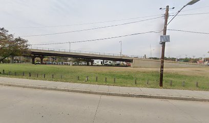
| Memorials | : | 0 |
| Location | : | Brookland, District of Columbia, USA |
| Coordinate | : | 38.9345290, -76.9934620 |
| Description | : | The map location is approximate based upon 1909 map showing Bunker Hill Road extending from 4th Street NE to Otis Street along path of current Michigan Avenue NE. Death certificate reads Addison's Chapel, Bunker Hill Road. Found the below from researching for documents: "The Washington Pocket Directory" compiled by Wm T Raley shows under Cemeteries: Addison's Chapel, Bunker Hill Road. "Addison's Chapel, Bunker Hill Road (Michigan Avenue), NE. RCDC report burials here from 1886-1902, totaling thirty four white and fifteen colored. Residential expansion probably accounts for its demise; however, no documented disinterment evidence of the area was found." - Bury Me... Read More |
frequently asked questions (FAQ):
-
Where is Addisons Chapel Cemetery?
Addisons Chapel Cemetery is located at Michigan Avenue NE Brookland, District of Columbia ,District of Columbia , 20017USA.
-
Addisons Chapel Cemetery cemetery's updated grave count on graveviews.com?
0 memorials
-
Where are the coordinates of the Addisons Chapel Cemetery?
Latitude: 38.9345290
Longitude: -76.9934620
Nearby Cemetories:
1. Basilica of National Shrine of Immaculate Concepti
Washington, District of Columbia, USA
Coordinate: 38.9333330, -77.0005560
2. Franciscan Monastery of the Holy Land Cemetery
Washington, District of Columbia, USA
Coordinate: 38.9375900, -76.9835200
3. Columbian Harmony Cemetery
Washington, District of Columbia, USA
Coordinate: 38.9206500, -76.9958500
4. Saint Anselms Abbey Cemetery
Washington, District of Columbia, USA
Coordinate: 38.9466870, -76.9837870
5. Glenwood Cemetery
Washington, District of Columbia, USA
Coordinate: 38.9233017, -77.0057983
6. US Soldiers' and Airmen's Home National Cemetery
Washington, District of Columbia, USA
Coordinate: 38.9436989, -77.0099640
7. Rock Creek Cemetery
Washington, District of Columbia, USA
Coordinate: 38.9445915, -77.0115128
8. Saint Francis DeSales Cemetery
Langdon, District of Columbia, USA
Coordinate: 38.9244003, -76.9749985
9. Saint Marys Catholic Cemetery
Washington, District of Columbia, USA
Coordinate: 38.9185982, -77.0061035
10. Prospect Hill Cemetery
Washington, District of Columbia, USA
Coordinate: 38.9192009, -77.0077972
11. Mount Olivet Cemetery
Washington, District of Columbia, USA
Coordinate: 38.9118996, -76.9792023
12. Saint Patricks Cemetery
Shaw, District of Columbia, USA
Coordinate: 38.9132996, -77.0139008
13. Saint Patricks Catholic Cemetery (Defunct)
Shaw, District of Columbia, USA
Coordinate: 38.9110985, -77.0124969
14. African American Civil War Memorial
Washington, District of Columbia, USA
Coordinate: 38.9165370, -77.0259690
15. Young Mens Baptist Cemetery
LeDroit Park, District of Columbia, USA
Coordinate: 38.9183330, -77.0283880
16. Columbian College Burying Ground
District of Columbia, USA
Coordinate: 38.9274849, -77.0346190
17. Saint Matthews Catholic Cemetery
Washington, District of Columbia, USA
Coordinate: 38.9180984, -77.0302963
18. Fort Lincoln Cemetery
Brentwood, Prince George's County, USA
Coordinate: 38.9296989, -76.9514008
19. All Souls Unitarian Church Court of the Founders
District of Columbia, USA
Coordinate: 38.9259640, -77.0359702
20. Saint Peters Catholic Burial Ground
Washington, District of Columbia, USA
Coordinate: 38.9006004, -77.0006027
21. Graceland Cemetery (Defunct)
Washington, District of Columbia, USA
Coordinate: 38.9015010, -76.9810860
22. Metropolitan Community Church Columbarium
Shaw, District of Columbia, USA
Coordinate: 38.9062430, -77.0186790
23. Christ Lutheran Church Memorial Garden
Petworth, District of Columbia, USA
Coordinate: 38.9519560, -77.0360790
24. House of the Temple
Washington, District of Columbia, USA
Coordinate: 38.9138000, -77.0359000

