
| Memorials | : | 4 |
| Location | : | Comfort, Boone County, USA |
| Coordinate | : | 38.1300316, -81.5870514 |
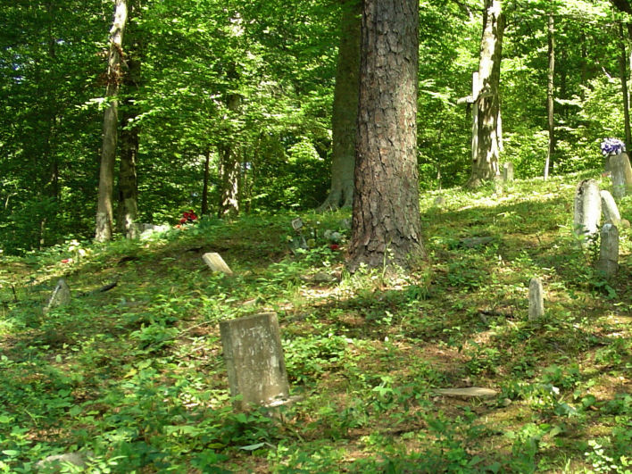
| Description | : | It is up the left-hand fork in Joes Creek, up Edison Lane, and up a creek and on the side of a mountain. The cemetery, doesn't truly have a name, even on the old maps it's just called Cemetery. People call it many names, whatever they want. I assume, they still will. It's a family owned cemetery. So, just I picked one of the 2 most popular and oldest of the names that people called it. PS. After a massive storm in 2014, half of the cemetery is destroyed, there are trees fallen, with the tombstones broken... Read More |
frequently asked questions (FAQ):
-
Where is Adkins Family Cemetery?
Adkins Family Cemetery is located at left-hand fork, up Joes Creek Holler Comfort, Boone County ,West Virginia , 25049USA.
-
Adkins Family Cemetery cemetery's updated grave count on graveviews.com?
4 memorials
-
Where are the coordinates of the Adkins Family Cemetery?
Latitude: 38.1300316
Longitude: -81.5870514
Nearby Cemetories:
1. Ferrell Cemetery
Comfort, Boone County, USA
Coordinate: 38.1296997, -81.6066971
2. Amick Cemetery
Comfort, Boone County, USA
Coordinate: 38.1286030, -81.6153430
3. Meadows Cemetery
Boone County, USA
Coordinate: 38.1286011, -81.6156006
4. Coon Cemetery
Boone County, USA
Coordinate: 38.1225014, -81.6185989
5. Pettry Cemetery
Comfort, Boone County, USA
Coordinate: 38.1189003, -81.5417023
6. Fauber Cemetery
Bloomingrose, Boone County, USA
Coordinate: 38.1458015, -81.6318970
7. Bloomingrose Cemetery
Bloomingrose, Boone County, USA
Coordinate: 38.1408790, -81.6371880
8. Mechanics And Miners Cemetery
Bloomingrose, Boone County, USA
Coordinate: 38.1411018, -81.6374969
9. Indian Creek Cemetery
Boone County, USA
Coordinate: 38.1268997, -81.6541977
10. Evans Family Cemetery
Boone County, USA
Coordinate: 38.1413994, -81.6556015
11. Mount Hope Cemetery
Dawes, Kanawha County, USA
Coordinate: 38.1077995, -81.5186005
12. Foster Cemetery
Dawes, Kanawha County, USA
Coordinate: 38.1053009, -81.5147018
13. Kirk Cemetery
Ashford, Boone County, USA
Coordinate: 38.1761017, -81.6616974
14. Courtney Cemetery
Boone County, USA
Coordinate: 38.1767006, -81.6622009
15. Scott Mountain Cemetery
Dawes, Kanawha County, USA
Coordinate: 38.0668602, -81.5181274
16. Price Cemetery
Ashford, Boone County, USA
Coordinate: 38.1745000, -81.6777250
17. Mahone Church Hill Cemetery
Boone County, USA
Coordinate: 38.1792160, -81.6744090
18. Barker Cemetery
Boone County, USA
Coordinate: 38.1800003, -81.6753006
19. Harless Cemetery
Ashford, Boone County, USA
Coordinate: 38.1615670, -81.6958590
20. Slaughters Creek Cemetery
Chelyan, Kanawha County, USA
Coordinate: 38.1896590, -81.4987280
21. Javins Cemetery
Boone County, USA
Coordinate: 38.1363983, -81.7058029
22. Bias Cemetery
Boone County, USA
Coordinate: 38.1081009, -81.7033005
23. Javins Cemetery
Boone County, USA
Coordinate: 38.1369019, -81.7071991
24. Gatewood Cemetery
Chelyan, Kanawha County, USA
Coordinate: 38.1941450, -81.4942650