
| Memorials | : | 0 |
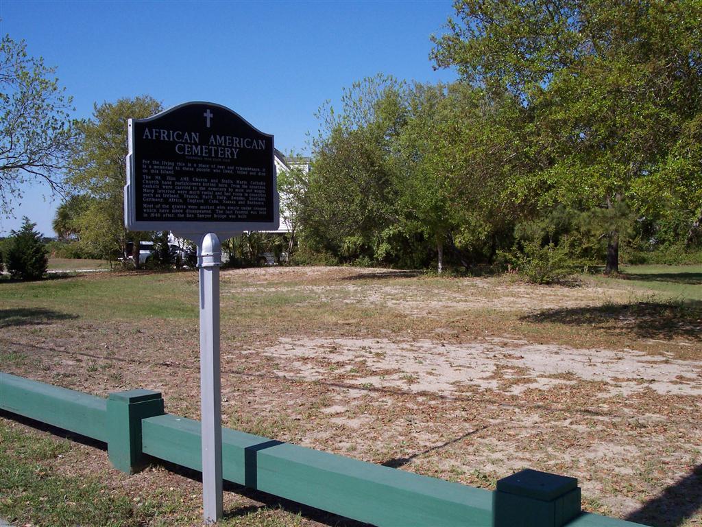
| Location | : | Sullivans Island, Charleston County, USA |
| Coordinate | : | 32.7648600, -79.8373000 |
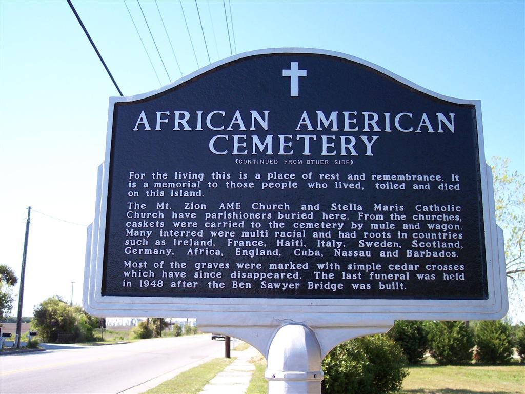
| Description | : | The sign reads: In this cemetery are the remains of some of Sullivan's Island's original Islanders, people of predominatly African American descent whose history parallels that of the Island. Buried here are Carpenters, Cooks, Oystermen, Laundresses, Nursemaids, House Keepers, Midwives, Soldiers and Seamen. People who rested on Sunday and went to church. Many helped build the historic structures that have enhanced the fabric of the island. They helped construct the palmetto log fort during the Revolutionary War, which later became Fort Moultrie. For the living this is a place of rest and remembrance. It is a memorial to those people who... Read More |
frequently asked questions (FAQ):
-
Where is African American Cemetery?
African American Cemetery is located at Sullivans Island, Charleston County ,South Carolina ,USA.
-
African American Cemetery cemetery's updated grave count on graveviews.com?
0 memorials
-
Where are the coordinates of the African American Cemetery?
Latitude: 32.7648600
Longitude: -79.8373000

Nearby Cemetories:
1. Sullivan's Island Historic Cemetery
Charleston County, USA
Coordinate: 32.7639900, -79.8381500
2. Sullivans Island Soldiers Graveyard
Sullivans Island, Charleston County, USA
Coordinate: 32.7634583, -79.8379059
3. Fort Moultrie Grounds
Charleston, Charleston County, USA
Coordinate: 32.7597560, -79.8577930
4. Saint Paul's Lutheran Cemetery
Mount Pleasant, Charleston County, USA
Coordinate: 32.7847800, -79.8681800
5. Ocean Grove Cemetery
Mount Pleasant, Charleston County, USA
Coordinate: 32.7844009, -79.8688965
6. Confederate Cemetery
Mount Pleasant, Charleston County, USA
Coordinate: 32.7855988, -79.8739014
7. Christ Our King Catholic Church
Mount Pleasant, Charleston County, USA
Coordinate: 32.7971690, -79.8649310
8. Lucas Family Cemetery
Mount Pleasant, Charleston County, USA
Coordinate: 32.7958336, -79.8716660
9. Battery Wagner Mass Union Grave
Charleston, Charleston County, USA
Coordinate: 32.7314800, -79.8706900
10. Venning Cemetery
Charleston County, USA
Coordinate: 32.8163986, -79.8341980
11. New Hope Missionary Baptist Church Cemetery
Mount Pleasant, Charleston County, USA
Coordinate: 32.8187800, -79.8437000
12. Mount Pleasant Memorial Gardens
Mount Pleasant, Charleston County, USA
Coordinate: 32.8209991, -79.8553848
13. Franke at Seaside Columbarium
Mount Pleasant, Charleston County, USA
Coordinate: 32.8215060, -79.8200210
14. Olive Branch AME Church Cemetery
Mount Pleasant, Charleston County, USA
Coordinate: 32.8263550, -79.8379974
15. I'on Cemetery
Hobcaw Point, Charleston County, USA
Coordinate: 32.8204780, -79.8838770
16. Holy Cross Cemetery
James Island, Charleston County, USA
Coordinate: 32.7411160, -79.9151860
17. Scanlonville Cemetery
Mount Pleasant, Charleston County, USA
Coordinate: 32.8140700, -79.8981700
18. Pritchard Family Cemetery
Mount Pleasant, Charleston County, USA
Coordinate: 32.8224640, -79.8917770
19. All Saints Memorial Gardens
Mount Pleasant, Charleston County, USA
Coordinate: 32.8371630, -79.8202670
20. Saint Philip's Episcopal Church Cemetery
Charleston, Charleston County, USA
Coordinate: 32.7792473, -79.9290695
21. French Protestant Huguenot Church Cemetery
Charleston, Charleston County, USA
Coordinate: 32.7784767, -79.9297638
22. First Baptist Churchyard
Charleston, Charleston County, USA
Coordinate: 32.7737122, -79.9306564
23. Saint Michaels Church Cemetery
Charleston, Charleston County, USA
Coordinate: 32.7765388, -79.9302444
24. Cook's Old Field Cemetery
Mount Pleasant, Charleston County, USA
Coordinate: 32.8389100, -79.8039900