
| Memorials | : | 0 |
| Location | : | Langley Park, Durham Unitary Authority, England |
| Coordinate | : | 54.7991100, -1.6757200 |
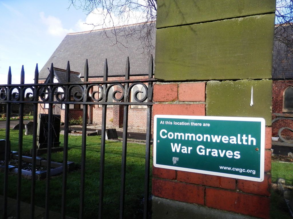
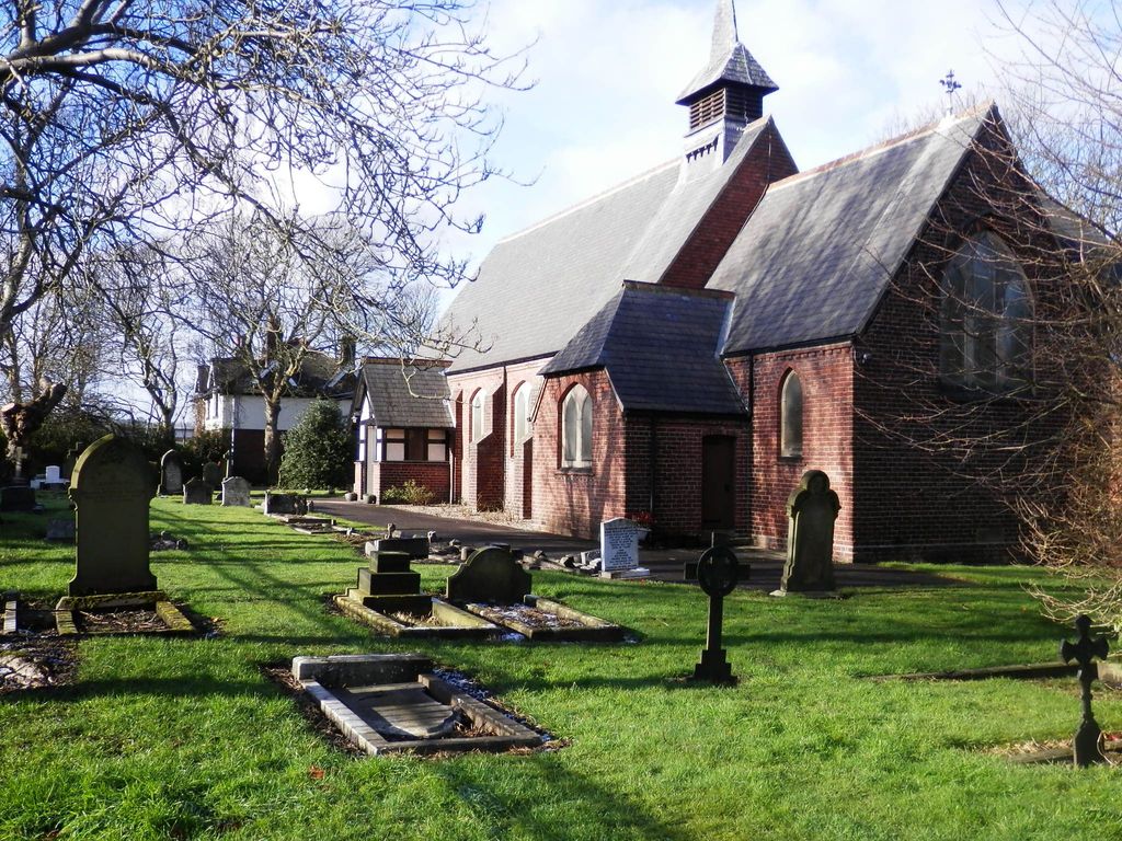
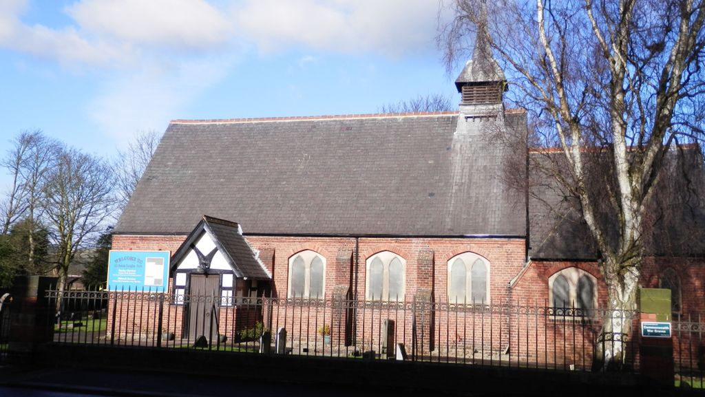
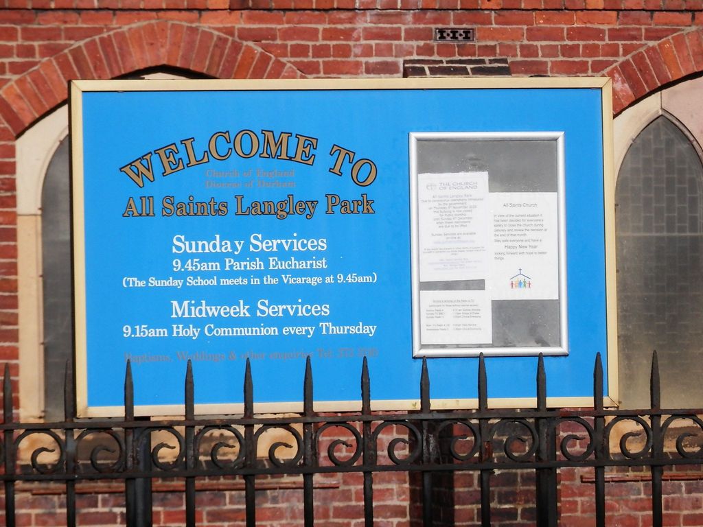
| Description | : | All Saints Church is on Quebec Street, in the centre of Langley Park, County Durham. The church was built in 1886-7 to a design by E. L. Swatman of London. It consists of nave with south porch, chancel with vestry to its south, and an organ chamber/vestry plus toilet subsequently added to its north. External walls are of red brick with stone dressings, plastered internally. Roofs are covered with Welsh slate. A slate-covered fleche or spirelet surmounts the east end of the nave roof, and the east wall of the nave above the chancel is timber-framed with the elaborate framing... Read More |
frequently asked questions (FAQ):
-
Where is All Saints Churchyard?
All Saints Churchyard is located at Quebec Street Langley Park, Durham Unitary Authority ,County Durham , DH7 9UBEngland.
-
All Saints Churchyard cemetery's updated grave count on graveviews.com?
0 memorials
-
Where are the coordinates of the All Saints Churchyard?
Latitude: 54.7991100
Longitude: -1.6757200
Nearby Cemetories:
1. Langley Park Cemetery
Langley Park, Durham Unitary Authority, England
Coordinate: 54.7981620, -1.6900060
2. St. Michael and All Angels Churchyard
Esh, Durham Unitary Authority, England
Coordinate: 54.7907860, -1.6954920
3. St. Michael's Roman Catholic Churchyard
Esh, Durham Unitary Authority, England
Coordinate: 54.7878680, -1.7059280
4. St. John the Baptist Churchyard
Hamsteels, Durham Unitary Authority, England
Coordinate: 54.7886840, -1.7249990
5. Our Lady Queen Of Martyrs Churchyard
Esh Winning, Durham Unitary Authority, England
Coordinate: 54.7736930, -1.7061950
6. St Edmund Churchyard
Bearpark, Durham Unitary Authority, England
Coordinate: 54.7829380, -1.6294350
7. Sacriston Cemetery
Sacriston, Durham Unitary Authority, England
Coordinate: 54.8200330, -1.6310180
8. St. Peter's Churchyard
Sacriston, Durham Unitary Authority, England
Coordinate: 54.8232600, -1.6307850
9. St Bede's Catholic Church
Sacriston, Durham Unitary Authority, England
Coordinate: 54.8221050, -1.6286550
10. Waterhouse Cemetery
Esh Winning, Durham Unitary Authority, England
Coordinate: 54.7685100, -1.7081310
11. St. John's Churchyard
Burnhope, Durham Unitary Authority, England
Coordinate: 54.8323830, -1.6997730
12. Parkwood Cemetery
Esh Winning, Durham Unitary Authority, England
Coordinate: 54.7662210, -1.7207360
13. All Saints Churchyard
Lanchester, Durham Unitary Authority, England
Coordinate: 54.8208930, -1.7406720
14. Brandon Cemetery
Brandon, Durham Unitary Authority, England
Coordinate: 54.7554210, -1.6435610
15. St Philip & St James Churchyard
Kimblesworth, Durham Unitary Authority, England
Coordinate: 54.8209600, -1.5956900
16. St Thomas Churchyard
Craghead, Durham Unitary Authority, England
Coordinate: 54.8505370, -1.6664580
17. Lanchester Cemetery
Lanchester, Durham Unitary Authority, England
Coordinate: 54.8268000, -1.7524600
18. Redhills Roman Catholic Cemetery
Durham, Durham Unitary Authority, England
Coordinate: 54.7761820, -1.5914530
19. Nevilles Cross
Durham Unitary Authority, England
Coordinate: 54.7724350, -1.5933540
20. St Cuthbert's Churchyard
Durham, Durham Unitary Authority, England
Coordinate: 54.7820357, -1.5849752
21. Meadowfield Cemetery
Meadowfield, Durham Unitary Authority, England
Coordinate: 54.7532510, -1.6126190
22. St. Margaret of Antioch Churchyard
Durham, Durham Unitary Authority, England
Coordinate: 54.7758510, -1.5802280
23. St. George's Churchyard
South Moor, Durham Unitary Authority, England
Coordinate: 54.8570620, -1.7050020
24. St Nicholas Burial Ground
Durham, Durham Unitary Authority, England
Coordinate: 54.7804500, -1.5721900