
| Memorials | : | 0 |
| Location | : | Feering, Braintree District, England |
| Coordinate | : | 51.8508370, 0.7167720 |
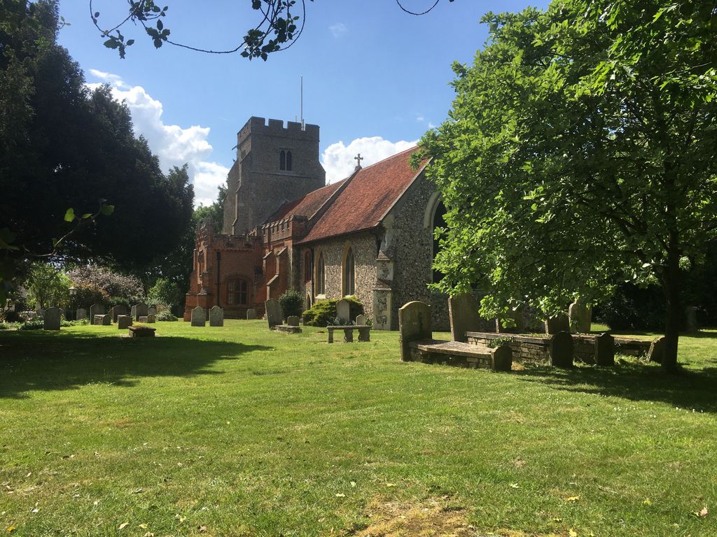
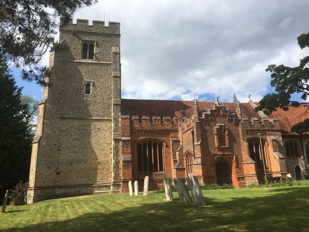
| Description | : | Feering is a village and parish in the Witham District of Essex, England situated on the river Blackwater between Colchester and Witham 2 miles SE of Coggeshall. The Post town is Kelvedon. There are two burial sites, the St Martins Cemetery and All Saints Churchyard. The parish once belonged to Edward the Confessor. The porch with pinnacles and battlements and south front of the church were rebuilt in red brick c1500. The chancel was rebuilt in the first half of the 14th century, whilst the tower, now with eight bells, is 15th century. There were probably five... Read More |
frequently asked questions (FAQ):
-
Where is All Saints Churchyard?
All Saints Churchyard is located at The Street , Feering, Braintree District ,Essex , CO5 9QJEngland.
-
All Saints Churchyard cemetery's updated grave count on graveviews.com?
0 memorials
-
Where are the coordinates of the All Saints Churchyard?
Latitude: 51.8508370
Longitude: 0.7167720
Nearby Cemetories:
1. St Martins Cemetery
Feering, Braintree District, England
Coordinate: 51.8504930, 0.7159460
2. United Reformed Churchyard
Kelvedon, Braintree District, England
Coordinate: 51.8391991, 0.7032000
3. All Saints Churchyard
Inworth, Colchester Borough, England
Coordinate: 51.8276200, 0.7257200
4. All Saints Churchyard
Messing, Colchester Borough, England
Coordinate: 51.8364416, 0.7491859
5. St Peter ad Vincula Churchyard
Coggeshall, Braintree District, England
Coordinate: 51.8748520, 0.6910450
6. Christ Church Churchyard
Coggeshall, Braintree District, England
Coordinate: 51.8725270, 0.6857280
7. Coggeshall Cemetery
Coggeshall, Braintree District, England
Coordinate: 51.8765110, 0.6899070
8. St James the Less Churchyard
Little Tey, Colchester Borough, England
Coordinate: 51.8799900, 0.7465800
9. St. Mary and All Saints Churchyard
Rivenhall, Braintree District, England
Coordinate: 51.8288260, 0.6514254
10. St Andrew Churchyard
Marks Tey, Colchester Borough, England
Coordinate: 51.8801600, 0.7752400
11. United Reformed Churchyard
Tiptree, Colchester Borough, England
Coordinate: 51.8109600, 0.7590600
12. All Saints Churchyard
Great Braxted, Maldon District, England
Coordinate: 51.8068900, 0.6833840
13. St. Barnabas Churchyard
Great Tey, Colchester Borough, England
Coordinate: 51.8988100, 0.7489600
14. St. Mary the Virgin Churchyard
Ivinghoe, Aylesbury Vale District, England
Coordinate: 51.8359001, 0.6288235
15. St Mary the Virgin Churchyard
Layer Marney, Colchester Borough, England
Coordinate: 51.8221070, 0.7964060
16. St Mary the Virgin Church
Layer Marney, Colchester Borough, England
Coordinate: 51.8221000, 0.7965000
17. St. Michael & All Angels Churchyard
Copford, Colchester Borough, England
Coordinate: 51.8693170, 0.8093620
18. Witham Cemetery
Witham, Braintree District, England
Coordinate: 51.8118520, 0.6421210
19. Saints Margaret and Catherine Churchyard
Aldham, Colchester Borough, England
Coordinate: 51.8979000, 0.7857100
20. St Peter and St Paul Churchyard
Birch, Colchester Borough, England
Coordinate: 51.8442460, 0.8202570
21. Holy Family Roman Catholic Churchyard
Witham, Braintree District, England
Coordinate: 51.8033400, 0.6448000
22. St Nicolas Churchyard
Witham, Braintree District, England
Coordinate: 51.8074500, 0.6346500
23. Great Totham United Reform Church
Great Totham, Maldon District, England
Coordinate: 51.7842880, 0.7078990
24. St Albright Churchyard
Stanway, Colchester Borough, England
Coordinate: 51.8830780, 0.8159380