
| Memorials | : | 0 |
| Location | : | Hill Township, Pulaski County, USA |
| Coordinate | : | 34.5112050, -92.0422520 |
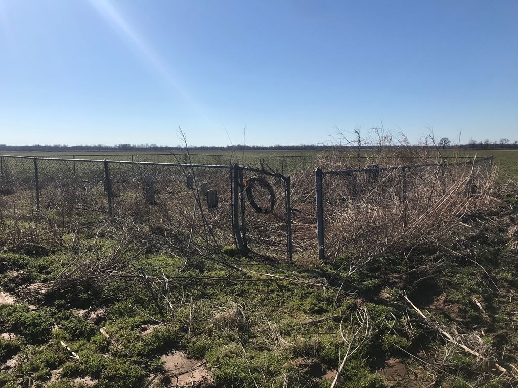
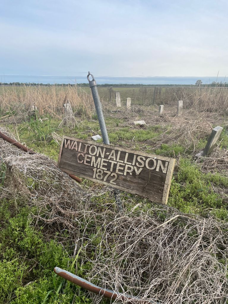
| Description | : | This family cemetery is located off Hwy 161 in Southeast Pulaski County, Arkansas. Take Hwy 161 South from Scott, Arkansas to the intersection with Hwy 61 (161 East), then turn East (left); drive 3 miles to Allison Road and turn South (right). The cemetery is located about one mile down this road on the West side. You will have walk out into a field to view the site. In 1978 a chain link fence was erected around the cemetery. Information from The Arkansas Family Historian, March 1984, Volume 22, Number 1, page 52. NOTE: At the time this... Read More |
frequently asked questions (FAQ):
-
Where is Allison-Walton-Venable-Wilder Cemetery?
Allison-Walton-Venable-Wilder Cemetery is located at Allison Road Hill Township, Pulaski County ,Arkansas , 72142USA.
-
Allison-Walton-Venable-Wilder Cemetery cemetery's updated grave count on graveviews.com?
0 memorials
-
Where are the coordinates of the Allison-Walton-Venable-Wilder Cemetery?
Latitude: 34.5112050
Longitude: -92.0422520
Nearby Cemetories:
1. Clear Lake Cemetery
England, Lonoke County, USA
Coordinate: 34.5410910, -92.0192760
2. Faver Cemetery
Lonoke County, USA
Coordinate: 34.4892006, -91.9914017
3. Jones Cemetery
Pine Bluff, Jefferson County, USA
Coordinate: 34.4771996, -91.9972000
4. Mulberry Cemetery
England, Lonoke County, USA
Coordinate: 34.5219002, -91.9669037
5. Nelson Cemetery
England, Lonoke County, USA
Coordinate: 34.5084297, -91.9640508
6. Nellum Cemetery
England, Lonoke County, USA
Coordinate: 34.5093994, -91.9627991
7. Morris Baptist Church Cemetery
Keo, Lonoke County, USA
Coordinate: 34.5845700, -92.0188020
8. Lonoke County Rural Burial Ground
Keo, Lonoke County, USA
Coordinate: 34.5993000, -92.0403000
9. Keo Cemetery
Keo, Lonoke County, USA
Coordinate: 34.5988998, -92.0006027
10. Red Bluff Cemetery
Redfield, Jefferson County, USA
Coordinate: 34.4794006, -92.1521988
11. Harris Cemetery
Pulaski County, USA
Coordinate: 34.4963989, -92.1632996
12. Fields Cemetery
Jefferson County, USA
Coordinate: 34.4225006, -91.9744034
13. Alexander Cemetery
Pulaski County, USA
Coordinate: 34.6081009, -92.1241989
14. Alexander Cemetery
Lonoke County, USA
Coordinate: 34.6082610, -92.1244870
15. New Hope Church and Cemetery
Sherrill, Jefferson County, USA
Coordinate: 34.4053810, -91.9762460
16. Nelson Cemetery
Little Rock, Pulaski County, USA
Coordinate: 34.6086006, -92.1275024
17. Mount Pleasant Cemetery
Jefferson County, USA
Coordinate: 34.4439011, -91.9203033
18. Dickey Cemetery
Pulaski County, USA
Coordinate: 34.6081009, -92.1303024
19. Clark Hill Cemetery
Jefferson County, USA
Coordinate: 34.3917007, -92.0927963
20. Antioch Cemetery
Sherrill, Jefferson County, USA
Coordinate: 34.3936005, -91.9835968
21. Campbells Cemetery
Hensley, Pulaski County, USA
Coordinate: 34.5107994, -92.1992035
22. Mount Moriah Cemetery
Scott, Lonoke County, USA
Coordinate: 34.6342010, -92.0931015
23. Mount Pleasant Cemetery
Redfield, Jefferson County, USA
Coordinate: 34.3929730, -92.1112930
24. New Salem Missionary Baptist Church Cemetery
Sherrill, Jefferson County, USA
Coordinate: 34.3813000, -92.0152600