
| Memorials | : | 0 |
| Location | : | Altdorf, Landkreis Südliche Weinstraße, Germany |
| Coordinate | : | 49.2908100, 8.2190500 |
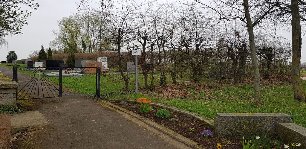
| Description | : | Location Information: Altdorf is a small village in South West Germany approx 55km west of Heidelberg. From the A65 Mannheim to Karlsruhe motorway take exit 14 (Ausfahrt 14) KIRRWEILER / VENNINGEN and follow direction K6 VENNINGEN. Continue along EDENKOBENER STRAßE and pass through VENNINGEN. Road changes name to ALTDORFER STRAßE, continue for approx 3.5kms, then turn left onto FRIEDHOFSTRAßE. After approx 300m the main entrance to the cemetery can be found. CWGC graves are located immediately on the right of the entrance gate against the front hedge. The cemetery address is:- Friedhofstraße 67482 Altdorf Germany GPS Location is:- N 49... Read More |
frequently asked questions (FAQ):
-
Where is Altdorf Protestant Cemetery?
Altdorf Protestant Cemetery is located at Altdorf, Landkreis Südliche Weinstraße ,Rheinland-Pfalz ,Germany.
-
Altdorf Protestant Cemetery cemetery's updated grave count on graveviews.com?
0 memorials
-
Where are the coordinates of the Altdorf Protestant Cemetery?
Latitude: 49.2908100
Longitude: 8.2190500
Nearby Cemetories:
1. Friedhof Böbingen
Böbingen, Landkreis Südliche Weinstraße, Germany
Coordinate: 49.2808020, 8.2320360
2. Friedhof Freimersheim
Freimersheim, Landkreis Südliche Weinstraße, Germany
Coordinate: 49.2696930, 8.2201180
3. Friedhof Geinsheim
Geinsheim, Stadtkreis Neustadt an der Weinstraße, Germany
Coordinate: 49.3077000, 8.2535000
4. Jüdischer Friedhof
Venningen, Landkreis Südliche Weinstraße, Germany
Coordinate: 49.2844994, 8.1753649
5. Friedhof Venningen
Venningen, Landkreis Südliche Weinstraße, Germany
Coordinate: 49.2844480, 8.1745920
6. Friedhof Lachen-Speyerdorf
Neustadt an der Weinstrasse, Stadtkreis Neustadt an der Weinstraße, Germany
Coordinate: 49.3262606, 8.1990718
7. Friedhof Freisbach
Freisbach, Landkreis Germersheim, Germany
Coordinate: 49.2721830, 8.2743120
8. Friedhof Hochstadt
Hochstadt, Landkreis Südliche Weinstraße, Germany
Coordinate: 49.2435910, 8.2229200
9. Evangelisch-reformierte Kirche Niederhochstadt
Landkreis Südliche Weinstraße, Germany
Coordinate: 49.2417880, 8.2194280
10. Evangelisch-reformierte Kirche Oberhochstadt
Landkreis Südliche Weinstraße, Germany
Coordinate: 49.2389230, 8.2053040
11. Friedhof Weingarten
Weingarten, Landkreis Germersheim, Germany
Coordinate: 49.2620500, 8.2874500
12. Friedhof Zeiskam
Zeiskam, Landkreis Germersheim, Germany
Coordinate: 49.2403830, 8.2474420
13. Friedhof Lustadt
Lustadt, Landkreis Germersheim, Germany
Coordinate: 49.2451020, 8.2640600
14. Friedhof Edenkoben
Edenkoben, Landkreis Südliche Weinstraße, Germany
Coordinate: 49.2885250, 8.1274230
15. Maikammer
Maikammer, Landkreis Südliche Weinstraße, Germany
Coordinate: 49.3083370, 8.1297970
16. Friedhof Essingen
Essingen, Landkreis Südliche Weinstraße, Germany
Coordinate: 49.2364900, 8.1694500
17. Friedhof Edesheim
Edesheim, Landkreis Südliche Weinstraße, Germany
Coordinate: 49.2626930, 8.1260560
18. Friedhof Schwegenheim
Schwegenheim, Landkreis Germersheim, Germany
Coordinate: 49.2664160, 8.3193930
19. Hauptfriedhof Neustadt
Neustadt an der Weinstrasse, Stadtkreis Neustadt an der Weinstraße, Germany
Coordinate: 49.3447700, 8.1498900
20. Friedhof Sankt Martin
Sankt Martin, Landkreis Südliche Weinstraße, Germany
Coordinate: 49.3006910, 8.1064490
21. Friedhof Bornheim
Bornheim, Landkreis Südliche Weinstraße, Germany
Coordinate: 49.2239540, 8.1666770
22. Friedhof Bornheim
Bornheim, Landkreis Südliche Weinstraße, Germany
Coordinate: 49.2239540, 8.1666770
23. Friedhof Roschbach
Roschbach, Landkreis Südliche Weinstraße, Germany
Coordinate: 49.2484510, 8.1187840
24. Alter Friedhof an der Bahnhofstrasse
Haßloch, Landkreis Bad Dürkheim, Germany
Coordinate: 49.3656500, 8.2552300