
| Memorials | : | 0 |
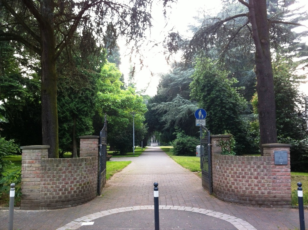
| Location | : | Brühl, Rhein-Erft-Kreis, Germany |
| Coordinate | : | 50.8294690, 6.9020310 |
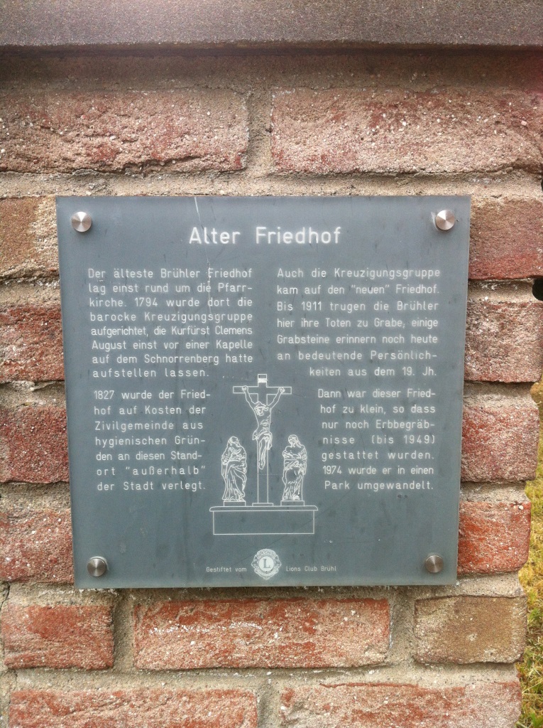
| Description | : | Converted into a park in 1974, several headstones still remain. Completely photographed in June 2013. The sign translation: The oldest Brühl cemetery once stood around the parish church, in 1794, there was erected the Baroque Calvary, the Elector Clemens August once before a chapel on the mountain Schnorr had placed. In 1827, the cemetery was relocated at the expense of the civil parish of hygiene reasons at this location "outside" of the city. The Crucifixion group came to the "new" cemetery. By 1911, the Brühl contributed here their dead to the grave, some grave stones are reminders of important personalities from countries 19th century. Then... Read More |
frequently asked questions (FAQ):
-
Where is Alter Friedhof?
Alter Friedhof is located at Mühlenstraße Brühl, Rhein-Erft-Kreis ,Nordrhein-Westfalen , 50321Germany.
-
Alter Friedhof cemetery's updated grave count on graveviews.com?
0 memorials
-
Where are the coordinates of the Alter Friedhof?
Latitude: 50.8294690
Longitude: 6.9020310
Nearby Cemetories:
1. Jüdischer Friedhof
Brühl, Rhein-Erft-Kreis, Germany
Coordinate: 50.8335030, 6.9071760
2. Südfriedhof
Brühl, Rhein-Erft-Kreis, Germany
Coordinate: 50.8204360, 6.9026590
3. Friedhof Brühl Pingsdorf
Brühl, Rhein-Erft-Kreis, Germany
Coordinate: 50.8157610, 6.8911180
4. Nordfriedhof Brühl
Brühl, Rhein-Erft-Kreis, Germany
Coordinate: 50.8431814, 6.8823332
5. Friedhof Wesseling-Berzdorf
Berzdorf, Rhein-Erft-Kreis, Germany
Coordinate: 50.8325148, 6.9483445
6. Friedhof Meschenich
Cologne, Stadtkreis Köln, Germany
Coordinate: 50.8564900, 6.9347500
7. Friedhof Walberberg
Walberberg, Rhein-Sieg-Kreis, Germany
Coordinate: 50.7928480, 6.9090950
8. Hürth-Kendenich Friedhof
Kendenich, Rhein-Erft-Kreis, Germany
Coordinate: 50.8656599, 6.8824201
9. Friedhof Friedensweg
Wesseling, Rhein-Erft-Kreis, Germany
Coordinate: 50.8220439, 6.9734016
10. Katholischer Friedhof Immendorf
Cologne, Stadtkreis Köln, Germany
Coordinate: 50.8594932, 6.9572050
11. Friedhof Godorf
Cologne, Stadtkreis Köln, Germany
Coordinate: 50.8503800, 6.9710600
12. Friedhof Steinneuerhof
Cologne, Stadtkreis Köln, Germany
Coordinate: 50.8734970, 6.9371040
13. Liblar Jewish Cemetery / Jüdischer Friedhof
Liblar, Rhein-Erft-Kreis, Germany
Coordinate: 50.8042225, 6.8330518
14. Friedhof Alt-Hürth
Hürth, Rhein-Erft-Kreis, Germany
Coordinate: 50.8763334, 6.8683863
15. Friedhof Merten Neu
Merten (Bornheim), Rhein-Sieg-Kreis, Germany
Coordinate: 50.7805880, 6.9329870
16. Friedhof Sechtem
Sechtem, Rhein-Sieg-Kreis, Germany
Coordinate: 50.7899300, 6.9574910
17. Friedhof Rondorf
Cologne, Stadtkreis Köln, Germany
Coordinate: 50.8680100, 6.9608300
18. Old Bornheim-Merten Cemetery
Bornheim, Rhein-Sieg-Kreis, Germany
Coordinate: 50.7727500, 6.9215000
19. Friedhof Rösberg
Rösberg, Rhein-Sieg-Kreis, Germany
Coordinate: 50.7671900, 6.9174690
20. Friedhof Langel
Cologne, Stadtkreis Köln, Germany
Coordinate: 50.8422080, 7.0036130
21. Friedhof Kardorf
Kardorf, Rhein-Sieg-Kreis, Germany
Coordinate: 50.7674080, 6.9413520
22. Friedhof Hemmerich
Hemmerich, Rhein-Sieg-Kreis, Germany
Coordinate: 50.7638950, 6.9272690
23. Cologne Memorial
Cologne, Stadtkreis Köln, Germany
Coordinate: 50.8979600, 6.9391700
24. Cologne Southern Cemetery
Cologne, Stadtkreis Köln, Germany
Coordinate: 50.8979600, 6.9391700