
| Memorials | : | 0 |
| Location | : | Bonn, Stadtkreis Bonn, Germany |
| Coordinate | : | 50.7096961, 7.0686202 |
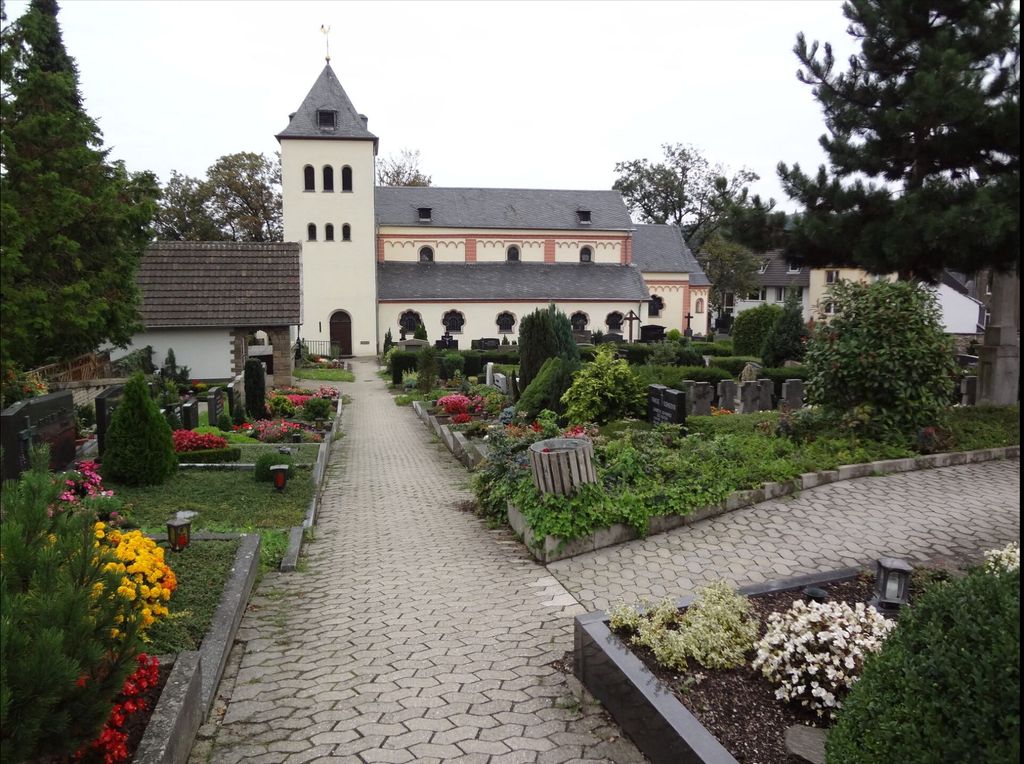
| Description | : | Seit dem frühen Mittelalter wurde der Burghof als Begräbnisplatz genutzt. Auch Röttgen, Ückesdorf und Ippendorf beerdigten die Toten in Lengsdorf. Als die Bevölkerungszahl im 19. Jahrhundert stark zunahm, wurde über Vergrößerung und dorfeigene Friedhöfe nachgedacht. Schwierigkeiten gab es bei der Klärung der Eigentumsverhältnisse, da Teile des Anwesens zur Zivil- andere zur Kirchengemeinde gehörten. Die königliche Regierung in Köln erklärte, dass die Kirchhöfe in den Rhein-Departements Eigentum der Zivilgemeinde seien. Nach langen Verhandlungen wurden 1880 drei Parzellen hinzu- gekauft und ein Teil der Pfarrländereien dazugenommen. Ippendorf hatte seit 1892 und Röttgen seit 1903 einen eigenen Friedhof. Nach dem Ersten Weltkrieg war der... Read More |
frequently asked questions (FAQ):
-
Where is Alter Friedhof Lengsdorf?
Alter Friedhof Lengsdorf is located at Uhlgasse Bonn, Stadtkreis Bonn ,Nordrhein-Westfalen , 53127Germany.
-
Alter Friedhof Lengsdorf cemetery's updated grave count on graveviews.com?
0 memorials
-
Where are the coordinates of the Alter Friedhof Lengsdorf?
Latitude: 50.7096961
Longitude: 7.0686202
Nearby Cemetories:
1. Neuer Friedhof Ippendorf
Ippendorf, Stadtkreis Bonn, Germany
Coordinate: 50.7037510, 7.0773380
2. Alter Ippendorfer Friedhof
Ippendorf, Stadtkreis Bonn, Germany
Coordinate: 50.7064690, 7.0827900
3. Alter Friedhof Duisdorf
Duisdorf, Stadtkreis Bonn, Germany
Coordinate: 50.7157210, 7.0505730
4. Poppelsdorfer Friedhof
Bonn, Stadtkreis Bonn, Germany
Coordinate: 50.7193800, 7.0829060
5. Neuer Friedhof Kessenich
Kessenich, Stadtkreis Bonn, Germany
Coordinate: 50.7151400, 7.1011840
6. Alter Kessenicher Friedhof
Bonn, Stadtkreis Bonn, Germany
Coordinate: 50.7133064, 7.1048393
7. Waldfriedhof Kottenforst
Roettgen, Stadtkreis Bonn, Germany
Coordinate: 50.6868335, 7.0622332
8. Jüdischer Friedhof
Roettgen, Stadtkreis Bonn, Germany
Coordinate: 50.6863825, 7.0636535
9. Friedhof Röttgen
Roettgen, Stadtkreis Bonn, Germany
Coordinate: 50.6849137, 7.0759506
10. Friedhof
Witterschlick, Rhein-Sieg-Kreis, Germany
Coordinate: 50.6979679, 7.0259695
11. Alter Friedhof
Bonn, Stadtkreis Bonn, Germany
Coordinate: 50.7359930, 7.0928950
12. Alter Friedhof Dottendorf
Dottendorf, Stadtkreis Bonn, Germany
Coordinate: 50.7049860, 7.1161410
13. Bonner Münster
Bonn, Stadtkreis Bonn, Germany
Coordinate: 50.7333330, 7.0997220
14. Friedhof Dransdorf
Dransdorf, Stadtkreis Bonn, Germany
Coordinate: 50.7417600, 7.0515600
15. Südfriedhof
Bonn, Stadtkreis Bonn, Germany
Coordinate: 50.7028240, 7.1226370
16. Friedhof Friesdorf
Friesdorf, Stadtkreis Bonn, Germany
Coordinate: 50.6976468, 7.1299940
17. Jüdischer Friedhof Bonn-Castell
Bonn, Stadtkreis Bonn, Germany
Coordinate: 50.7473473, 7.0981511
18. Nordfriedhof Bonn
Bonn, Stadtkreis Bonn, Germany
Coordinate: 50.7530880, 7.0684580
19. Friedhof St. Joseph
Bonn, Stadtkreis Bonn, Germany
Coordinate: 50.7416189, 7.1218919
20. Zentralfriedhof
Bonn, Stadtkreis Bonn, Germany
Coordinate: 50.6963550, 7.1466270
21. Friedhof Schwarz Rheindorf
Schwarz Rheindorf, Stadtkreis Bonn, Germany
Coordinate: 50.7518380, 7.1152190
22. Friedhof Buschdorf
Buschdorf, Stadtkreis Bonn, Germany
Coordinate: 50.7606100, 7.0550200
23. Friedhof Beuel am Plantanenweg
Beuel, Stadtkreis Bonn, Germany
Coordinate: 50.7464600, 7.1272100
24. Jüdischer Friedhof Alfter
Alfter, Rhein-Sieg-Kreis, Germany
Coordinate: 50.7420650, 7.0037160