
| Memorials | : | 0 |
| Location | : | Rastatt, Landkreis Rastatt, Germany |
| Coordinate | : | 48.8612000, 8.2068000 |
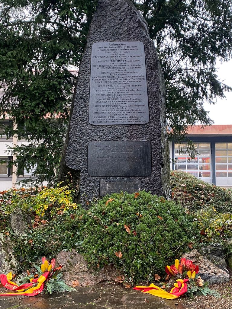
| Description | : | Alter Friedhof der Stadt Rastatt westlich der früheren Ludwigsfeste, der im 19. Jahrhundert durch den heutigen Stadtfriedhof östlich der Ludwigsfeste ergänzt wurde. Der alte Friedhof wurde stillgelegt und weite Teile mit dem Kreiskrankenhaus überbaut. Nur ausgewählte Denkmale und Gräber blieben in einem kleinen Park südöstlich des Krankenhauses erhalten. Rastatt's old cemetery west of the former fortress Ludwigsfeste. It was complemented in the 19th century by the current town cemetery (Stadtfriedhof) east of the Ludwigsfeste. The old cemetery has been discontinued and most of the area was used to build the county hospital. Only a selection of memorials and... Read More |
frequently asked questions (FAQ):
-
Where is Alter Friedhof Rastatt?
Alter Friedhof Rastatt is located at An der Ludwigsfeste Rastatt, Landkreis Rastatt ,Baden-Württemberg , 76437Germany.
-
Alter Friedhof Rastatt cemetery's updated grave count on graveviews.com?
0 memorials
-
Where are the coordinates of the Alter Friedhof Rastatt?
Latitude: 48.8612000
Longitude: 8.2068000
Nearby Cemetories:
1. Schlosskirche Rastatt
Rastatt, Landkreis Rastatt, Germany
Coordinate: 48.8595670, 8.2045940
2. Stadtfriedhof Rastatt
Rastatt, Landkreis Rastatt, Germany
Coordinate: 48.8637000, 8.2136000
3. Jüdischer Friedhof Rastatt
Rastatt, Landkreis Rastatt, Germany
Coordinate: 48.8626770, 8.2158970
4. Waldfriedhof Rastatt
Rastatt, Landkreis Rastatt, Germany
Coordinate: 48.8716000, 8.2239000
5. Friedhof Niederbühl
Niederbühl, Landkreis Rastatt, Germany
Coordinate: 48.8396953, 8.2155689
6. Friedhof Rauental
Rauental, Landkreis Rastatt, Germany
Coordinate: 48.8594200, 8.2517900
7. Friedhof Ottersdorf
Ottersdorf, Landkreis Rastatt, Germany
Coordinate: 48.8646083, 8.1547389
8. Friedhof Ötigheim
Ötigheim, Landkreis Rastatt, Germany
Coordinate: 48.8938219, 8.2382023
9. Friedhof Plittersdorf
Plittersdorf, Landkreis Rastatt, Germany
Coordinate: 48.8846000, 8.1592800
10. Friedhof Steinmauern
Steinmauern, Landkreis Rastatt, Germany
Coordinate: 48.9022000, 8.2027000
11. Friedhof Wintersdorf
Wintersdorf, Landkreis Rastatt, Germany
Coordinate: 48.8497421, 8.1417449
12. Friedhof Muggensturm
Muggensturm, Landkreis Rastatt, Germany
Coordinate: 48.8605000, 8.2742000
13. Friedhof Kuppenheim
Kuppenheim, Landkreis Rastatt, Germany
Coordinate: 48.8224146, 8.2515798
14. Friedhof Iffezheim
Iffezheim, Landkreis Rastatt, Germany
Coordinate: 48.8241280, 8.1515650
15. Friedhof Sandweier
Sandweier, Stadtkreis Baden-Baden, Germany
Coordinate: 48.8091000, 8.1904000
16. Jüdischer Friedhof Kuppenheim
Kuppenheim, Landkreis Rastatt, Germany
Coordinate: 48.8208400, 8.2619400
17. Friedhof Bischweier
Bischweier, Landkreis Rastatt, Germany
Coordinate: 48.8398269, 8.2834119
18. Friedhof Haueneberstein
Haueneberstein, Stadtkreis Baden-Baden, Germany
Coordinate: 48.8067295, 8.2255045
19. Friedhof Oberndorf
Oberndorf, Landkreis Rastatt, Germany
Coordinate: 48.8267328, 8.2761550
20. Friedhof Bietigheim
Bietigheim, Landkreis Rastatt, Germany
Coordinate: 48.9167000, 8.2566000
21. Friedhof Oberweier
Oberweier, Ortenaukreis, Germany
Coordinate: 48.8481570, 8.3041720
22. Friedhof Elchesheim
Elchesheim, Landkreis Rastatt, Germany
Coordinate: 48.9297000, 8.2163000
23. Friedhof Balg
Balg, Stadtkreis Baden-Baden, Germany
Coordinate: 48.7907010, 8.2323000
24. Friedhof Baden-Oos
Oos, Stadtkreis Baden-Baden, Germany
Coordinate: 48.7888218, 8.1974498