
| Memorials | : | 0 |
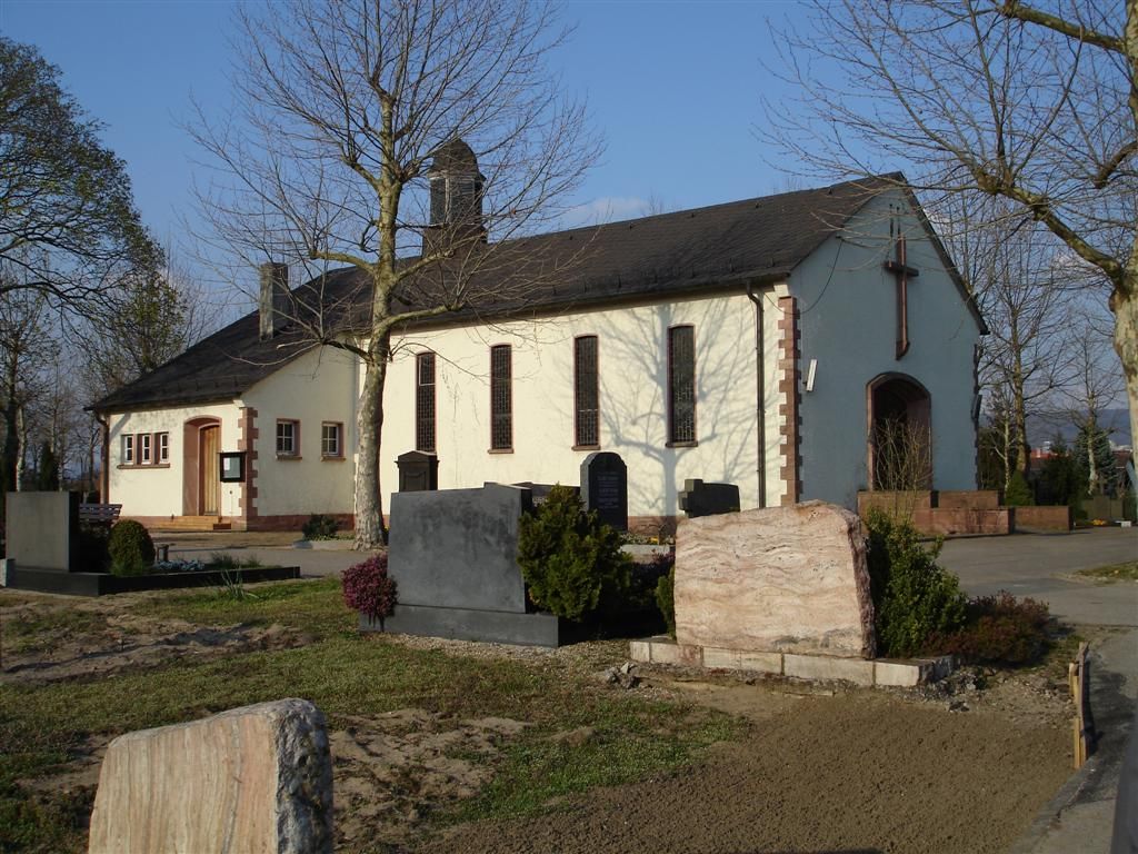
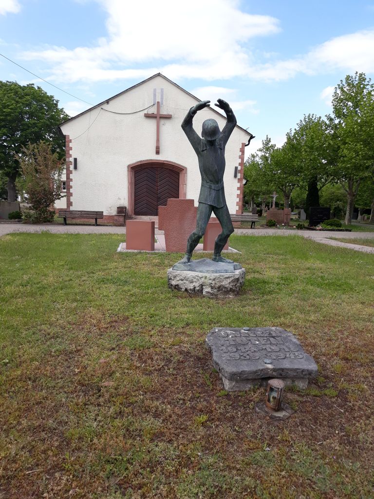
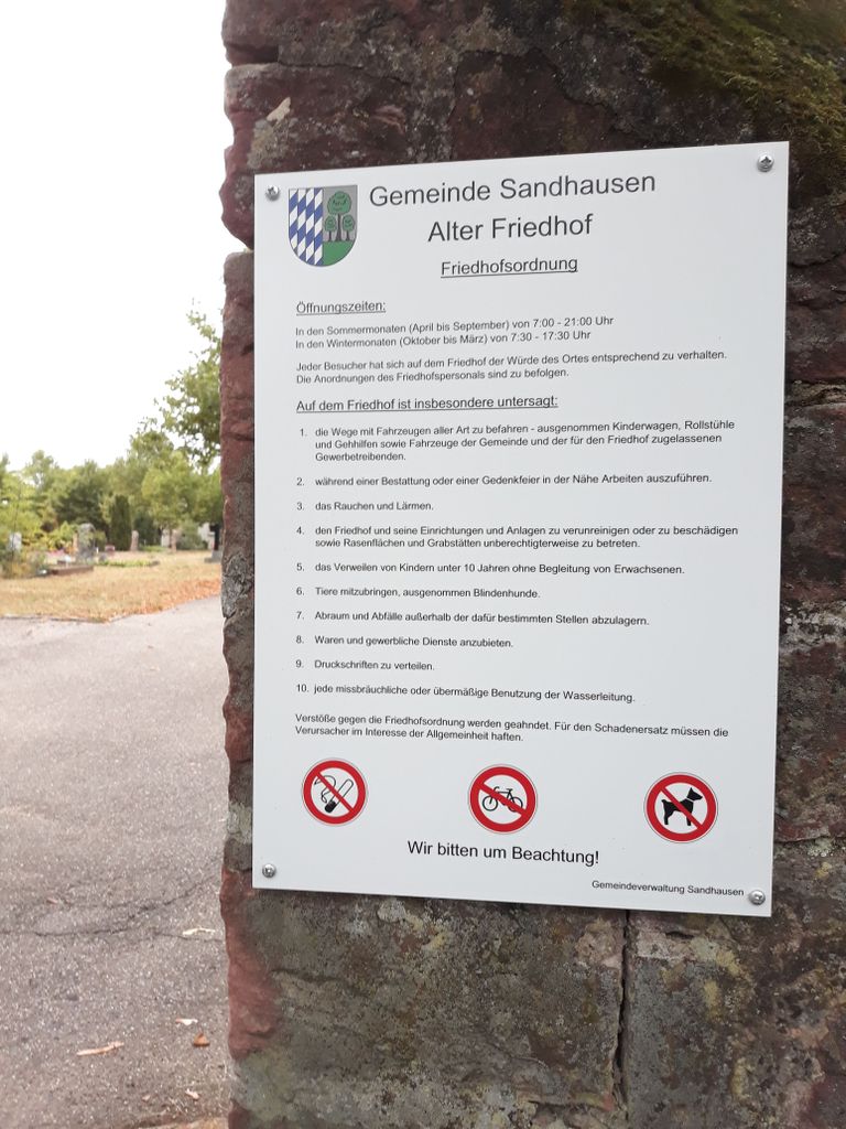
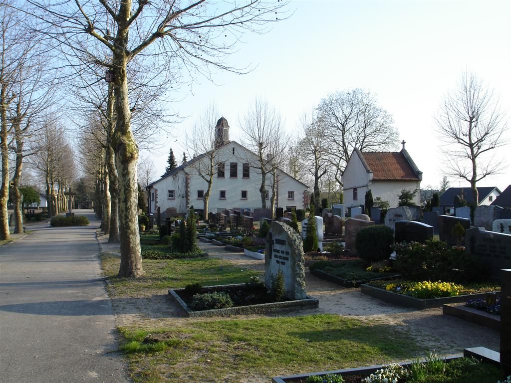
| Location | : | Sandhausen, Rhein-Neckar-Kreis, Germany |
| Coordinate | : | 49.3420789, 8.6502024 |
| Description | : | This cemetery was created on 23 August 2018 by Larry Payton. This is one of two cemeteries in this town. This cemetery is designated to be closed in the coming years. There hasn't been any burials here for many years. This cemetery will probably be turned into a park. |
frequently asked questions (FAQ):
-
Where is Alter Friedhof Sandhausen?
Alter Friedhof Sandhausen is located at Waldstraße 52 Sandhausen, Rhein-Neckar-Kreis ,Baden-Württemberg , 69207Germany.
-
Alter Friedhof Sandhausen cemetery's updated grave count on graveviews.com?
0 memorials
-
Where are the coordinates of the Alter Friedhof Sandhausen?
Latitude: 49.3420789
Longitude: 8.6502024

Nearby Cemetories:
1. Waldfriedhof Sandhausen
Sandhausen, Rhein-Neckar-Kreis, Germany
Coordinate: 49.3436200, 8.6438100
2. Waldfriedhof St. Ilgen
Heidelberg, Stadtkreis Heidelberg, Germany
Coordinate: 49.3301176, 8.6646061
3. Friedhof St. Ilgen
Sankt Ilgen, Rhein-Neckar-Kreis, Germany
Coordinate: 49.3297500, 8.6657100
4. Bergfriedhof Leimen
Leimen, Rhein-Neckar-Kreis, Germany
Coordinate: 49.3444178, 8.6957149
5. Friedhof Leimen
Leimen, Rhein-Neckar-Kreis, Germany
Coordinate: 49.3441700, 8.6957500
6. Friedhof Kirchheim
Kirchheim, Stadtkreis Heidelberg, Germany
Coordinate: 49.3743800, 8.6583000
7. Nußloch Friedhof
Nußloch, Rhein-Neckar-Kreis, Germany
Coordinate: 49.3198300, 8.6985000
8. Friedhof Walldorf
Walldorf, Rhein-Neckar-Kreis, Germany
Coordinate: 49.3033100, 8.6326000
9. Jüdischer Friedhof Walldorf
Walldorf, Rhein-Neckar-Kreis, Germany
Coordinate: 49.3028500, 8.6310000
10. Friedhof Rohrbach
Heidelberg, Stadtkreis Heidelberg, Germany
Coordinate: 49.3759370, 8.6944170
11. Friedhof Oftersheim
Oftersheim, Rhein-Neckar-Kreis, Germany
Coordinate: 49.3628800, 8.5813500
12. Jüdischer Friedhof Wiesloch
Wiesloch, Rhein-Neckar-Kreis, Germany
Coordinate: 49.2942910, 8.7036810
13. Friedhof Pfaffengrund
Heidelberg, Stadtkreis Heidelberg, Germany
Coordinate: 49.4014359, 8.6552090
14. Jüdischer Friedhof Bergfriedhof
Heidelberg, Stadtkreis Heidelberg, Germany
Coordinate: 49.3950770, 8.6936571
15. Heidelberg Ehrenfriedhof 1939-1945
Heidelberg, Stadtkreis Heidelberg, Germany
Coordinate: 49.3937560, 8.6976480
16. Bergfriedhof Heidelberg
Heidelberg, Stadtkreis Heidelberg, Germany
Coordinate: 49.3972220, 8.6902780
17. Jüdischer Friedhof Hockenheim
Hockenheim, Rhein-Neckar-Kreis, Germany
Coordinate: 49.3236000, 8.5599800
18. Hauptfriedhof Wiesloch
Wiesloch, Rhein-Neckar-Kreis, Germany
Coordinate: 49.2870582, 8.6936138
19. Waldfriedhof Hockenheim
Hockenheim, Rhein-Neckar-Kreis, Germany
Coordinate: 49.3250949, 8.5588202
20. Friedhof Reilingen
Reilingen, Rhein-Neckar-Kreis, Germany
Coordinate: 49.2958474, 8.5821459
21. Eppelheimer Friedhof
Eppelheim, Rhein-Neckar-Kreis, Germany
Coordinate: 49.4052184, 8.6237435
22. Friedhof Plankstadt
Plankstadt, Rhein-Neckar-Kreis, Germany
Coordinate: 49.3990179, 8.5967883
23. Parkfriedhof
Großostheim, Landkreis Aschaffenburg, Germany
Coordinate: 49.4034944, 8.6941696
24. Jüdischer Friedhof Klingenteich
Heidelberg, Stadtkreis Heidelberg, Germany
Coordinate: 49.4077412, 8.7078480