
| Memorials | : | 0 |
| Location | : | Blomberg, Kreis Lippe, Germany |
| Coordinate | : | 51.9142010, 9.0288220 |
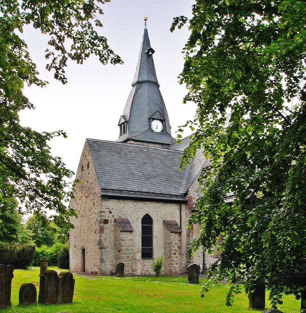
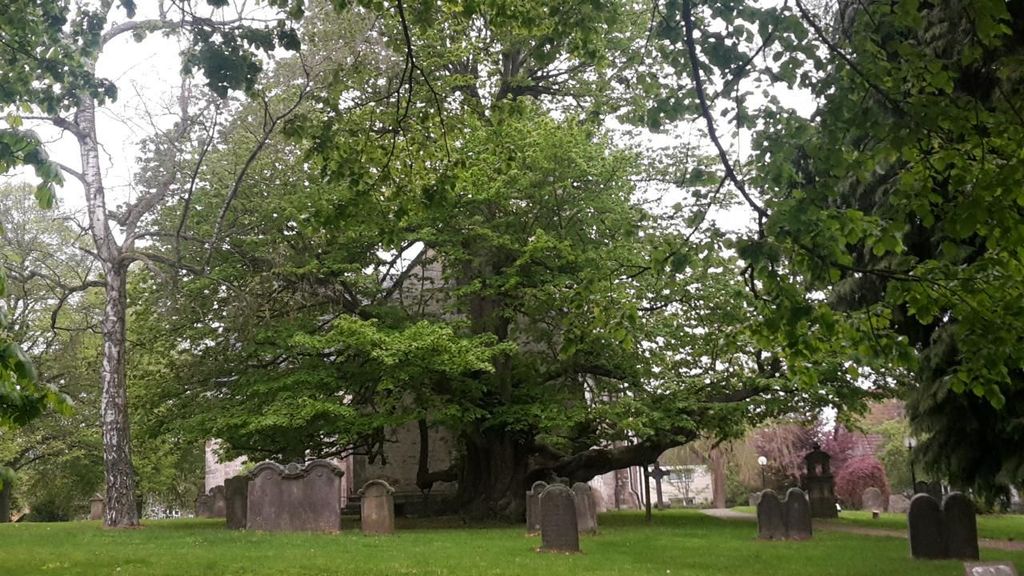
| Description | : | in 1970 eleven villages and towns were merged, the current city of Blomberg was formed. Though each district maintained their own cemetery. Since all of those villages date back several hundred of years, they usually had an old church with a church yard for burials around it. These old cemeteries are no longer in use, but some stones were restored and are maintained for historical purposes. This old church yard in Reelkirchen saw its last burial in 1916. Since then the new cemetery at Karnweg has been used. There are some war monuments located in front of the church. The... Read More |
frequently asked questions (FAQ):
-
Where is Alter Kirchhof Reelkirchen?
Alter Kirchhof Reelkirchen is located at Mittelstrasse Blomberg, Kreis Lippe ,Nordrhein-Westfalen , 32825Germany.
-
Alter Kirchhof Reelkirchen cemetery's updated grave count on graveviews.com?
0 memorials
-
Where are the coordinates of the Alter Kirchhof Reelkirchen?
Latitude: 51.9142010
Longitude: 9.0288220
Nearby Cemetories:
1. Friedhof Reelkirchen-Herrentrup
Blomberg, Kreis Lippe, Germany
Coordinate: 51.9190740, 9.0261720
2. Jüdischer Friedhof Reelkirchen
Blomberg, Kreis Lippe, Germany
Coordinate: 51.9090543, 9.0315349
3. Waldfriedhof Wehren
Horn-Bad Meinberg, Kreis Lippe, Germany
Coordinate: 51.9101400, 9.0089129
4. Friedhof Höntrup
Blomberg, Kreis Lippe, Germany
Coordinate: 51.9278980, 9.0188570
5. Friedhof Wellentrup
Blomberg, Kreis Lippe, Germany
Coordinate: 51.9352603, 9.0254408
6. Friedhof Tintrup
Blomberg, Kreis Lippe, Germany
Coordinate: 51.9174250, 9.0631560
7. Friedhof Brüntrup
Blomberg, Kreis Lippe, Germany
Coordinate: 51.9454350, 8.9963340
8. Vahlhausen Amt Horn
Vahlhausen (Horn-Bad Meinberg), Kreis Lippe, Germany
Coordinate: 51.8826153, 8.9905619
9. Friedhof Istrup
Blomberg, Kreis Lippe, Germany
Coordinate: 51.9517110, 9.0545060
10. Bellenberg
Bellenberg, Kreis Lippe, Germany
Coordinate: 51.8737216, 9.0078175
11. Friedhof Cappel
Blomberg, Kreis Lippe, Germany
Coordinate: 51.9585030, 9.0040710
12. Kirchhof Wöbbel
Schieder-Schwalenberg, Kreis Lippe, Germany
Coordinate: 51.8974010, 9.1013910
13. Klosterkirche Blomberg
Blomberg, Kreis Lippe, Germany
Coordinate: 51.9443340, 9.0892660
14. Friedhof Wöbbel
Schieder-Schwalenberg, Kreis Lippe, Germany
Coordinate: 51.9002880, 9.1033440
15. Jüdischer Friedhof Cappel
Blomberg, Kreis Lippe, Germany
Coordinate: 51.9607898, 9.0020705
16. Friedhof Blomberg
Blomberg, Kreis Lippe, Germany
Coordinate: 51.9433540, 9.0987350
17. Jüdischer Friedhof Blomberg
Blomberg, Kreis Lippe, Germany
Coordinate: 51.9444765, 9.1015768
18. Detmold Schoenemark
Schönemark, Kreis Lippe, Germany
Coordinate: 51.9058620, 8.9293890
19. Friedhof Vinsebeck
Steinheim, Kreis Höxter, Germany
Coordinate: 51.8502770, 9.0266890
20. Evangelische Kirche Horn
Horn-Bad Meinberg, Kreis Lippe, Germany
Coordinate: 51.8718876, 8.9424464
21. Friedhof Dalborn
Blomberg, Kreis Lippe, Germany
Coordinate: 51.9744420, 8.9714960
22. Friedhof Selbeck
Selbeck, Kreis Lippe, Germany
Coordinate: 51.9831014, 9.0798872
23. Friedhof Siekholz
Schieder-Schwalenberg, Kreis Lippe, Germany
Coordinate: 51.9301030, 9.1514520
24. Friedhof Donop
Blomberg, Kreis Lippe, Germany
Coordinate: 51.9896119, 8.9992402