
| Memorials | : | 0 |
| Location | : | Atglen, Chester County, USA |
| Coordinate | : | 39.9280400, -75.9480900 |
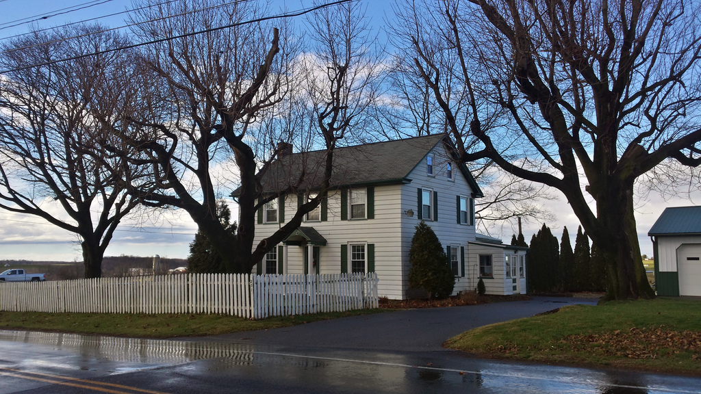
| Description | : | Andrews' Methodist Episcopal Church was founded in the late 1820s, with meetings being held first in the dwelling-house of Henry Andrews, and then at a nearby schoolhouse. In 1831, a meetinghouse was built on a one-acre lot on the corner of Henry Andrews' farm, for which no deed was given until July 20, 1833. The church was sold to James Smith in 1856 and converted into a dwelling-house. The graveyard across the Highland Ridge Road was reserved as such and was used through the 1880s as a burying place. By 1926, the cemetery was overgrown in a grove of locust trees,... Read More |
frequently asked questions (FAQ):
-
Where is Andrews Methodist Episcopal Cemetery?
Andrews Methodist Episcopal Cemetery is located at 226 Highland Road Atglen, Chester County ,Pennsylvania , 19310USA.
-
Andrews Methodist Episcopal Cemetery cemetery's updated grave count on graveviews.com?
0 memorials
-
Where are the coordinates of the Andrews Methodist Episcopal Cemetery?
Latitude: 39.9280400
Longitude: -75.9480900
Nearby Cemetories:
1. Glen Run Cemetery
Atglen, Chester County, USA
Coordinate: 39.9356000, -75.9532100
2. Atglen Baptist Cemetery
Atglen, Chester County, USA
Coordinate: 39.9457680, -75.9725820
3. Penningtonville Cemetery
Atglen, Chester County, USA
Coordinate: 39.9461340, -75.9729050
4. Atglen Methodist Cemetery
Atglen, Chester County, USA
Coordinate: 39.9477900, -75.9741700
5. Maple Grove Mennonite Cemetery
Atglen, Chester County, USA
Coordinate: 39.9597549, -75.9676666
6. Cochranville United Methodist Cemetery
Cochranville, Chester County, USA
Coordinate: 39.8960000, -75.9239000
7. Our Lady of the Seven Dolors Roman Catholic Cemetery
Parkesburg, Chester County, USA
Coordinate: 39.9632912, -75.9295197
8. Mount Zion African Methodist Episcopal Cemetery
Atglen, Chester County, USA
Coordinate: 39.9546390, -75.9850720
9. Wasteland Church Cemetery
Christiana, Lancaster County, USA
Coordinate: 39.9105220, -76.0033160
10. Adams Cemetery
Highland Township, Chester County, USA
Coordinate: 39.9117690, -75.8866670
11. Upper Octorara Presbyterian Church Cemetery
Sadsbury Township, Chester County, USA
Coordinate: 39.9742012, -75.9163971
12. Mount Pleasant United Methodist Cemetery
Christiana, Lancaster County, USA
Coordinate: 39.9059900, -76.0100000
13. Upper Octorara New Side Presbyterian Cemetery
Sadsbury Township, Chester County, USA
Coordinate: 39.9667300, -75.9001400
14. Sadsbury Friends Burial Ground
Christiana, Lancaster County, USA
Coordinate: 39.9708080, -75.9906830
15. East Sadsbury Friends Burial Ground
Parkesburg, Chester County, USA
Coordinate: 39.9796490, -75.9149740
16. Friendship United Methodist Church Cemetery
Gum Tree, Chester County, USA
Coordinate: 39.9154015, -75.8740997
17. Friendship Cemetery East
Gum Tree, Chester County, USA
Coordinate: 39.9155200, -75.8707000
18. Bawa Muhaiyaddeen Fellowship Farm Grounds Cemetery
Coatesville, Chester County, USA
Coordinate: 39.9447330, -75.8618150
19. Brinton Family Burial Ground
Lancaster County, USA
Coordinate: 39.9772910, -76.0114550
20. Homeville Amish Cemetery
Homeville, Chester County, USA
Coordinate: 39.8628505, -75.9809139
21. Doe Run Friends Cemetery
Cochranville, Chester County, USA
Coordinate: 39.8886000, -75.8722600
22. Andrews Bridge Mennonite Cemetery
Christiana, Lancaster County, USA
Coordinate: 39.8747000, -76.0087000
23. Homeville Friends Burying Ground
Homeville, Chester County, USA
Coordinate: 39.8605000, -75.9876000
24. Simmontown Mennonite Church Cemetery
Gap, Lancaster County, USA
Coordinate: 39.9842230, -76.0120010