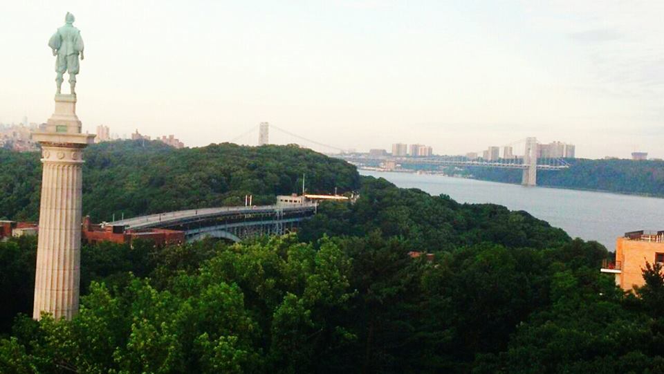
| Memorials | : | 0 |
| Location | : | Spuyten Duyvil, Bronx County, USA |
| Coordinate | : | 40.8825000, -73.9186111 |
| Description | : | The family plot containing the remains of John Archer, founder of Fordham Manor, is said to be located on Tetard's Hill, which was formerly a part of the family estate. |
frequently asked questions (FAQ):
-
Where is Archer Family Plot?
Archer Family Plot is located at Spuyten Duyvil, Bronx County ,New York ,USA.
-
Archer Family Plot cemetery's updated grave count on graveviews.com?
0 memorials
-
Where are the coordinates of the Archer Family Plot?
Latitude: 40.8825000
Longitude: -73.9186111
Nearby Cemetories:
1. Bell Tower Park Memorial
Riverdale, Bronx County, USA
Coordinate: 40.8892600, -73.9083400
2. Dyckman-Nagel Cemetery (Defunct)
Inwood, New York County (Manhattan), USA
Coordinate: 40.8677000, -73.9153300
3. Undercliff Cemetery
Englewood Cliffs, Bergen County, USA
Coordinate: 40.8872400, -73.9423200
4. Berrian Burying Ground
Fordham, Bronx County, USA
Coordinate: 40.8625100, -73.9085990
5. Vault Hill Cemetery
Bronx, Bronx County, USA
Coordinate: 40.8958800, -73.8916700
6. Monastery of the Visitation Cemetery
Bronx, Bronx County, USA
Coordinate: 40.9061010, -73.9092290
7. Saint Frances Cabrini Shrine Chapel
Manhattan, New York County (Manhattan), USA
Coordinate: 40.8576241, -73.9354172
8. Valentine-Varian Family Cemetery (Defunct)
Bronx, Bronx County, USA
Coordinate: 40.8771270, -73.8799590
9. Holy Cross Armenian Church
Manhattan, New York County (Manhattan), USA
Coordinate: 40.8527500, -73.9304100
10. Fordham College Cemetery
Bronx, Bronx County, USA
Coordinate: 40.8634350, -73.8858690
11. Sisters of Charity Cemetery
Riverdale, Bronx County, USA
Coordinate: 40.9134490, -73.9072730
12. Corsa Family Cemetery
Fordham, Bronx County, USA
Coordinate: 40.8616200, -73.8857000
13. James Gordon Bennet Park
Manhattan, New York County (Manhattan), USA
Coordinate: 40.8528040, -73.9380950
14. Woodlawn Cemetery
Bronx, Bronx County, USA
Coordinate: 40.8883018, -73.8728027
15. Woodland Cemetery
Englewood Cliffs, Bergen County, USA
Coordinate: 40.8703510, -73.9653150
16. First Presbyterian Church Memorial Garden
Englewood, Bergen County, USA
Coordinate: 40.8910030, -73.9702980
17. Saint Pauls Church Memorial Garden
Englewood, Bergen County, USA
Coordinate: 40.8962750, -73.9705010
18. Brookside Cemetery
Englewood, Bergen County, USA
Coordinate: 40.9057999, -73.9646988
19. Mount Carmel Cemetery
Tenafly, Bergen County, USA
Coordinate: 40.9118996, -73.9666977
20. Old Presbyterian Church Cemetery
West Farms, Bronx County, USA
Coordinate: 40.8439960, -73.8797820
21. Leonia Slave Cemetery (Defunct)
Leonia, Bergen County, USA
Coordinate: 40.8715410, -73.9809930
22. West Farms Soldier Cemetery
West Farms, Bronx County, USA
Coordinate: 40.8435826, -73.8793190
23. Fort Lee Municipal Building
Fort Lee, Bergen County, USA
Coordinate: 40.8525900, -73.9725800
24. Madonna Cemetery
Fort Lee, Bergen County, USA
Coordinate: 40.8619003, -73.9805984

