| Memorials | : | 0 |
| Location | : | Clio, Roane County, USA |
| Coordinate | : | 38.5694800, -81.3097500 |
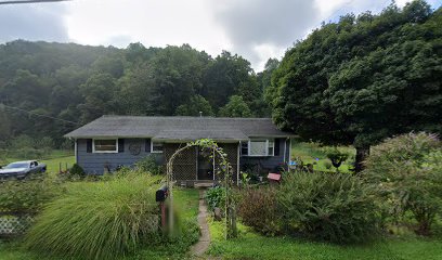
| Description | : | Located at 730 Clio Rd., Clio, Roane County, WV. This is the only grave at this location. WPA reading dated 3/25/1940 ARMSTEAD CEMETERY #3, nr. Clio, on Hurricane Rd., Henry Roupe farm. Established 1904 as family burial ground; extend, 1 grave; not fenced; condition, poor; grave not marked; no longer in use as burial ground. Marked graves, none; unmarked graves, one. Margin note: This man was buried here at his own request, it being under a shade tree where he often rested when at work on his farm. Grave is not marked; information given by Charley Armstead, Clio, W.Va. |
frequently asked questions (FAQ):
-
Where is Armstead Cemetery #3?
Armstead Cemetery #3 is located at 730 Clio Rd. Clio, Roane County ,West Virginia ,USA.
-
Armstead Cemetery #3 cemetery's updated grave count on graveviews.com?
0 memorials
-
Where are the coordinates of the Armstead Cemetery #3?
Latitude: 38.5694800
Longitude: -81.3097500
Nearby Cemetories:
1. Armstead Cemetery
Clio, Roane County, USA
Coordinate: 38.5671997, -81.3114014
2. Jackson Cemetery
Roane County, USA
Coordinate: 38.5541992, -81.3242035
3. Ashley Waitman Cemetery
Amma, Roane County, USA
Coordinate: 38.5727997, -81.2835999
4. Ashley Cemetery
Clio, Roane County, USA
Coordinate: 38.5728930, -81.2831610
5. Payne Cemetery
Clio, Roane County, USA
Coordinate: 38.5891991, -81.2957993
6. Holbert Cemetery
Cotton, Roane County, USA
Coordinate: 38.5878900, -81.3312500
7. Barnhouse Cemetery
Roane County, USA
Coordinate: 38.5842018, -81.3375015
8. Harper Cemetery
Cotton, Roane County, USA
Coordinate: 38.5703600, -81.3441800
9. Harper Family Cemetery
Cotton, Roane County, USA
Coordinate: 38.5689316, -81.3494580
10. Franklin Taylor Cemetery
Roane County, USA
Coordinate: 38.5494003, -81.3403015
11. Amma Cemetery
Amma, Roane County, USA
Coordinate: 38.5660190, -81.2670710
12. Hayes Cemetery
Cotton, Roane County, USA
Coordinate: 38.5480800, -81.3473250
13. Gandee Cemetery
Roane County, USA
Coordinate: 38.6049995, -81.3249969
14. Reed Cemetery
Amma, Roane County, USA
Coordinate: 38.5614014, -81.2608032
15. Groves Cemetery
Roane County, USA
Coordinate: 38.6081000, -81.2964000
16. George Groves Cemetery
Left Hand, Roane County, USA
Coordinate: 38.6083861, -81.2963389
17. Casey Cemetery
Roane County, USA
Coordinate: 38.5414009, -81.3486023
18. J. Herbert Smith Sr. Cemetery
Roane County, USA
Coordinate: 38.6109380, -81.3227570
19. Jones Cemetery
Roane County, USA
Coordinate: 38.5929700, -81.3559900
20. Board Cemetery
Clendenin, Kanawha County, USA
Coordinate: 38.5358290, -81.3447250
21. Groves Cemetery
Roane County, USA
Coordinate: 38.6123560, -81.2968860
22. Jackson Cemetery
Roane County, USA
Coordinate: 38.6138992, -81.3067017
23. Bird Cemetery
Roane County, USA
Coordinate: 38.5868988, -81.3644028
24. Hershberger Cemetery
Roane County, USA
Coordinate: 38.6150017, -81.2996979

