
| Memorials | : | 0 |
| Location | : | Macon County, USA |
| Coordinate | : | 35.0969162, -83.5438004 |
frequently asked questions (FAQ):
-
Where is Ascension Episcopal Chapel and Cemetery?
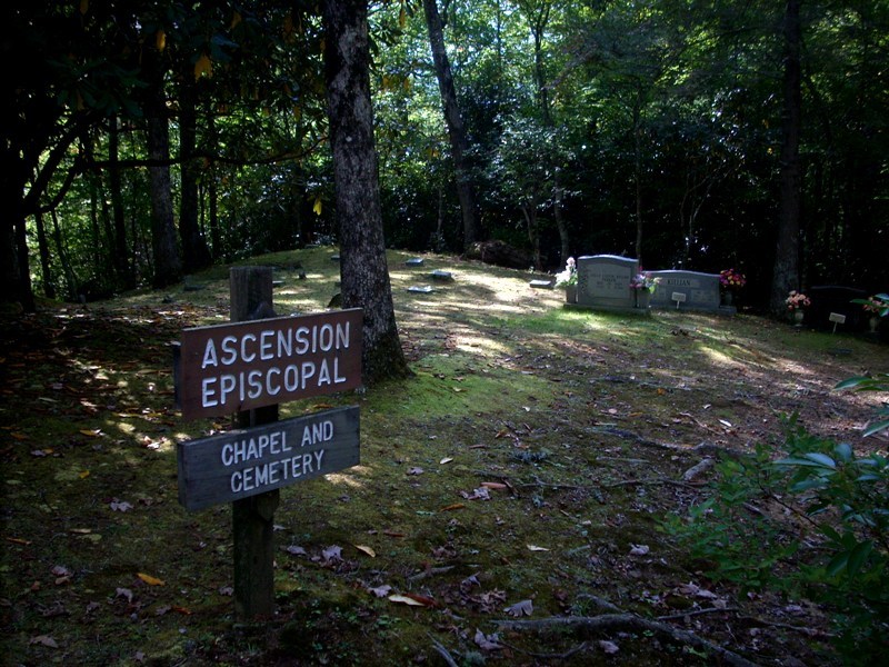
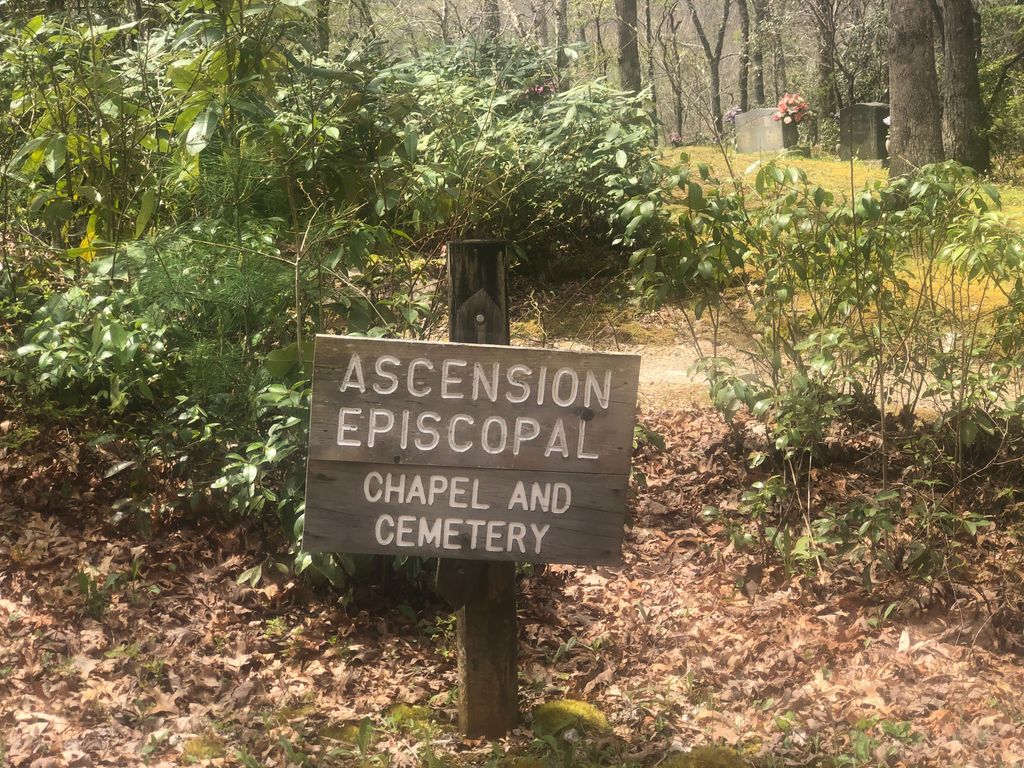
Ascension Episcopal Chapel and Cemetery is located at Macon County ,North Carolina ,USA.
-
Ascension Episcopal Chapel and Cemetery cemetery's updated grave count on graveviews.com?
0 memorials
-
Where are the coordinates of the Ascension Episcopal Chapel and Cemetery?
Latitude: 35.0969162
Longitude: -83.5438004
Nearby Cemetories:
1. St. John's Cartoogechaye Episcopal Church Cemetery
Franklin, Macon County, USA
Coordinate: 35.1425000, -83.4925000
2. Mount Zion Cemetery
Macon County, USA
Coordinate: 35.1469020, -83.4721720
3. Charlie Sanders Cemetery
Franklin, Macon County, USA
Coordinate: 35.1077882, -83.4232834
4. Bethel United Methodist Church Cemetery
Shooting Creek, Clay County, USA
Coordinate: 35.0205850, -83.6414240
5. Eagle Fork Baptist Church Cemetery
Hayesville, Clay County, USA
Coordinate: 35.0205850, -83.6414240
6. Patton United Methodist Church Cemetery
Franklin, Macon County, USA
Coordinate: 35.1491600, -83.4182600
7. Roper Cemetery
Macon County, USA
Coordinate: 35.2129870, -83.5060500
8. Tippet Cemetery
Macon County, USA
Coordinate: 35.2172012, -83.5194016
9. Mission Hill Baptist Cemetery
Shooting Creek, Clay County, USA
Coordinate: 35.0243910, -83.6648690
10. Ledford-Moffitt Cemetery
Macon County, USA
Coordinate: 35.1281013, -83.3972015
11. Marshall's Chapel UMC Cemetery
Hayesville, Clay County, USA
Coordinate: 35.0230270, -83.6656550
12. Union Methodist Church Cemetery
Franklin, Macon County, USA
Coordinate: 35.1232170, -83.3921340
13. Shooting Creek Church of God Cemetery
Hayesville, Clay County, USA
Coordinate: 35.0227750, -83.6711320
14. Asbury Cemetery
Otto, Macon County, USA
Coordinate: 35.0628014, -83.3899994
15. Rush Cemetery
Otto, Macon County, USA
Coordinate: 35.0905991, -83.3842010
16. Aquone Baptist Church Cemetery
Aquone, Macon County, USA
Coordinate: 35.2094100, -83.6259800
17. Dowdle Family Cemetery
Prentiss, Macon County, USA
Coordinate: 35.1167410, -83.3848680
18. Ben Klassen Memorial Park
Otto, Macon County, USA
Coordinate: 35.0600921, -83.3876547
19. Bethabara Cemetery
Hayesville, Clay County, USA
Coordinate: 35.0063470, -83.6628070
20. Wilkes Cemetery
Burningtown, Macon County, USA
Coordinate: 35.2125000, -83.4627800
21. New Hope Cemetery
Franklin, Macon County, USA
Coordinate: 35.1780710, -83.4126770
22. Conley - Penland
Macon County, USA
Coordinate: 35.0598490, -83.3830180
23. Woodlawn Cemetery
Franklin, Macon County, USA
Coordinate: 35.1716670, -83.4005500
24. Galloway Hill Cemetery
Clay County, USA
Coordinate: 35.0205994, -83.6866989