
| Memorials | : | 1 |
| Location | : | Chesterfield, Cheshire County, USA |
| Website | : | chesterfield.nh.gov/cemetary-commission/ |
| Coordinate | : | 42.9036110, -72.3908330 |
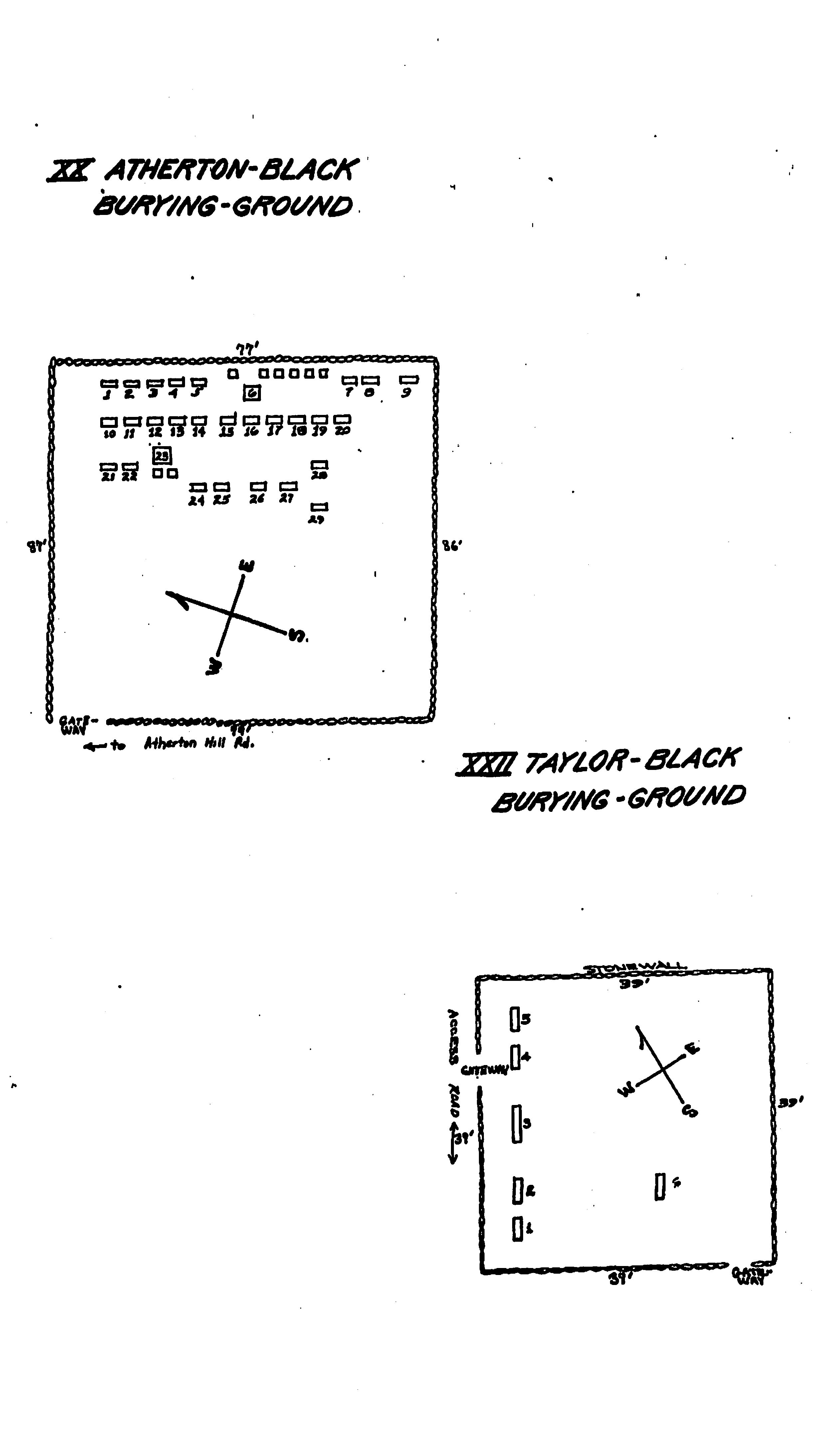
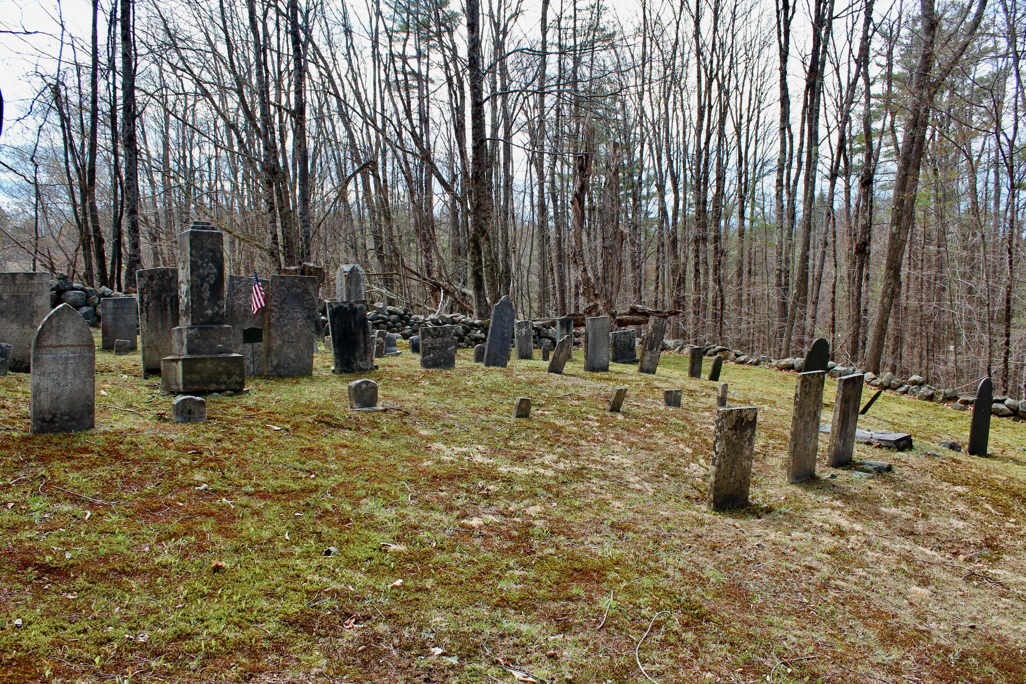
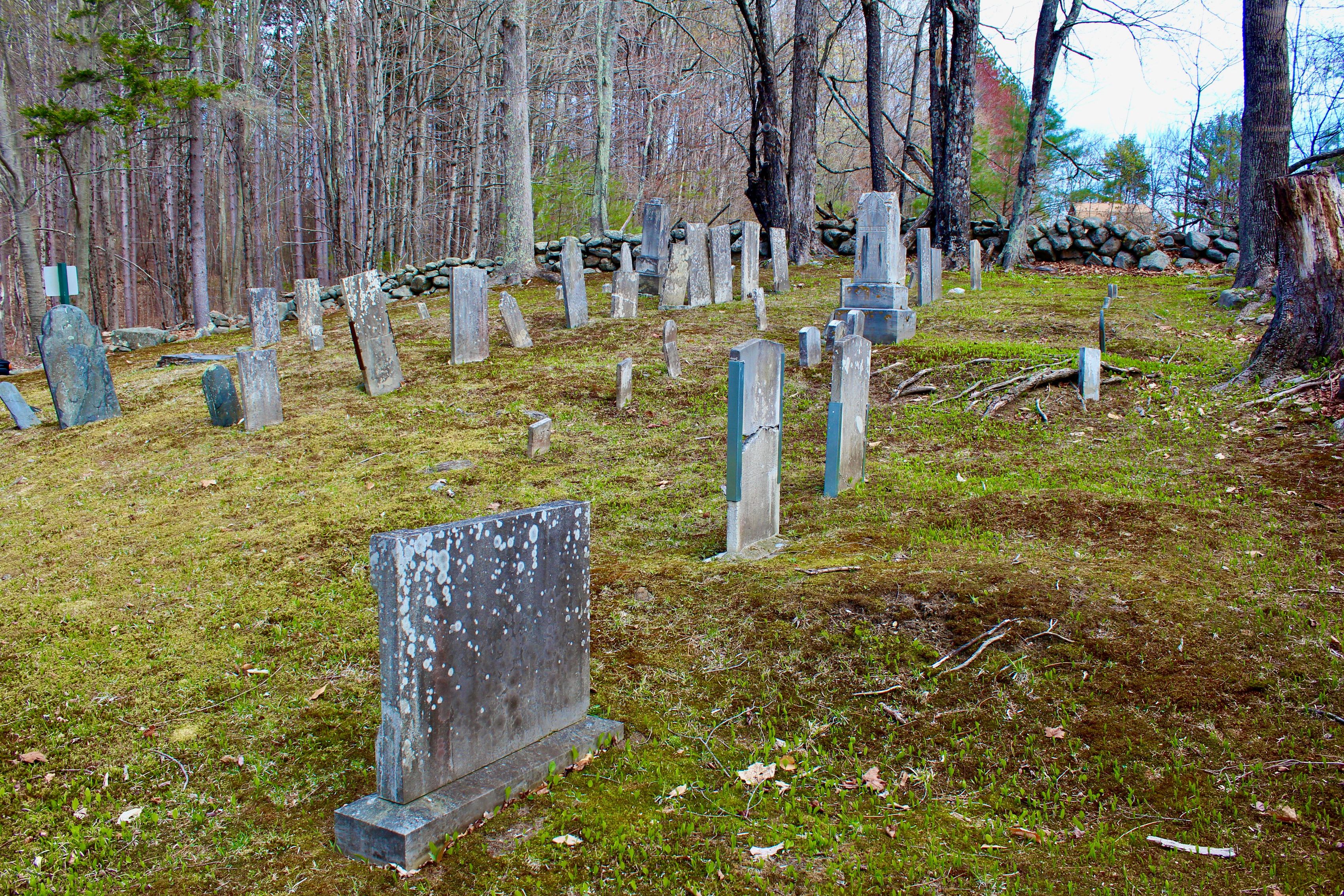
| Description | : | This lovely old burying-ground is a five minute walk long a narrow lane (Bartlett Rd.) to the south of Atherton Hill Road, about 1-1/2 miles from the junction with Route 9 near Spofford Village. Deeded to the town in 1817 by Joseph Atherton, this yard contains 36 graves ranging in date from 1814-1917. (From the book "From Journey's End to Hardscrabble: A guided tour of the cemeteries and burying-grounds of Chesterfield, NH", published by the Cemeteries Committee of the Chesterfield Historical Society. Originally published in 1980, updated in 2002.) New Hampshire Old Graveyard Association database cemetery... Read More |
frequently asked questions (FAQ):
-
Where is Atherton-Black Burying-Ground?
Atherton-Black Burying-Ground is located at Bartlett Road Chesterfield, Cheshire County ,New Hampshire , 03443USA.
-
Atherton-Black Burying-Ground cemetery's updated grave count on graveviews.com?
1 memorials
-
Where are the coordinates of the Atherton-Black Burying-Ground?
Latitude: 42.9036110
Longitude: -72.3908330


Nearby Cemetories:
1. Pattridge-Albee Cemetery
Chesterfield, Cheshire County, USA
Coordinate: 42.9194000, -72.3946000
2. Robbins Burying Ground
Chesterfield, Cheshire County, USA
Coordinate: 42.8827780, -72.4027780
3. Spofford Cemetery
Spofford, Cheshire County, USA
Coordinate: 42.9088800, -72.4208400
4. Field Burying Ground
Chesterfield, Cheshire County, USA
Coordinate: 42.9235000, -72.4061000
5. Taylor-Black Burying Ground
Chesterfield, Cheshire County, USA
Coordinate: 42.8794440, -72.4022220
6. Latham-Beal Cemetery
Chesterfield, Cheshire County, USA
Coordinate: 42.8605560, -72.4000000
7. Draper-Crouch Burying Ground
Chesterfield, Cheshire County, USA
Coordinate: 42.8594440, -72.3852780
8. Lord Cemetery
Westmoreland, Cheshire County, USA
Coordinate: 42.9511700, -72.4266600
9. Wetherbee Cemetery
Chesterfield, Cheshire County, USA
Coordinate: 42.8942500, -72.4650800
10. Ware-Joslyn Cemetery
Chesterfield, Cheshire County, USA
Coordinate: 42.8875000, -72.4633330
11. Friedsam Cemetery
Chesterfield, Cheshire County, USA
Coordinate: 42.8942800, -72.4663800
12. Mead-Converse Burying Ground
Cheshire County, USA
Coordinate: 42.8931000, -72.4668000
13. Hurricane Road Cemetery
Keene, Cheshire County, USA
Coordinate: 42.9555700, -72.3594300
14. Center Cemetery
Chesterfield, Cheshire County, USA
Coordinate: 42.8870670, -72.4693210
15. Oak Hill Cemetery
West Swanzey, Cheshire County, USA
Coordinate: 42.8721800, -72.3213200
16. Homestead Cemetery
West Swanzey, Cheshire County, USA
Coordinate: 42.8681940, -72.3241210
17. Ash Swamp Burying Ground
Keene, Cheshire County, USA
Coordinate: 42.9294100, -72.3153800
18. Wheeler Burying Ground
Cheshire County, USA
Coordinate: 42.9006000, -72.4771000
19. West Cemetery
Keene, Cheshire County, USA
Coordinate: 42.9376200, -72.3165600
20. Presho Burying Ground
Chesterfield, Cheshire County, USA
Coordinate: 42.9194440, -72.4761110
21. Thompson-Chamberlain Burying Ground
West Chesterfield, Cheshire County, USA
Coordinate: 42.9148000, -72.4794000
22. Timothy Robertson Burying Ground
Chesterfield, Cheshire County, USA
Coordinate: 42.9152000, -72.4794000
23. South Village Cemetery
Westmoreland, Cheshire County, USA
Coordinate: 42.9608300, -72.4400200
24. Village Cemetery
Westport, Cheshire County, USA
Coordinate: 42.8457300, -72.3412100