
| Memorials | : | 0 |
| Location | : | Johnson County, USA |
| Coordinate | : | 39.3748400, -85.9901200 |
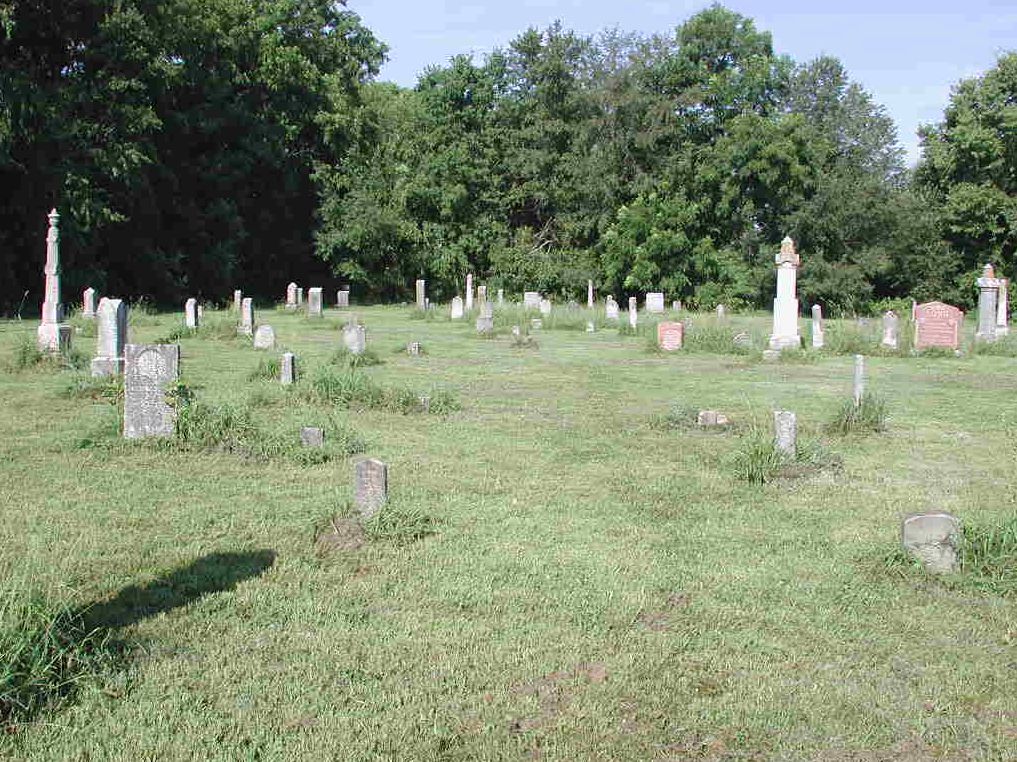
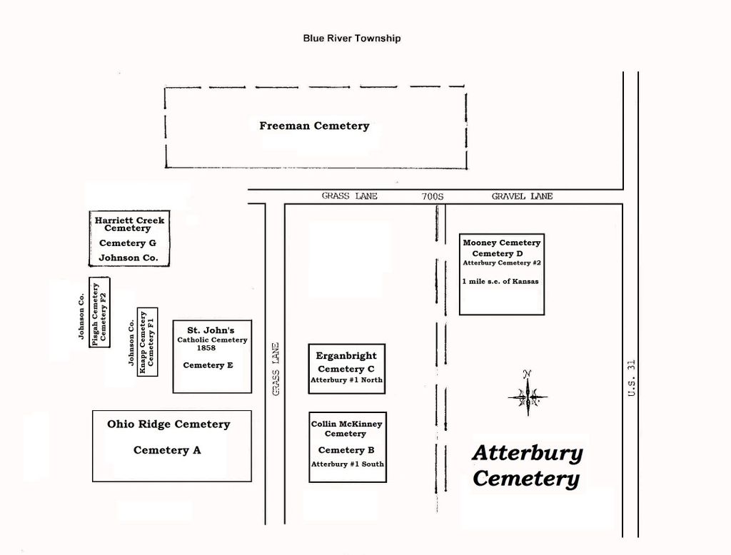
| Description | : | This cemetery contains cemeteries that were moved from the site of Camp Atterbury in the early 1940s. The Johnson County cemeteries that were relocated to Atterbury Cemetery are: Knapp (DeHart), Pisgah Methodist, Hollandbeck and Pritchard Cemeteries. The Bartholomew County cemeteries that were relocated to Atterbury are : Ohio Ridge, St. John's Lutheran, Bethel Methodist, Long, Garrison, Mt.Olive, and Mt. Carmel. When the Government relocated these cemeteries, they gave each cemetery a number to identify them, and did not use the original cemetery name. We are not sure which cemetery corresponds to these numbers except for St. John's Lutheran Cemetery, which is identified... Read More |
frequently asked questions (FAQ):
-
Where is Atterbury Cemetery?
Atterbury Cemetery is located at Johnson County ,Indiana ,USA.
-
Atterbury Cemetery cemetery's updated grave count on graveviews.com?
0 memorials
-
Where are the coordinates of the Atterbury Cemetery?
Latitude: 39.3748400
Longitude: -85.9901200
Nearby Cemetories:
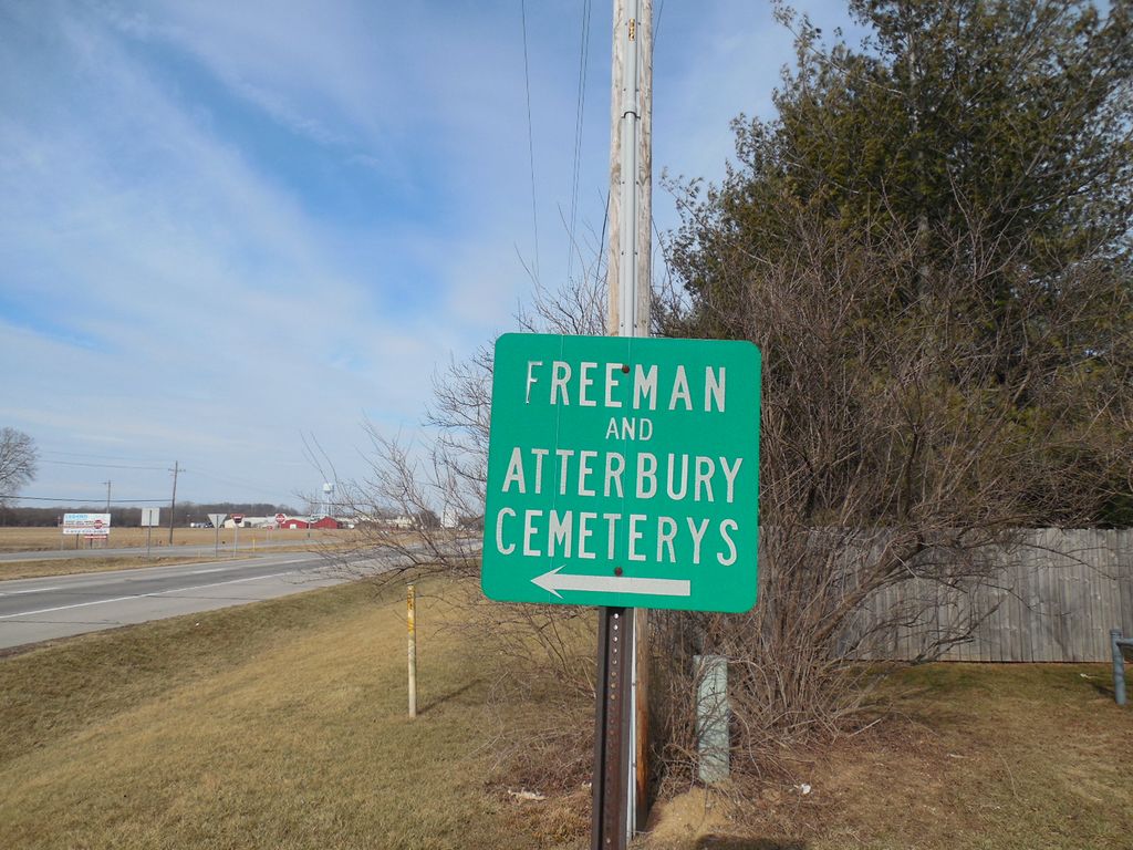
1. Freeman Cemetery
Edinburgh, Johnson County, USA
Coordinate: 39.3760986, -85.9894028
2. Edinburgh Hill Cemetery
Edinburgh, Johnson County, USA
Coordinate: 39.3541150, -85.9716870
3. Cutsinger Cemetery
Edinburgh, Johnson County, USA
Coordinate: 39.3944340, -85.9636510
4. Rest Haven Cemetery
Edinburgh, Johnson County, USA
Coordinate: 39.3466988, -85.9738998
5. Hamner Cemetery
Amity, Johnson County, USA
Coordinate: 39.4143982, -86.0006027
6. Pritchard Cemetery (Defunct)
Nineveh, Johnson County, USA
Coordinate: 39.3682750, -86.0423480
7. Cutsinger Cemetery
Shelby County, USA
Coordinate: 39.3664246, -85.9358292
8. Graham Cemetery
Mount Auburn, Shelby County, USA
Coordinate: 39.3914530, -85.9379460
9. Armstrong Cemetery
Amity, Johnson County, USA
Coordinate: 39.4191933, -85.9914856
10. Frost Hill Cemetery
Shelby County, USA
Coordinate: 39.3554916, -85.9377441
11. Ergenbright Graveyard
Kansas, Bartholomew County, USA
Coordinate: 39.3314340, -86.0100530
12. Middle of the Road Grave
Franklin, Johnson County, USA
Coordinate: 39.4198800, -85.9759000
13. Garrison Cemetery (Defunct)
Kansas, Bartholomew County, USA
Coordinate: 39.3307620, -86.0105900
14. Atwood Cemetery
Johnson County, USA
Coordinate: 39.4170800, -85.9616000
15. Nay-Tremain Cemetery
Nineveh, Johnson County, USA
Coordinate: 39.4010620, -86.0416031
16. Kyle Family Graveyard
Cuba, Bartholomew County, USA
Coordinate: 39.3419810, -85.9428910
17. Carvin Family Graveyard
Cuba, Bartholomew County, USA
Coordinate: 39.3343560, -85.9519140
18. Brockman Cemetery
Shelby County, USA
Coordinate: 39.4136009, -85.9413986
19. Kansas Cemetery
Kansas, Bartholomew County, USA
Coordinate: 39.3293991, -86.0322037
20. Thomas Jones Family Graves
Taylorsville, Bartholomew County, USA
Coordinate: 39.3183600, -85.9958700
21. Old Nineveh Cemetery
Nineveh, Johnson County, USA
Coordinate: 39.3669624, -86.0665817
22. POW Chapel Cemetery (Defunct)
Nineveh, Johnson County, USA
Coordinate: 39.3752940, -86.0688320
23. Legan Cemetery
Nineveh, Johnson County, USA
Coordinate: 39.4185890, -86.0495710
24. Conover Cemetery
Shelby County, USA
Coordinate: 39.4032640, -85.9157360