
| Memorials | : | 0 |
| Location | : | Flag Pond, Unicoi County, USA |
| Coordinate | : | 36.0161800, -82.5929100 |
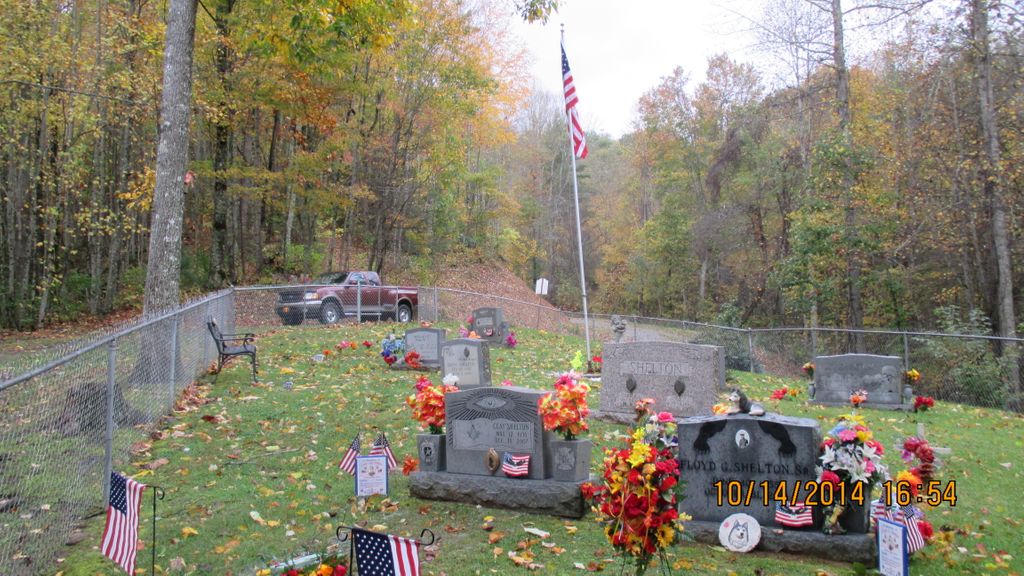
| Description | : | B Z Shelton cemetery is located approximately three miles up Devils Fork Road (Highway 352) It is the first road turning left after you pass Sweetwater Church of God. The cemetery was named after the man who owned the land and the first one to be buried there. Boney Z Shelton gave a portion of his land to Sweetwater Church of God so the church could expand. Boney Shelton and his heirs has been very generous with their land supporting the grand old church. The cemetery is a family cemetery as everyone buried there are related. We thank God for the Shelton... Read More |
frequently asked questions (FAQ):
-
Where is B Z Shelton Cemetery?
B Z Shelton Cemetery is located at Highway 352 Flag Pond, Unicoi County ,Tennessee , 37657USA.
-
B Z Shelton Cemetery cemetery's updated grave count on graveviews.com?
0 memorials
-
Where are the coordinates of the B Z Shelton Cemetery?
Latitude: 36.0161800
Longitude: -82.5929100
Nearby Cemetories:
1. Carter Cemetery #2
Flag Pond, Unicoi County, USA
Coordinate: 36.0183900, -82.5916300
2. John H. Carter Cemetery
Unicoi County, USA
Coordinate: 36.0184000, -82.5916400
3. McIntosh-Hensley Cemetery
Flag Pond, Unicoi County, USA
Coordinate: 36.0127200, -82.5990900
4. Shelton Cemetery #2
Flag Pond, Unicoi County, USA
Coordinate: 36.0089300, -82.5909300
5. Shelton Family Cemetery
Flag Pond, Unicoi County, USA
Coordinate: 36.0138100, -82.6054500
6. Luther Hensley Cemetery
Unicoi County, USA
Coordinate: 36.0090500, -82.6047700
7. Ray-Rice Cemetery
Flag Pond, Unicoi County, USA
Coordinate: 36.0186250, -82.5783690
8. Haire Cemetery
Flag Pond, Unicoi County, USA
Coordinate: 36.0055800, -82.6071750
9. Claude Hensley Cemetery
Flag Pond, Unicoi County, USA
Coordinate: 36.0015700, -82.6013700
10. Donald Shelton Cemetery
Carmen, Madison County, USA
Coordinate: 36.0111600, -82.6120900
11. Shelton-Ray Cemetery
Flag Pond, Unicoi County, USA
Coordinate: 36.0235300, -82.5740800
12. Hensley-Riddle Cemetery
Unicoi County, USA
Coordinate: 36.0027100, -82.6063600
13. Silvers Cemetery
Flag Pond, Unicoi County, USA
Coordinate: 36.0086600, -82.5729400
14. Roseville Cemetery
Flag Pond, Unicoi County, USA
Coordinate: 36.0096000, -82.5721200
15. B. E. Shelton Cemetery
Marshall, Madison County, USA
Coordinate: 36.0226097, -82.6156616
16. Boone Cove Gap Cemetery
Madison County, USA
Coordinate: 36.0049200, -82.6138900
17. Douglas Rice Cemetery
Flag Pond, Unicoi County, USA
Coordinate: 36.0273000, -82.5689200
18. Silvers Cemetery
Flag Pond, Unicoi County, USA
Coordinate: 35.9965100, -82.5769600
19. Stokley Cutshall Cemetery
Marshall, Madison County, USA
Coordinate: 36.0186000, -82.6228800
20. Hogskin Creek Cemetery
Flag Pond, Unicoi County, USA
Coordinate: 36.0139427, -82.5623627
21. Moore Cemetery
Flag Pond, Unicoi County, USA
Coordinate: 36.0085400, -82.5625300
22. Farmer Family Cemetery
Flag Pond, Unicoi County, USA
Coordinate: 36.0173819, -82.5588547
23. Harris Cemetery
Flag Pond, Unicoi County, USA
Coordinate: 36.0298940, -82.5614150
24. Treadway Cemetery
Flag Pond, Unicoi County, USA
Coordinate: 36.0067000, -82.5567400