
| Memorials | : | 3 |
| Location | : | Middleton Corner, Greene County, USA |
| Coordinate | : | 39.5809700, -83.9081700 |
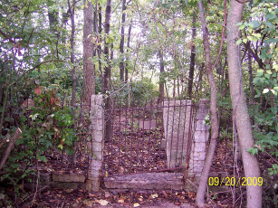
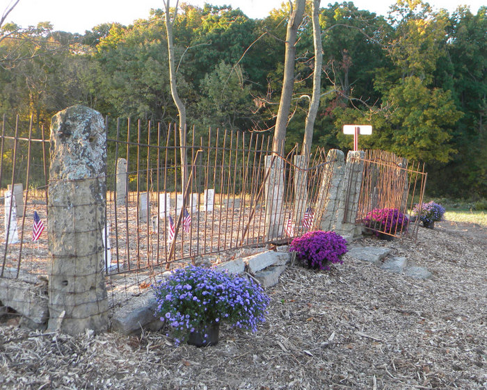
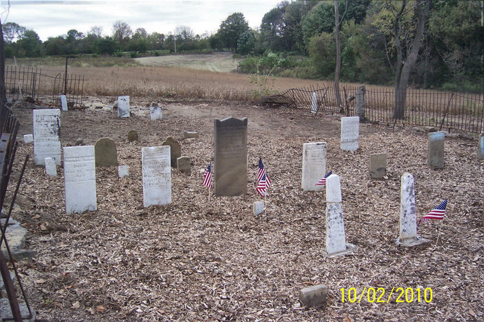
| Description | : | The Babb Cemetery is located on a privately-owned farm (Lat. N39.58097°, Long. W-83.90817°, elevation 973') near the corner of Old Winchester Trail and Mill Road, in a section of Caesarscreek Township formerly known as Babbtown (or Winchester) in Greene County, Ohio. The farm was originally owned by Abel Peterson and is currently owned by a descendant, Jeff Peterson. The cemetery was named after the Babb family, who emigrated to this area from Frederick County, Virginia in 1810. Thomas Babb, Jr. owned nearby land to the north. In September 2009 the Xenia Ohio chapter of the National Society of... Read More |
frequently asked questions (FAQ):
-
Where is Babb Cemetery?
Babb Cemetery is located at Old Winchester Trail Middleton Corner, Greene County ,Ohio , 45385USA.
-
Babb Cemetery cemetery's updated grave count on graveviews.com?
3 memorials
-
Where are the coordinates of the Babb Cemetery?
Latitude: 39.5809700
Longitude: -83.9081700

Nearby Cemetories:
1. Zoar Methodist Church Cemetery
Paintersville, Greene County, USA
Coordinate: 39.5898323, -83.9038086
2. Peterson Family Cemetery
Chester Township, Clinton County, USA
Coordinate: 39.5638300, -83.9064910
3. Boots Cemetery
Middleton Corner, Greene County, USA
Coordinate: 39.5942530, -83.8886890
4. Brown Cemetery
Maple Corner, Greene County, USA
Coordinate: 39.6006000, -83.8928810
5. Wilberforce Cemetery
Wilberforce, Greene County, USA
Coordinate: 39.6006000, -83.8928810
6. Eleazer Cemetery
Middleton Corner, Greene County, USA
Coordinate: 39.5827065, -83.8757477
7. Keiter Cemetery
Lumberton, Clinton County, USA
Coordinate: 39.5616989, -83.8814011
8. Maple Corner Cemetery
Maple Corner, Greene County, USA
Coordinate: 39.6106161, -83.9065960
9. Martindale Cemetery
New Jasper, Greene County, USA
Coordinate: 39.6145970, -83.8857580
10. Mount Pisgah Cemetery (Defunct)
Chester Township, Clinton County, USA
Coordinate: 39.5428640, -83.9177940
11. New Burlington Cemetery
New Burlington, Clinton County, USA
Coordinate: 39.5675201, -83.9591064
12. Ireland Cemetery #2
Paintersville, Greene County, USA
Coordinate: 39.6214000, -83.8864060
13. New Burlington-Oglesbee Cemetery
Lumberton, Clinton County, USA
Coordinate: 39.5506470, -83.8652910
14. Mercer Cemetery
Spring Valley Township, Greene County, USA
Coordinate: 39.6097830, -83.9543750
15. McKnight Cemetery
Spring Valley Township, Greene County, USA
Coordinate: 39.5906860, -83.9725670
16. Maxey Cemetery
Xenia, Greene County, USA
Coordinate: 39.6333110, -83.9201500
17. Ireland Cemetery #1
Paintersville, Greene County, USA
Coordinate: 39.6083330, -83.8473130
18. Rich Cemetery
Xenia, Greene County, USA
Coordinate: 39.6316390, -83.9339140
19. New Hope Cemetery
Paintersville, Greene County, USA
Coordinate: 39.5778923, -83.8358994
20. Lewis Cemetery
Caesarscreek Township, Greene County, USA
Coordinate: 39.5782000, -83.8348000
21. Elam Cemetery
Spring Valley, Greene County, USA
Coordinate: 39.6060867, -83.9771729
22. Lucas Cemetery
Xenia, Greene County, USA
Coordinate: 39.6150140, -83.8447220
23. Chester Friends Church Cemetery
Gurneyville, Clinton County, USA
Coordinate: 39.5197832, -83.8963175
24. McDonald Cemetery
Xenia, Greene County, USA
Coordinate: 39.6410190, -83.8825030