
| Memorials | : | 0 |
| Location | : | Arcola, Douglas County, USA |
| Coordinate | : | 39.6796500, -88.3872800 |
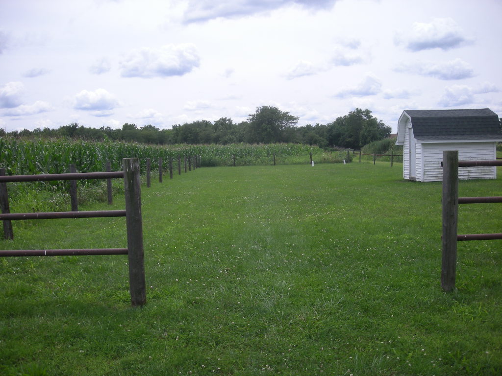
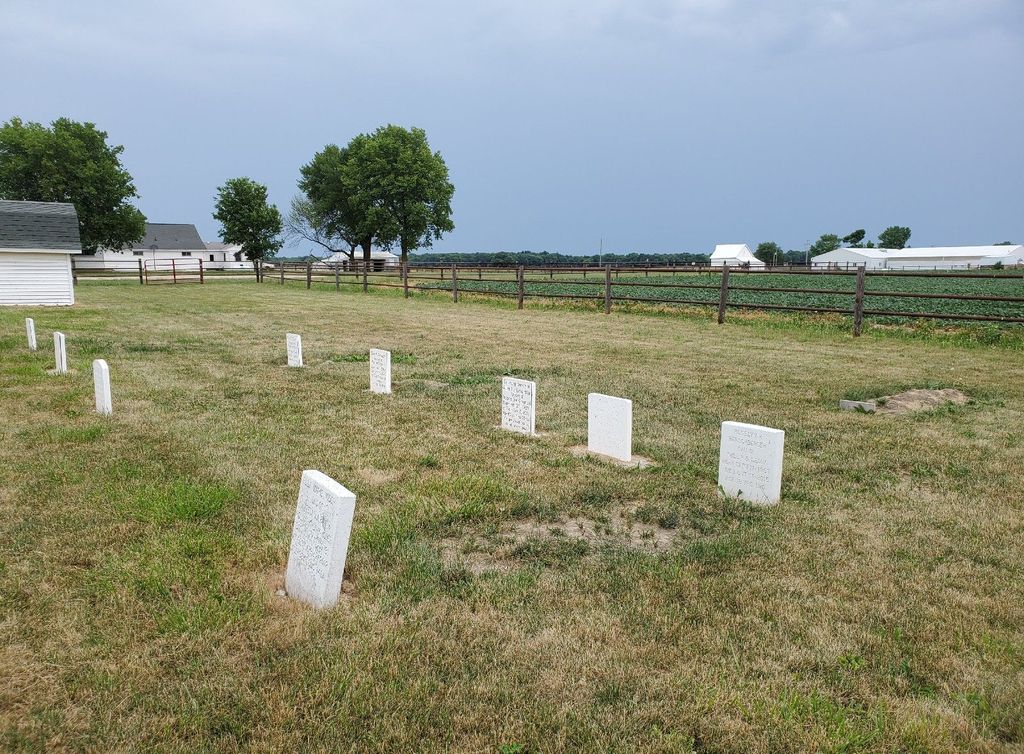
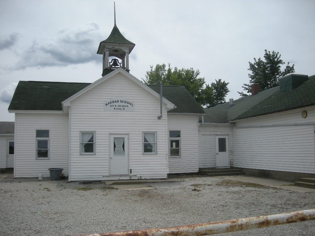
| Description | : | The internet listing for the school states that the address is 379 E CR 200N but the building plaque shows 427 E. CR 200N. The cemetery is in the rear of the property behind the school. Campbell Cemetery is about a quarter of a mile away and shares the Bagdad part of the name. |
frequently asked questions (FAQ):
-
Where is Bagdad School Cemetery?
Bagdad School Cemetery is located at 379E Cord 200N, Arcola, Douglas County ,Illinois , 61910USA.
-
Bagdad School Cemetery cemetery's updated grave count on graveviews.com?
0 memorials
-
Where are the coordinates of the Bagdad School Cemetery?
Latitude: 39.6796500
Longitude: -88.3872800
Nearby Cemetories:
1. Bagdad Cemetery
Douglas County, USA
Coordinate: 39.6821000, -88.3724000
2. Pleasant View Church Cemetery
Chesterville, Douglas County, USA
Coordinate: 39.6732292, -88.4136581
3. Sunnyside Mennonite Church Cemetery
Douglas County, USA
Coordinate: 39.7009000, -88.3811000
4. Chesterville Cemetery
Chesterville, Douglas County, USA
Coordinate: 39.7060000, -88.3865000
5. Miller Cemetery
Chesterville, Douglas County, USA
Coordinate: 39.7032242, -88.4142761
6. Filmore Cemetery
Chesterville, Douglas County, USA
Coordinate: 39.7177000, -88.3910000
7. Gardner Cemetery
Humboldt Township, Coles County, USA
Coordinate: 39.6514015, -88.3531036
8. Brann Cemetery
North Okaw Township, Coles County, USA
Coordinate: 39.6403008, -88.3628006
9. Yoder Cemetery
Arthur, Douglas County, USA
Coordinate: 39.6608009, -88.4477997
10. Yoder Cemetery
Arthur, Douglas County, USA
Coordinate: 39.7105293, -88.4577026
11. Arthur Cemetery
Arthur, Douglas County, USA
Coordinate: 39.7151909, -88.4610901
12. Trinity Christian Fellowship Cemetery
Sullivan, Moultrie County, USA
Coordinate: 39.6666990, -88.4761040
13. Bourbon Cemetery
Bourbon, Douglas County, USA
Coordinate: 39.7510986, -88.3768997
14. Arcola Township Cemetery
Arcola, Douglas County, USA
Coordinate: 39.6745500, -88.2891000
15. Zion Cemetery
Arthur, Douglas County, USA
Coordinate: 39.7551000, -88.4226000
16. Humboldt Township Cemetery
Humboldt Township, Coles County, USA
Coordinate: 39.6028786, -88.3418503
17. Prairie Mennonite Church Cemetery
Douglas County, USA
Coordinate: 39.7550960, -88.4391840
18. Humboldt Cemetery
Humboldt Township, Coles County, USA
Coordinate: 39.6012001, -88.3339005
19. Pleasant Grove Cemetery
North Okaw Township, Coles County, USA
Coordinate: 39.5859299, -88.4144135
20. Lower Lester Cemetery
Douglas County, USA
Coordinate: 39.7835999, -88.3632965
21. Smith Cemetery
North Okaw Township, Coles County, USA
Coordinate: 39.5744019, -88.4000015
22. East Humboldt Cemetery
Humboldt Township, Coles County, USA
Coordinate: 39.6516991, -88.2546997
23. Taylor Cemetery
Atwood, Douglas County, USA
Coordinate: 39.7700005, -88.4614029
24. Cartwright Cemetery
Tuscola, Douglas County, USA
Coordinate: 39.7916679, -88.3663864