| Memorials | : | 0 |
| Location | : | Williamstown, Lewis County, USA |
| Coordinate | : | 40.2385180, -91.7220780 |
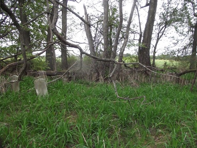
| Description | : | The GPS is to the farm house for this property. 23062 State Hwy E between Canton and Williamstown. Do not attempt to find the cemetery on your own. It is on private property about a quarter of a mile walk through a field. Seek permission from the land owner. In 2012, the cemetery was quite overgrown and part of the wrought iron fence was down but was surrounded by trees so it is fairly protected from the weather. There are only two stones remaining, Willis and Henrietta Baker's stones. Thomas Baker and his wife... Read More |
frequently asked questions (FAQ):
-
Where is Baker Cemetery?
Baker Cemetery is located at Williamstown, Lewis County ,Missouri ,USA.
-
Baker Cemetery cemetery's updated grave count on graveviews.com?
0 memorials
-
Where are the coordinates of the Baker Cemetery?
Latitude: 40.2385180
Longitude: -91.7220780
Nearby Cemetories:
1. Providence Cemetery
Williamstown, Lewis County, USA
Coordinate: 40.2419600, -91.7567400
2. Zion Hill Cemetery
Monticello, Lewis County, USA
Coordinate: 40.2166730, -91.7000890
3. Fee-Carlin Cemetery
Lewis County, USA
Coordinate: 40.2514040, -91.7816640
4. Antioch Cemetery
Lewis County, USA
Coordinate: 40.2153140, -91.6634800
5. Morris Cemetery
Lewis County, USA
Coordinate: 40.1917000, -91.7707977
6. Williamstown Cemetery
Williamstown, Lewis County, USA
Coordinate: 40.2402992, -91.8099976
7. Smith Cemetery
Clark County, USA
Coordinate: 40.3045349, -91.6926651
8. Cowgill Cemetery
Clark County, USA
Coordinate: 40.2975006, -91.6641998
9. Cecil Cemetery
Lewis County, USA
Coordinate: 40.2178001, -91.8155975
10. Henton Cemetery
Lewis County, USA
Coordinate: 40.1794014, -91.6552963
11. Saint Patrick Cemetery
Saint Patrick, Clark County, USA
Coordinate: 40.2627983, -91.6247025
12. Ellison Cemetery
Clark County, USA
Coordinate: 40.2886200, -91.6327400
13. Higbee Cemetery
Clark County, USA
Coordinate: 40.2886009, -91.6322021
14. Antioch Cemetery
Antioch, Clark County, USA
Coordinate: 40.3238068, -91.6931381
15. Graves Cemetery
Lewis County, USA
Coordinate: 40.1567001, -91.6744003
16. Mitts Cemetery
Clark County, USA
Coordinate: 40.3196983, -91.6656036
17. Walker Cemetery
Neeper, Clark County, USA
Coordinate: 40.3127570, -91.8061350
18. Bash Cemetery
Winchester, Clark County, USA
Coordinate: 40.3097000, -91.6318970
19. Benjamin Cemetery
Benjamin, Lewis County, USA
Coordinate: 40.1611700, -91.6360200
20. Old Sisson Cemetery
Antioch, Clark County, USA
Coordinate: 40.3275100, -91.6577700
21. Sisson Cemetery
Clark County, USA
Coordinate: 40.3274994, -91.6575012
22. New Prospect Cemetery
Lyon Township, Lewis County, USA
Coordinate: 40.1714920, -91.6206420
23. Jarvis Cemetery
Monticello, Lewis County, USA
Coordinate: 40.1347008, -91.7133026
24. Day Cemetery
Winchester, Clark County, USA
Coordinate: 40.3135986, -91.6267014

