
| Memorials | : | 0 |
| Location | : | Bedford Township, Meigs County, USA |
| Coordinate | : | 39.1255989, -82.0258026 |
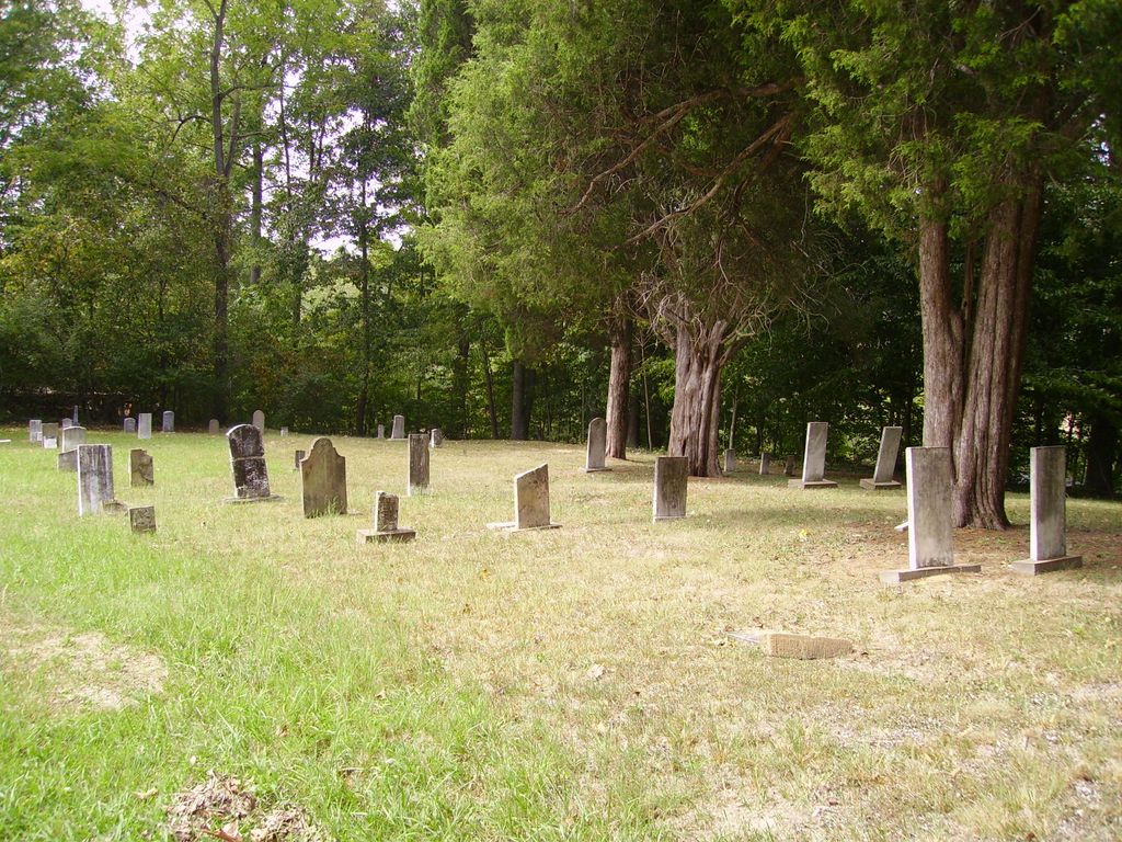
| Description | : | The cemetery is located at the northeast end of Baker Road about 0.1 miles from its intersection with Kingsbury Road (County Road 18). The cemetery is 0.43 acres in size. The cemetery is located in Bedford Township, Meigs County, Ohio, and is # 7533 (Baker Cemetery) in “Ohio Cemeteries 1803-2003”, compiled by the Ohio Genealogical Society. The U.S. Geological Survey (USGS) Geographic Names Information System (GNIS) feature ID for the cemetery is 1037580 (Baker Cemetery). |
frequently asked questions (FAQ):
-
Where is Baker Cemetery?
Baker Cemetery is located at Baker Road Bedford Township, Meigs County ,Ohio , 45769USA.
-
Baker Cemetery cemetery's updated grave count on graveviews.com?
0 memorials
-
Where are the coordinates of the Baker Cemetery?
Latitude: 39.1255989
Longitude: -82.0258026
Nearby Cemetories:
1. Carleton Church Cemetery
Bedford Township, Meigs County, USA
Coordinate: 39.1300011, -82.0456009
2. Barton Cemetery
Bedford Township, Meigs County, USA
Coordinate: 39.1352997, -81.9942017
3. Smith Cemetery
Bedford Township, Meigs County, USA
Coordinate: 39.1046982, -81.9955978
4. Hemlock Grove Cemetery
Hemlock Grove, Meigs County, USA
Coordinate: 39.1206017, -81.9819031
5. White Oak Cemetery
Darwin, Meigs County, USA
Coordinate: 39.1343994, -82.0725021
6. Bunker Hill Cemetery
Salisbury Township, Meigs County, USA
Coordinate: 39.0998530, -82.0613350
7. Burlingham Cemetery
Burlingham, Meigs County, USA
Coordinate: 39.1706009, -82.0280991
8. Eastman Cemetery
Hemlock Grove, Meigs County, USA
Coordinate: 39.1199989, -81.9591980
9. Cherry Ridge Cemetery
Darwin, Meigs County, USA
Coordinate: 39.1561012, -81.9700012
10. Mount Herman Cemetery
Chester, Meigs County, USA
Coordinate: 39.0938988, -81.9685974
11. Flora Cemetery
Flora, Meigs County, USA
Coordinate: 39.1655830, -81.9731670
12. Horner Hill Cemetery
Scipio Township, Meigs County, USA
Coordinate: 39.1116982, -82.1007996
13. Pratts Fork Cemetery
Pratts Fork, Athens County, USA
Coordinate: 39.1906013, -82.0102997
14. Rock Springs Cemetery
Rock Springs, Meigs County, USA
Coordinate: 39.0586014, -82.0203018
15. Meigs County Infirmary Cemetery
Pomeroy, Meigs County, USA
Coordinate: 39.0662110, -82.0664850
16. Blackwood Cemetery
Burlingham, Meigs County, USA
Coordinate: 39.1825610, -82.0730110
17. Flatwoods Cemetery
Chester Township, Meigs County, USA
Coordinate: 39.0659430, -81.9777920
18. Keebaugh Cemetery
Orange Township, Meigs County, USA
Coordinate: 39.1397018, -81.9328003
19. Howell Hill Cemetery
Rutland, Meigs County, USA
Coordinate: 39.0520390, -82.0584810
20. Huggins Cemetery
Rutland, Meigs County, USA
Coordinate: 39.1275760, -82.1271290
21. French Cemetery
Rutland, Meigs County, USA
Coordinate: 39.1275750, -82.1272850
22. Austin Cemetery
Salisbury Township, Meigs County, USA
Coordinate: 39.0463982, -82.0269012
23. Mound Cemetery
Pomeroy, Meigs County, USA
Coordinate: 39.1134100, -81.9234700
24. Chester Cemetery
Chester, Meigs County, USA
Coordinate: 39.0863991, -81.9285965