
| Memorials | : | 0 |
| Location | : | Plantersville, Grimes County, USA |
| Coordinate | : | 30.3548180, -95.8576790 |
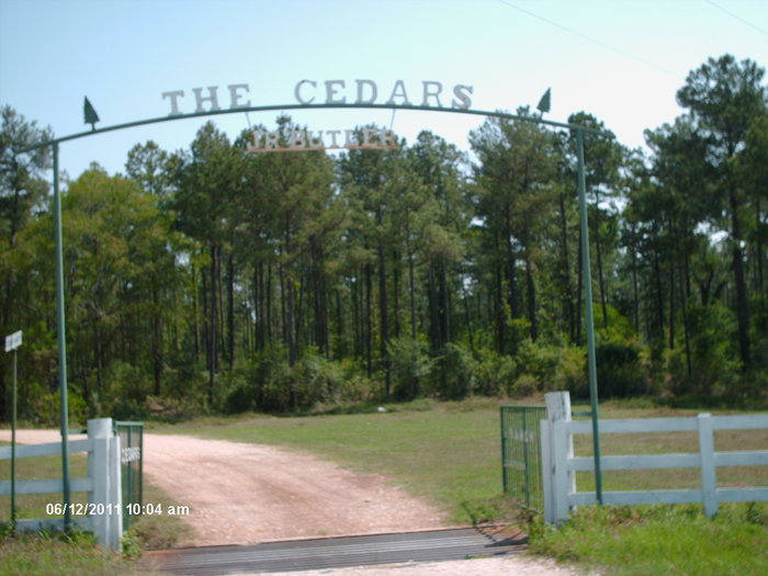
| Description | : | To reach the Baker cemetery, from the intersection of HWY 105 and 1774, go north on 1774 to the first driveway on the right, which is the entrance to "The Cedars". Going down the drive about 1 mile until the house can be seen, the cemetery can be seen just to the left behind a chain link fence. To reach where the second Baker cemetery was located going south on FM 1774 toward Plantersville, past County Road 313 on the right and County Road 213 on the left, travel a short distance to drive on the right. On that... Read More |
frequently asked questions (FAQ):
-
Where is Baker Family Cemetery?
Baker Family Cemetery is located at Plantersville, Grimes County ,Texas ,USA.
-
Baker Family Cemetery cemetery's updated grave count on graveviews.com?
0 memorials
-
Where are the coordinates of the Baker Family Cemetery?
Latitude: 30.3548180
Longitude: -95.8576790

Nearby Cemetories:
1. Center Point Cemetery
Plantersville, Grimes County, USA
Coordinate: 30.3436400, -95.8727460
2. Plantersville Cemetery
Plantersville, Grimes County, USA
Coordinate: 30.3369630, -95.8592270
3. Saint Marys Church Cemetery
Plantersville, Grimes County, USA
Coordinate: 30.3691770, -95.8729650
4. Forrester Family Cemetery
Plantersville, Grimes County, USA
Coordinate: 30.3767280, -95.8825460
5. Rose Hill Cemetery
Grimes County, USA
Coordinate: 30.3255997, -95.8261032
6. Stonehamville Cemetery
Stoneham, Grimes County, USA
Coordinate: 30.3353004, -95.9039001
7. Old Zion AME Church Cemetery
Stoneham, Grimes County, USA
Coordinate: 30.3346900, -95.9037300
8. Saint Joseph's Catholic Cemetery
Stoneham, Grimes County, USA
Coordinate: 30.3338300, -95.9086490
9. Smith-Floyd Cemetery
Grimes County, USA
Coordinate: 30.4040910, -95.8605740
10. Harris Cemetery
Grimes County, USA
Coordinate: 30.3029310, -95.8632500
11. Stoneham Cemetery
Stoneham, Grimes County, USA
Coordinate: 30.3572006, -95.9218979
12. Coaxberry Cemetery
Navasota, Grimes County, USA
Coordinate: 30.4102980, -95.8982590
13. McIntire Family Cemetery
Grimes County, USA
Coordinate: 30.3909830, -95.9263450
14. Whiteside Cemetery
Yarboro, Grimes County, USA
Coordinate: 30.3240630, -95.9313370
15. Hughey Chapel Cemetery
Navasota, Grimes County, USA
Coordinate: 30.3113937, -95.9446335
16. Yarboro Cemetery
Grimes County, USA
Coordinate: 30.3341999, -95.9644012
17. Dedmons Cemetery
Anderson, Grimes County, USA
Coordinate: 30.4090720, -95.9489520
18. Waller Cemetery
Grimes County, USA
Coordinate: 30.4496994, -95.8388977
19. Old Salem Lutheran Cemetery
Grimes County, USA
Coordinate: 30.3137880, -95.9624770
20. Childre Cemetery
Grimes County, USA
Coordinate: 30.2663994, -95.9332962
21. Fairview Cemetery
Whitehall, Grimes County, USA
Coordinate: 30.2976940, -95.9671640
22. McDonald Cemetery
Navasota, Grimes County, USA
Coordinate: 30.3513350, -95.9903870
23. Harmony Cemetery
Grimes County, USA
Coordinate: 30.3747005, -95.9886017
24. Salem Lutheran Church Cemetery
Whitehall, Grimes County, USA
Coordinate: 30.3029500, -95.9779510