
| Memorials | : | 0 |
| Location | : | Mount Storm, Grant County, USA |
| Coordinate | : | 39.2448840, -79.2968270 |
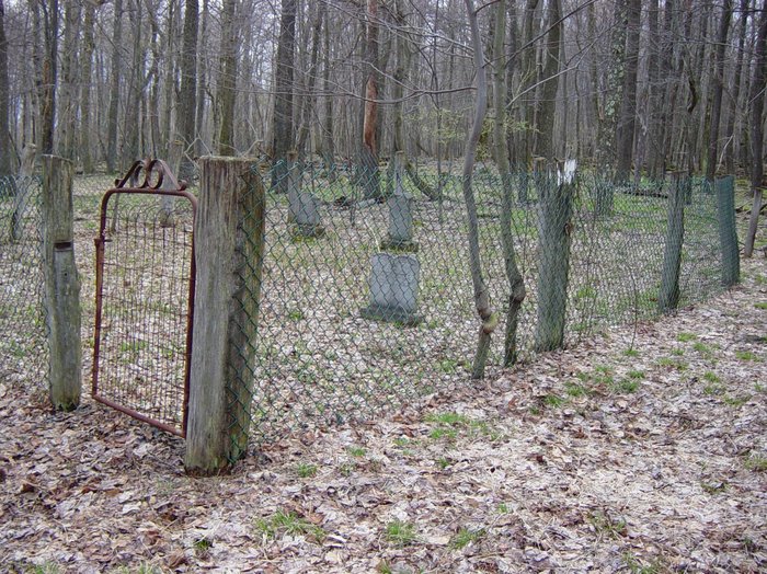
| Description | : | This cemetery is located on private property near Cherry Ridge Road, Mt. Storm, West Virginia. The name is unofficial, based upon the expertise of local residents who live near the cemetery and the old Baker homestead. There are several unmarked graves on the site, mostly within but also outside the fenced-in area. |
frequently asked questions (FAQ):
-
Where is Baker Family Cemetery?
Baker Family Cemetery is located at Cherry Ridge Road Mount Storm, Grant County ,West Virginia ,USA.
-
Baker Family Cemetery cemetery's updated grave count on graveviews.com?
0 memorials
-
Where are the coordinates of the Baker Family Cemetery?
Latitude: 39.2448840
Longitude: -79.2968270
Nearby Cemetories:
1. Alkire Cemetery
Mount Storm, Grant County, USA
Coordinate: 39.2642890, -79.2695500
2. Locust Grove Cemetery
Mount Storm, Grant County, USA
Coordinate: 39.2294300, -79.2451590
3. Bayard Cemetery
Bayard, Grant County, USA
Coordinate: 39.2728004, -79.3447037
4. Old Bayard Cemetery
Grant County, USA
Coordinate: 39.2776740, -79.3435850
5. Moreland Cemetery
Bismarck, Grant County, USA
Coordinate: 39.2145330, -79.2467020
6. Schaeffer Cemetery
Grant County, USA
Coordinate: 39.2607994, -79.2311020
7. Pope Cemetery
Gorman, Garrett County, USA
Coordinate: 39.2870120, -79.3473470
8. Cosner Family Cemetery
Grant County, USA
Coordinate: 39.2151530, -79.2327150
9. Likens-Cosner Family Cemetery
Bismarck, Grant County, USA
Coordinate: 39.2194138, -79.2251587
10. Kitzmiller Cemetery
Bismarck, Grant County, USA
Coordinate: 39.2115990, -79.2252340
11. Moreland Cemetery
Garrett County, USA
Coordinate: 39.2952995, -79.3703003
12. Chisholm-Nydegger Cemetery
Garrett County, USA
Coordinate: 39.3189011, -79.3403015
13. Geisert Cemetery
Scherr, Grant County, USA
Coordinate: 39.2056313, -79.2037201
14. Oak Grove Cemetery
Gorman, Garrett County, USA
Coordinate: 39.3147011, -79.3531036
15. Rehobeth Cemetery
Mount Storm, Grant County, USA
Coordinate: 39.3164540, -79.2330010
16. Harvey-Wilson Cemetery
Garrett County, USA
Coordinate: 39.3325005, -79.3114014
17. James M Wilkins Cemetery
Dobbin, Grant County, USA
Coordinate: 39.2388734, -79.4154218
18. Helmick
Dobbin, Grant County, USA
Coordinate: 39.2379970, -79.4156120
19. Dobbin Cemetery
Garrett County, USA
Coordinate: 39.2421425, -79.4159961
20. Fairview Cemetery
Oakland, Garrett County, USA
Coordinate: 39.2703018, -79.4124985
21. Thompson Cemetery
Oakland, Garrett County, USA
Coordinate: 39.3386100, -79.3184700
22. White Church Community Cemetery
Kearney, Garrett County, USA
Coordinate: 39.3427100, -79.3199400
23. Lish Cemetery
Garrett County, USA
Coordinate: 39.3347015, -79.3561020
24. Idleman Cemetery
Scherr, Grant County, USA
Coordinate: 39.1911840, -79.1769200