
| Memorials | : | 1 |
| Location | : | Rome Township, Jefferson County, USA |
| Coordinate | : | 38.4251600, -88.9708330 |
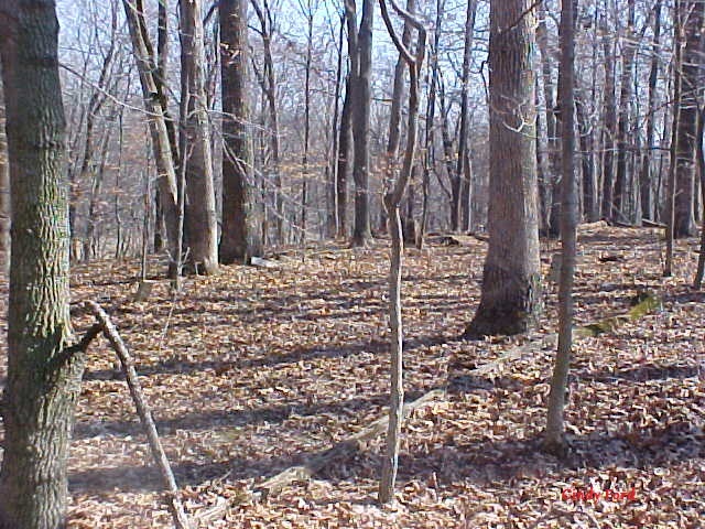
| Description | : | The old Gaston cemetery is located in the township of Rome, in Jefferson County, Illinois on a forty foot high bluff in the bend of a creek with perennial periwinkle covering many of the graves. Two ancient cedar trees still mark the burying ground. Large oak trees shade the are and provide protection from the weather. This was once land originally purchase by Samuel Gaston per Illinois land records back on the 7th of October 1818. His family lived on and farmed this land for the next 100 plus years. The cemetery is known as Baldridge Cemetery after the ridge on which... Read More |
frequently asked questions (FAQ):
-
Where is Baldridge Cemetery?
Baldridge Cemetery is located at Rome Township, Jefferson County ,Illinois ,USA.
-
Baldridge Cemetery cemetery's updated grave count on graveviews.com?
1 memorials
-
Where are the coordinates of the Baldridge Cemetery?
Latitude: 38.4251600
Longitude: -88.9708330
Nearby Cemetories:
1. Gilead Cemetery
Rome Township, Jefferson County, USA
Coordinate: 38.4446983, -88.9599991
2. Jennings Farm Cemetery
Mount Vernon, Jefferson County, USA
Coordinate: 38.4133825, -88.9467310
3. Six Graves Cemetery
Rome Township, Jefferson County, USA
Coordinate: 38.4447600, -88.9573100
4. Ebenezer Cemetery
Jefferson County, USA
Coordinate: 38.3969002, -88.9563980
5. Boyd Farm Cemetery
Boyd, Jefferson County, USA
Coordinate: 38.4135900, -89.0076500
6. Pleasant Hill Cemetery
Dix, Jefferson County, USA
Coordinate: 38.4106700, -88.9323000
7. Boyd Cemetery
Boyd, Jefferson County, USA
Coordinate: 38.4184800, -89.0140900
8. Jordan Chapel Cemetery
Dix, Jefferson County, USA
Coordinate: 38.4463997, -88.9175034
9. Antioch Cemetery
Dix, Jefferson County, USA
Coordinate: 38.4400700, -88.9032700
10. Zion Grove Cemetery
Kell, Marion County, USA
Coordinate: 38.4766998, -88.9421997
11. Little Grove Cemetery
Dix, Jefferson County, USA
Coordinate: 38.4648530, -89.0241910
12. Old Covenanter Cemetery
Centralia, Marion County, USA
Coordinate: 38.4838982, -88.9903030
13. Pleasant Grove Cemetery
Mount Vernon, Jefferson County, USA
Coordinate: 38.3736790, -88.9248060
14. Old Shiloh Cemetery
Mount Vernon, Jefferson County, USA
Coordinate: 38.3591995, -88.9543991
15. Gaston Cemetery
Grand Prairie Township, Jefferson County, USA
Coordinate: 38.3978004, -89.0588989
16. Locust Grove Cemetery
Jefferson County, USA
Coordinate: 38.3796997, -89.0488968
17. New Shiloh Cemetery
Mount Vernon, Jefferson County, USA
Coordinate: 38.3492012, -88.9599991
18. Oak Grove Cemetery
Idlewood, Jefferson County, USA
Coordinate: 38.4067001, -88.8739014
19. Piskey Cemetery
Grand Prairie Township, Jefferson County, USA
Coordinate: 38.4119290, -89.0707840
20. Hopewell Cemetery
Idlewood, Jefferson County, USA
Coordinate: 38.3857390, -88.8813330
21. Mount Catherine Christian Cemetery
Woodlawn, Jefferson County, USA
Coordinate: 38.3658010, -89.0519490
22. Roper Cemetery
Grand Prairie Township, Jefferson County, USA
Coordinate: 38.4677000, -89.0812000
23. Romine Prairie Cemetery
Marion County, USA
Coordinate: 38.5200005, -88.9458008
24. Union Chapel Cemetery
Texico, Jefferson County, USA
Coordinate: 38.4323000, -88.8470000