
| Memorials | : | 4 |
| Location | : | Laxfield, Mid Suffolk District, England |
| Coordinate | : | 52.3015500, 1.3627300 |
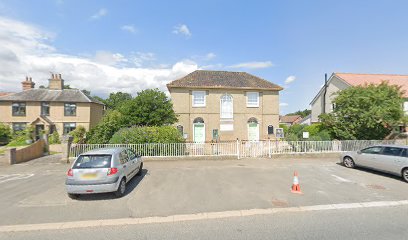
| Description | : | The church may be located using this map provided by the church: http://www.genuki.org.uk/cgi-bin/churchmap?T=SP,CCC=SFK,ID=10429 Chapel (now Baptist Church) High Street, Laxfield Suffolk Cemeteries: The church has/had a graveyard. [Note - Two Burial Grounds] Church History: It was founded before 1855. The General Baptists and Particular Baptists amalgamated in 1891. |
frequently asked questions (FAQ):
-
Where is Baptist's Church Burial Ground?
Baptist's Church Burial Ground is located at High Street Laxfield, Mid Suffolk District ,Suffolk ,England.
-
Baptist's Church Burial Ground cemetery's updated grave count on graveviews.com?
4 memorials
-
Where are the coordinates of the Baptist's Church Burial Ground?
Latitude: 52.3015500
Longitude: 1.3627300
Nearby Cemetories:
1. All Saints Churchyard
Laxfield, Mid Suffolk District, England
Coordinate: 52.3020950, 1.3663410
2. Laxfield Cemetery
Laxfield, Mid Suffolk District, England
Coordinate: 52.3022920, 1.3575990
3. St. Peter's Churchyard
Ubbeston, Suffolk Coastal District, England
Coordinate: 52.3021220, 1.4062940
4. Saint Mary's Churchyard
Cratfield, Suffolk Coastal District, England
Coordinate: 52.3227330, 1.3940450
5. St Lawrence Churchyard
Brundish, Mid Suffolk District, England
Coordinate: 52.2771070, 1.3283390
6. St Margaret Churchyard
Heveningham, Suffolk Coastal District, England
Coordinate: 52.3017670, 1.4209263
7. St John the Baptist Churchyard
Badingham, Suffolk Coastal District, England
Coordinate: 52.2647040, 1.3770250
8. St. Mary The Virgin Churchyard
Huntingfield, Suffolk Coastal District, England
Coordinate: 52.3170350, 1.4263510
9. Fressingfield Cemetery
Fressingfield, Mid Suffolk District, England
Coordinate: 52.3392240, 1.3135440
10. St. Mary the Virgin Churchyard
Dennington, Suffolk Coastal District, England
Coordinate: 52.2534740, 1.3412550
11. Stradbroke Cemetery
Stradbroke, Mid Suffolk District, England
Coordinate: 52.3187700, 1.2831900
12. Baptist Churchyard
Fressingfield, Mid Suffolk District, England
Coordinate: 52.3481570, 1.3216200
13. St. Peter and St. Paul Churchyard
Fressingfield, Mid Suffolk District, England
Coordinate: 52.3487940, 1.3190390
14. Fressingfield Methodist Churchyard
Fressingfield, Mid Suffolk District, England
Coordinate: 52.3472430, 1.3133970
15. St Michael and All Angels Churchyard
Cookley, Suffolk Coastal District, England
Coordinate: 52.3258980, 1.4466090
16. All Saints Churchyard
Stradbroke, Mid Suffolk District, England
Coordinate: 52.3186110, 1.2733720
17. Peasenhall Cemetery
Peasenhall, Suffolk Coastal District, England
Coordinate: 52.2693020, 1.4474450
18. St. Peter's Churchyard
Bruisyard, Suffolk Coastal District, England
Coordinate: 52.2453720, 1.4044820
19. St. Margaret's Churchyard of Antioch
Linstead Parva, Suffolk Coastal District, England
Coordinate: 52.3477630, 1.4302960
20. St Michael Churchyard
Peasenhall, Suffolk Coastal District, England
Coordinate: 52.2706000, 1.4509580
21. St Ethelbert Churchyard
Tannington, Mid Suffolk District, England
Coordinate: 52.2597880, 1.2846630
22. All Saints Churchyard
Saxtead, Suffolk Coastal District, England
Coordinate: 52.2433040, 1.3125269
23. Metfield Cemetery
Metfield, Mid Suffolk District, England
Coordinate: 52.3678410, 1.3635810
24. Horham Baptist Church
Horham, Mid Suffolk District, England
Coordinate: 52.2965910, 1.2536000