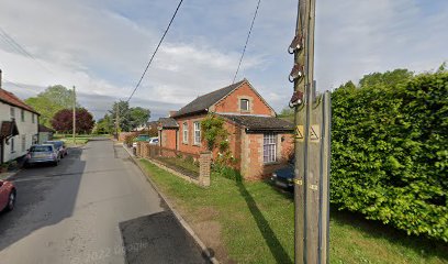
| Memorials | : | 0 |
| Location | : | Bardwell, St Edmundsbury Borough, England |
| Coordinate | : | 52.3263280, 0.8504770 |
| Description | : | It was founded before 1840. It closed before 1842. |
frequently asked questions (FAQ):
-
Where is Bardwell Friends Burial Ground?
Bardwell Friends Burial Ground is located at Bardwell, St Edmundsbury Borough, Suffolk, England Bardwell, St Edmundsbury Borough ,Suffolk ,England.
-
Bardwell Friends Burial Ground cemetery's updated grave count on graveviews.com?
0 memorials
-
Where are the coordinates of the Bardwell Friends Burial Ground?
Latitude: 52.3263280
Longitude: 0.8504770
Nearby Cemetories:
1. St Peter and St Paul Churchyard
Bardwell, St Edmundsbury Borough, England
Coordinate: 52.3262860, 0.8469720
2. Bardwell Baptist Burial Ground
Bardwell, St Edmundsbury Borough, England
Coordinate: 52.3191350, 0.8451990
3. St. John the Baptist Cemetery
Stanton, St Edmundsbury Borough, England
Coordinate: 52.3266320, 0.8779620
4. All Saints Churchyard
Stanton, St Edmundsbury Borough, England
Coordinate: 52.3238580, 0.8835220
5. Saint Andrew Churchyard
Sapiston, St Edmundsbury Borough, England
Coordinate: 52.3327150, 0.8172910
6. All Saints Churchyard
Ixworth Thorpe, St Edmundsbury Borough, England
Coordinate: 52.3170920, 0.8121620
7. All Saints Churchyard
Honington, St Edmundsbury Borough, England
Coordinate: 52.3358290, 0.8069860
8. Ixworth Cemetery
Ixworth, St Edmundsbury Borough, England
Coordinate: 52.2981945, 0.8373241
9. St. Mary the Virgin Churchyard
Ixworth, St Edmundsbury Borough, England
Coordinate: 52.2978490, 0.8312590
10. St Andrews Barningham
Barningham, St Edmundsbury Borough, England
Coordinate: 52.3547760, 0.8879500
11. Barningham Cemetery
Barningham, St Edmundsbury Borough, England
Coordinate: 52.3553880, 0.8888050
12. St Peter Churchyard
Fakenham Magna, St Edmundsbury Borough, England
Coordinate: 52.3543640, 0.8040780
13. Methodist Church Burial Ground
Pakenham, St Edmundsbury Borough, England
Coordinate: 52.2866000, 0.8392770
14. St. Mary's Churchyard
Troston, St Edmundsbury Borough, England
Coordinate: 52.3156400, 0.7866000
15. St Peter Churchyard
Hepworth, St Edmundsbury Borough, England
Coordinate: 52.3356090, 0.9159050
16. St Mary Churchyard
Coney Weston, St Edmundsbury Borough, England
Coordinate: 52.3681000, 0.8946000
17. St George Churchyard
Stowlangtoft, Mid Suffolk District, England
Coordinate: 52.2771010, 0.8683970
18. St. Mary's in the Field
Langham, Mid Suffolk District, England
Coordinate: 52.2837690, 0.9022270
19. St Peter Parish Churchyard
Great Livermere, St Edmundsbury Borough, England
Coordinate: 52.3080840, 0.7640220
20. Church of St Peter and St Paul
Little Livermere, St Edmundsbury Borough, England
Coordinate: 52.3125630, 0.7591850
21. St Michael Churchyard
Hunston, Mid Suffolk District, England
Coordinate: 52.2750420, 0.8947420
22. St Genevieve Churchyard
Euston, St Edmundsbury Borough, England
Coordinate: 52.3714880, 0.7903930
23. St Mary Churchyard
Market Weston, St Edmundsbury Borough, England
Coordinate: 52.3649970, 0.9223330
24. Market Weston War Memorial
Market Weston, St Edmundsbury Borough, England
Coordinate: 52.3648470, 0.9225730

