| Memorials | : | 13 |
| Location | : | Hitt, Scotland County, USA |
| Coordinate | : | 40.5969900, -92.3256500 |
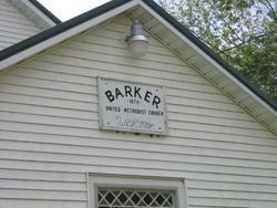
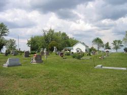
| Description | : | Built in conjunction with Barker United Methodist church (formerly United Bretheren). Located on the south side of the state line gravel road in S23 T67 R13, Miller Township. The Barker Church and Cemetery are located so close to the Iowa /Missouri State lines that it is often confused as to which state it belongs in. The location is actually in Missouri, Scotland County which is South of Stiles, Iowa. Entries for this church should be put under Barker Cemetery, Scotland County, Missouri and not the one for Iowa. The Knupps donated some of this land for the Barker Church and also... Read More |
frequently asked questions (FAQ):
-
Where is Barker Cemetery?
Barker Cemetery is located at Hitt, Scotland County ,Missouri ,USA.
-
Barker Cemetery cemetery's updated grave count on graveviews.com?
11 memorials
-
Where are the coordinates of the Barker Cemetery?
Latitude: 40.5969900
Longitude: -92.3256500
Nearby Cemetories:
1. Sacred Heart Cemetery
Scotland County, USA
Coordinate: 40.5900002, -92.3455963
2. Lister Cemetery
Davis County, USA
Coordinate: 40.6239014, -92.3146973
3. Rader Cemetery
Davis County, USA
Coordinate: 40.6274790, -92.2956930
4. Collins Cemetery
Stiles, Davis County, USA
Coordinate: 40.6361670, -92.3387580
5. Stiles Cemetery
Stiles, Davis County, USA
Coordinate: 40.6375008, -92.3506012
6. French Cemetery
Stiles, Davis County, USA
Coordinate: 40.6227780, -92.3747220
7. Union Cemetery
Davis County, USA
Coordinate: 40.6488991, -92.3367004
8. Round Grove Cemetery
Pulaski, Davis County, USA
Coordinate: 40.6118000, -92.2553000
9. Pleasant Grove Cemetery
Downing, Schuyler County, USA
Coordinate: 40.5794700, -92.4007400
10. Brown Cemetery
Davis County, USA
Coordinate: 40.6507988, -92.2913971
11. Cone Cemetery
Schuyler County, USA
Coordinate: 40.5388985, -92.3630981
12. Richland Cemetery
Hitt, Scotland County, USA
Coordinate: 40.5613000, -92.2538700
13. Kilwinning Cemetery
Scotland County, USA
Coordinate: 40.5318985, -92.3403015
14. York Cemetery
Wyacondah, Davis County, USA
Coordinate: 40.6032300, -92.4134050
15. Trinity Cemetery
Scotland County, USA
Coordinate: 40.5868988, -92.2371979
16. Hubbard Cemetery
Davis County, USA
Coordinate: 40.6222000, -92.2410965
17. Gardner Cemetery
Schuyler County, USA
Coordinate: 40.5800018, -92.4175034
18. Inskeep Cemetery
Davis County, USA
Coordinate: 40.6316986, -92.4132996
19. John Bragg Gravesite
Wyacondah, Davis County, USA
Coordinate: 40.6305820, -92.4168524
20. Pleasant Hill Cemetery
Scotland County, USA
Coordinate: 40.5338500, -92.2652900
21. Bridwell Birdwell Cemetery
Wyacondah, Davis County, USA
Coordinate: 40.6083340, -92.4416700
22. Darby Cemetery
Schuyler County, USA
Coordinate: 40.5816994, -92.4421005
23. Savannah Cemetery
Savannah, Davis County, USA
Coordinate: 40.6208000, -92.4569016
24. Pulaski Cemetery
Pulaski, Davis County, USA
Coordinate: 40.6963806, -92.2872009


