
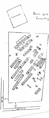
| Memorials | : | 157 |
| Location | : | Bath Township, Greene County, USA |
| Coordinate | : | 39.8263206, -84.0821533 |
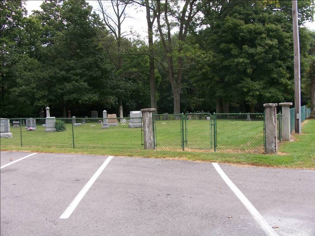
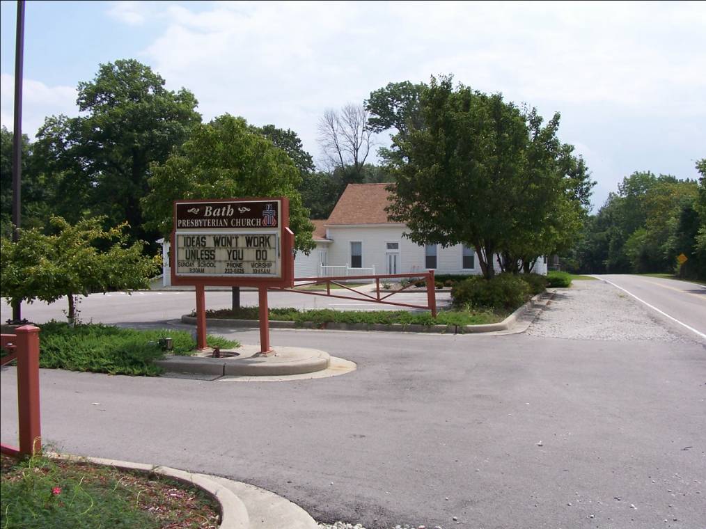
| Description | : | The cemetery is located on the south side of the Bath Presbyterian Church on the east side of Bath Road about 0.7 miles west of its junction with Ohio State Route 4. The cemetery is located in Bath Township, Greene County, Ohio, and is # 4213 (Bath Cemetery / United Presbyterian Cemetery) in “Ohio Cemeteries 1803-2003”, compiled by the Ohio Genealogical Society. The cemetery is registered with the Ohio Division of Real Estate and Professional Licensing (ODRE) as Bath Church Cemetery with registration license number CGR.0000980419. The U.S. Geological Survey (USGS) Geographic Names Information System (GNIS) feature ID for... Read More |
frequently asked questions (FAQ):
-
Where is Bath Presbyterian Church Cemetery?
Bath Presbyterian Church Cemetery is located at 4624 Bath Road Bath Township, Greene County ,Ohio , 45424USA.
-
Bath Presbyterian Church Cemetery cemetery's updated grave count on graveviews.com?
157 memorials
-
Where are the coordinates of the Bath Presbyterian Church Cemetery?
Latitude: 39.8263206
Longitude: -84.0821533
Nearby Cemetories:
1. Hufferville Grave Yard
Bath Township, Greene County, USA
Coordinate: 39.8188040, -84.0753360
2. Huffersville Cemetery
Fairborn, Greene County, USA
Coordinate: 39.8183860, -84.0750470
3. Kneisley Cemetery
Caesarscreek Township, Greene County, USA
Coordinate: 39.8132700, -84.0835300
4. Union Schoolhouse Cemetery
Fairborn, Greene County, USA
Coordinate: 39.8153170, -84.0932580
5. Shearer Cemetery
Huber Heights, Montgomery County, USA
Coordinate: 39.8399140, -84.1212950
6. Landis-Shank Cemetery
Wright-Patterson Air Force Base, Montgomery County, USA
Coordinate: 39.7999000, -84.0543000
7. Dille Cemetery
Dayton, Montgomery County, USA
Coordinate: 39.8039017, -84.1222000
8. Hebble-Landis Cemetery (Defunct)
Fairborn, Greene County, USA
Coordinate: 39.8013640, -84.0432830
9. Fairfield Cemetery
Fairborn, Greene County, USA
Coordinate: 39.8204956, -84.0289230
10. Cox Cemetery
Fairborn, Greene County, USA
Coordinate: 39.8402672, -84.0305862
11. Rockafield Cemetery
Fairborn, Greene County, USA
Coordinate: 39.7846642, -84.0573807
12. Arnold Family Cemetery
Montgomery County, USA
Coordinate: 39.8723310, -84.0925310
13. Islamic Cemetery of Dayton
Riverside, Montgomery County, USA
Coordinate: 39.8262910, -84.1450760
14. Cost Cemetery
Fairborn, Greene County, USA
Coordinate: 39.7950180, -84.0335220
15. Jennings Cemetery
Huber Heights, Montgomery County, USA
Coordinate: 39.8732300, -84.0558400
16. Mitman Cemetery
Fairborn, Greene County, USA
Coordinate: 39.8358345, -84.0161819
17. Beth Jacob Cemetery
Dayton, Montgomery County, USA
Coordinate: 39.8128014, -84.1477966
18. Price Cemetery
Montgomery County, USA
Coordinate: 39.8337020, -84.1500970
19. Harshman Cemetery
Riverside, Montgomery County, USA
Coordinate: 39.7800369, -84.1177139
20. Hall Graveyard
Fairborn, Greene County, USA
Coordinate: 39.8215470, -84.0100520
21. Cozad-Hall Cemetery
Fairborn, Greene County, USA
Coordinate: 39.8215485, -84.0099487
22. Gerlaugh Cemetery
Beavercreek Township, Greene County, USA
Coordinate: 39.7708920, -84.0946590
23. Palmer Chapel Cemetery
Bethel Township, Miami County, USA
Coordinate: 39.8813740, -84.0662970
24. Hain-Slagle Cemetery
Clark County, USA
Coordinate: 39.8720000, -84.0320000