
| Memorials | : | 0 |
| Location | : | Peralta, Valencia County, USA |
| Coordinate | : | 34.8429100, -106.6645970 |
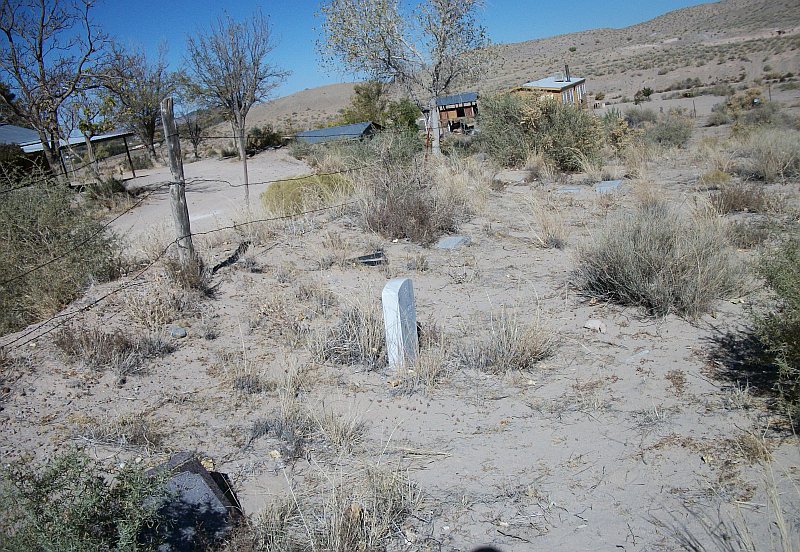
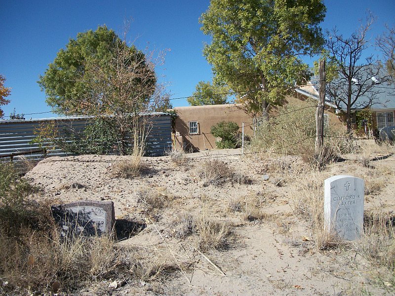
| Description | : | The Baxter Cemetery is also known as Bosque Farms Project Community Cemetery, however it is believed that only the Baxter family ever used this cemetery. In the Great Depression, the US Resettlement Administration (nowadays the Department of Agriculture) had the Bosque Farms Project wherein they moved New Mexicans from the Dust Bowl areas of the Northeastern counties to Valencia county. 42 families were selected to move by lottery. The relocation included giving each family land, water, and a house. The cemetery was also a benefit, but the vast majority of the citizens chose burial in one of the... Read More |
frequently asked questions (FAQ):
-
Where is Baxter Cemetery?
Baxter Cemetery is located at Quiet Lane (off of La Ladera) Peralta, Valencia County ,New Mexico , 87042USA.
-
Baxter Cemetery cemetery's updated grave count on graveviews.com?
0 memorials
-
Where are the coordinates of the Baxter Cemetery?
Latitude: 34.8429100
Longitude: -106.6645970
Nearby Cemetories:
1. Peralta Cemetery
Peralta, Valencia County, USA
Coordinate: 34.8431570, -106.6635400
2. Pereas Cemetery
Peralta, Valencia County, USA
Coordinate: 34.8433680, -106.6634810
3. Peralta Spanish Methodist Cemetery
Peralta, Valencia County, USA
Coordinate: 34.8369400, -106.6900000
4. Peralta and Valencia Cemetery
Peralta, Valencia County, USA
Coordinate: 34.8139000, -106.6678009
5. Our Lady of Guadalupe Catholic Cemetery
Valencia, Valencia County, USA
Coordinate: 34.8136400, -106.6685300
6. Sangre de Cristo Cemetery
Los Lunas, Valencia County, USA
Coordinate: 34.8100160, -106.6997550
7. El Camposanto de la Liverta
Los Lunas, Valencia County, USA
Coordinate: 34.7905998, -106.6746979
8. Isleta Cemetery
Isleta, Bernalillo County, USA
Coordinate: 34.9025002, -106.6968994
9. Los Lentes Cemetery
Los Lentes, Valencia County, USA
Coordinate: 34.8203011, -106.7406006
10. San Antonio de los Lentes Cemetery
Los Lunas, Valencia County, USA
Coordinate: 34.8202200, -106.7412700
11. Los Lunas Hospital And Training School Cemetery
Los Lunas, Valencia County, USA
Coordinate: 34.8198060, -106.7427210
12. San Clemente Cemetery
Los Lunas, Valencia County, USA
Coordinate: 34.8059550, -106.7353750
13. Saint Augustine Church
Isleta Village Proper, Bernalillo County, USA
Coordinate: 34.9091290, -106.6933070
14. San Agustín de la Isleta Mission
Isleta Pueblo, Bernalillo County, USA
Coordinate: 34.9091380, -106.6933270
15. San Clemente Cemetery
Los Lunas, Valencia County, USA
Coordinate: 34.8105000, -106.7424000
16. Seventh Day Adventist Cemetery
Los Lunas, Valencia County, USA
Coordinate: 34.7774840, -106.7105250
17. Immaculate Conception Church Cemetery
Tome, Valencia County, USA
Coordinate: 34.7417270, -106.7299250
18. El Cemeterio de Los Ricos
Tome, Valencia County, USA
Coordinate: 34.7388790, -106.7325590
19. Los Padillas Cemetery
Los Padillas, Bernalillo County, USA
Coordinate: 34.9557991, -106.7164001
20. Tome Cemetery
Tome, Valencia County, USA
Coordinate: 34.7243996, -106.7071991
21. Santa Maria de la Vid Campo Santo
Albuquerque, Bernalillo County, USA
Coordinate: 34.9839700, -106.7246800
22. Pajarito Cemetery
Pajarito, Bernalillo County, USA
Coordinate: 34.9907990, -106.7197037
23. First United Methodist Church Columbarium
Belen, Valencia County, USA
Coordinate: 34.6556000, -106.7259000
24. Evangelico Cemetery
Albuquerque, Bernalillo County, USA
Coordinate: 35.0370450, -106.7158980