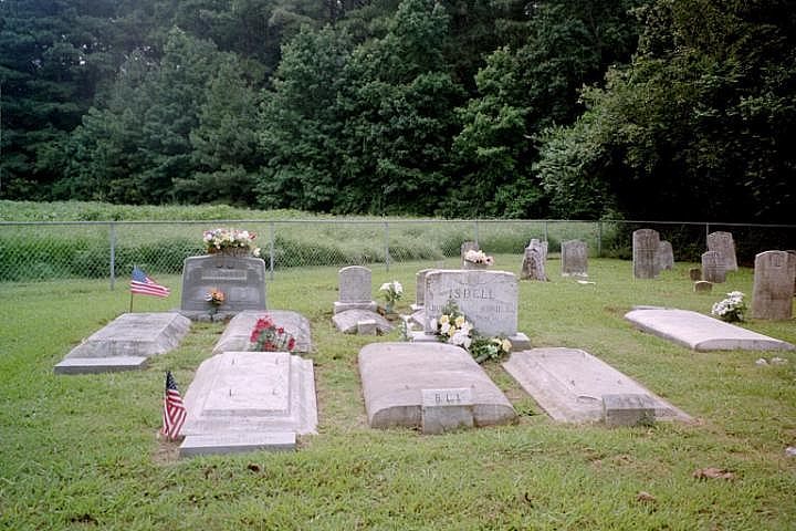
| Memorials | : | 0 |
| Location | : | Wachapreague, Accomack County, USA |
| Coordinate | : | 37.5940000, -75.7210000 |
| Description | : | It is west of Old Trower. In the publication Graven Stones: Inscriptions from Lower Accomack County, Virginia,..., it is Number 61 and is abbreviated Anth. The Bell-Mears-Isdell Cemetery, also known as the Anthony Bell Cemetery, is designated Number 61 and is abbreviated Anth for Anthony in the book Graven Stones: Inscriptions from Lower Accomack County, Virginia, including Liberty and Parksley Cemeteries, Third Edition, by Jean Merritt Mihalyka and Faye Downing Wilson, 1992. This cemetery is near 37.594 N and –75.721 W. |
frequently asked questions (FAQ):
-
Where is Bell-Mears-Isdell Cemetery?
Bell-Mears-Isdell Cemetery is located at Wachapreague, Accomack County ,Virginia ,USA.
-
Bell-Mears-Isdell Cemetery cemetery's updated grave count on graveviews.com?
0 memorials
-
Where are the coordinates of the Bell-Mears-Isdell Cemetery?
Latitude: 37.5940000
Longitude: -75.7210000
Nearby Cemetories:
1. Davis-Mears Burial Ground
Old Trower, Accomack County, USA
Coordinate: 37.5960000, -75.7210000
2. Thomas H. bell Burial Ground
Old Trower, Accomack County, USA
Coordinate: 37.5890000, -75.7150000
3. Poulson Grave
Quinby, Accomack County, USA
Coordinate: 37.5930000, -75.7100000
4. Kellam-Bell
Trower, Accomack County, USA
Coordinate: 37.5910000, -75.7060000
5. Turlington Burial Ground
Quinby, Accomack County, USA
Coordinate: 37.5880000, -75.7030000
6. Gulf Stream
Old Trower, Accomack County, USA
Coordinate: 37.5930000, -75.7000000
7. Beach Family Cemetery
Wachapreague, Accomack County, USA
Coordinate: 37.6120000, -75.7150000
8. Stockley Burial Plot
Painter, Accomack County, USA
Coordinate: 37.6000000, -75.7440000
9. Mapp Burial Ground
Old Trower, Accomack County, USA
Coordinate: 37.5970000, -75.6960000
10. Mapp Cemetery
Wachapreague, Accomack County, USA
Coordinate: 37.5970000, -75.6960000
11. Morrison Hill Cemetery At FrogStool
Wachapreague, Accomack County, USA
Coordinate: 37.5976600, -75.7481200
12. Bell Burial Ground
Old Trower, Accomack County, USA
Coordinate: 37.5720000, -75.7200000
13. Hyslop Graveyard
Keller, Accomack County, USA
Coordinate: 37.6040000, -75.7460000
14. Garrison Graveyard
Quinby, Accomack County, USA
Coordinate: 37.5720000, -75.7160000
15. Lingo Burial Grounds
Keller, Accomack County, USA
Coordinate: 37.6100000, -75.7410000
16. Hyslup Burial Plot
Keller, Accomack County, USA
Coordinate: 37.6110000, -75.7400000
17. Edmonds Burial Ground
Keller, Accomack County, USA
Coordinate: 37.6160000, -75.7300000
18. Old Wachapreague Burial Ground
Wachapreague, Accomack County, USA
Coordinate: 37.6039000, -75.6944000
19. Savage Plot
Painter, Accomack County, USA
Coordinate: 37.5940000, -75.7520000
20. Bradford-Hyslop Cemetery
Keller, Accomack County, USA
Coordinate: 37.6140000, -75.7390000
21. Mears-Bird Cemetery
Wachapreague, Accomack County, USA
Coordinate: 37.6186700, -75.7226600
22. Snead's United Methodist Church Cemetery
Keller, Accomack County, USA
Coordinate: 37.5920640, -75.7532870
23. Mount Willis Cemetery
Keller, Accomack County, USA
Coordinate: 37.6188030, -75.7350490
24. Teackle Family Graveyard
Wachapreague, Accomack County, USA
Coordinate: 37.6040000, -75.6890000

