| Memorials | : | 1 |
| Location | : | Baywood, Grayson County, USA |
| Coordinate | : | 36.6660614, -81.0475235 |
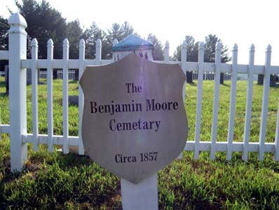
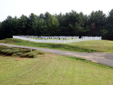
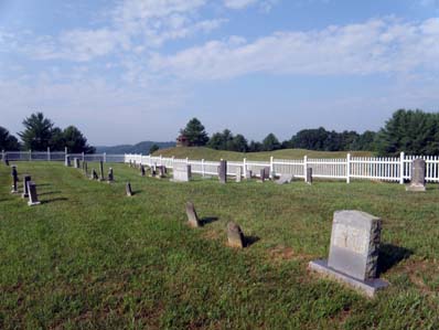
| Description | : | Benjamin Moore Cemetery aka Warrick-Moore Cemetery Grayson County, Virginia Location: Crackers Neck Directions: The Benjamin Moore Cemetery is on a high hillside overlooking the New River. The Moore Ferry was located nearby. From the intersection of Grayson Parkway (US 58) and Beech Grove Lane (Rt 632) follow Beech Grove Lane to the end of state maintenance. Then enter the Eagle View development. Keep to the left at the next intersection and continue on to the top of the hill. The cemetery is beside the road. GPS Coordinates: N36.66606 W81.04752 Surveyed by: Buford C. Wilson 14 Mar 2004, Updated 25 Mar 2008. Comments: ... Read More |
frequently asked questions (FAQ):
-
Where is Benjamin Moore Cemetery?
Benjamin Moore Cemetery is located at Baywood, Grayson County ,Virginia ,USA.
-
Benjamin Moore Cemetery cemetery's updated grave count on graveviews.com?
1 memorials
-
Where are the coordinates of the Benjamin Moore Cemetery?
Latitude: 36.6660614
Longitude: -81.0475235
Nearby Cemetories:
1. Old Duffy Farm Cemetery
Baywood, Grayson County, USA
Coordinate: 36.6625140, -81.0530810
2. Abel Carrico IV Cemetery
Carsonville, Grayson County, USA
Coordinate: 36.6797000, -81.0548800
3. Minitree Jones Cemetery
Providence, Grayson County, USA
Coordinate: 36.6755930, -81.0263600
4. Pleasant Hill Methodist Church Cemetery
Elk Creek, Grayson County, USA
Coordinate: 36.6767600, -81.0701040
5. Ring Family Cemetery
Fries, Grayson County, USA
Coordinate: 36.6876140, -81.0351740
6. Diamond Family Cemetery
Grayson County, USA
Coordinate: 36.6586164, -81.0193214
7. Louis Hampton Family Cemetery
Grayson County, USA
Coordinate: 36.6454300, -81.0280000
8. William H Hutchens Family Cemetery
Baywood, Grayson County, USA
Coordinate: 36.6597900, -81.0158100
9. James Galyean Family Cemetery
Grayson County, USA
Coordinate: 36.6405390, -81.0662110
10. Dickenson Family Cemetery
Riverside, Grayson County, USA
Coordinate: 36.6719000, -81.0110600
11. Howard Wilson Family Cemetery
Baywood, Grayson County, USA
Coordinate: 36.6501490, -81.0150680
12. Goins Cemetery
Grayson County, USA
Coordinate: 36.6411460, -81.0248240
13. Goins Cemetery
Baywood, Grayson County, USA
Coordinate: 36.6410800, -81.0248300
14. Combs Family Cemetery
Fries, Grayson County, USA
Coordinate: 36.6982817, -81.0476962
15. Wiley Davis Family Cemetery
Independence, Grayson County, USA
Coordinate: 36.6313630, -81.0416350
16. Tolbert Wright Cemetery
Carsonville, Grayson County, USA
Coordinate: 36.6915240, -81.0799330
17. Pilgrims Rest Primitive Baptist Church Cemetery
Independence, Grayson County, USA
Coordinate: 36.6658330, -81.0933970
18. Fields Memorial Cemetery
Baywood, Grayson County, USA
Coordinate: 36.6304588, -81.0325928
19. Fulton Family Cemetery
Independence, Grayson County, USA
Coordinate: 36.6484470, -81.0901500
20. John Byrd Cemetery
Baywood, Grayson County, USA
Coordinate: 36.6347008, -81.0190887
21. Yarber Cemetery
Baywood, Grayson County, USA
Coordinate: 36.6416300, -81.0081000
22. Elbert Carico Cemetery
Providence, Grayson County, USA
Coordinate: 36.6895760, -81.0066070
23. Bourn-Padgett Cemetery
Fries, Grayson County, USA
Coordinate: 36.6847290, -81.0025010
24. Providence Cemetery at Providence United Methodist
Fries, Grayson County, USA
Coordinate: 36.6977997, -81.0152969


