
| Memorials | : | 0 |
| Location | : | Maryville, Blount County, USA |
| Coordinate | : | 35.3671200, -84.0519500 |
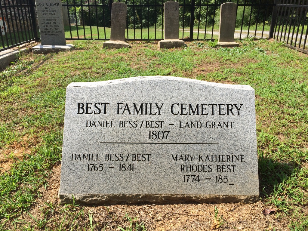
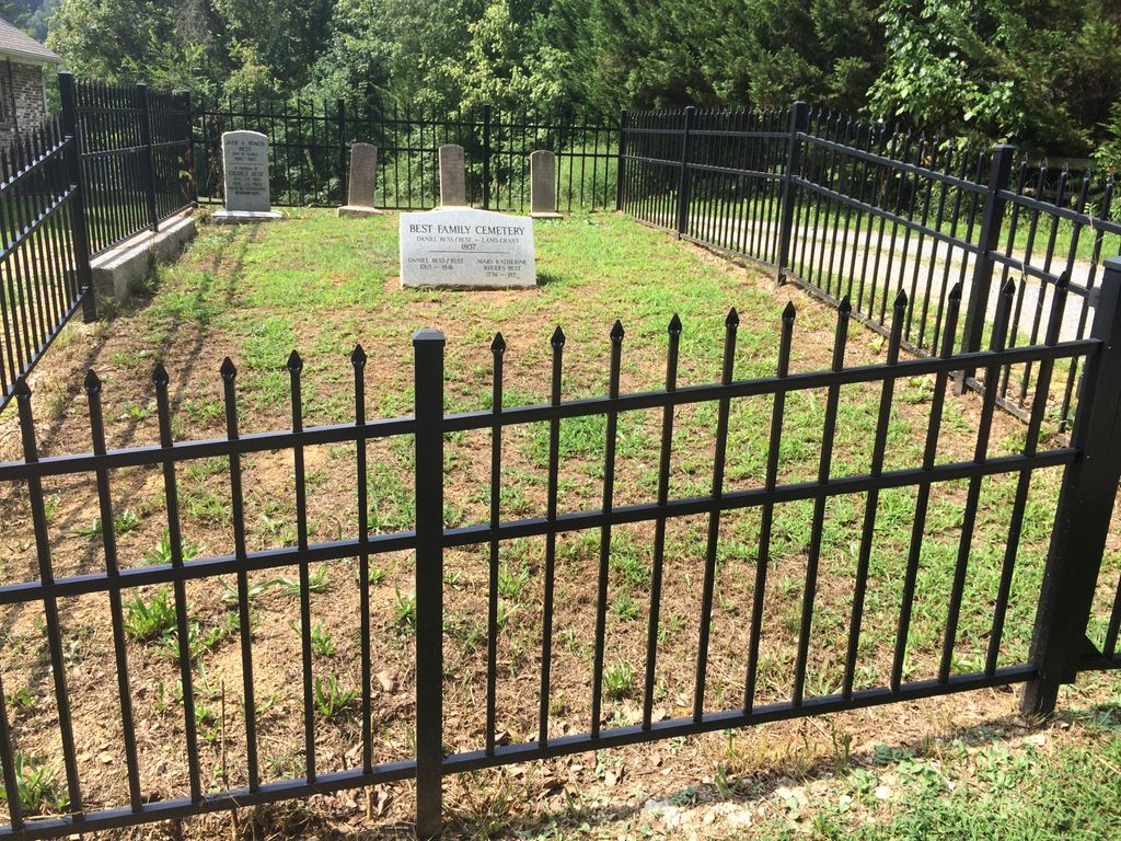
| Description | : | This is the cemetery for a family who were early settlers into Blount County. The Best family is widely represented in the genealogies of Blount County. Someone has done a masterful recovery of this cemetery especially with the wrought iron fence. When I last visited several years ago, the homeowner had the stones laid down and covered with a flower bed. |
frequently asked questions (FAQ):
-
Where is Best Family Cemetery?
Best Family Cemetery is located at Mullins Way Maryville, Blount County ,Tennessee ,USA.
-
Best Family Cemetery cemetery's updated grave count on graveviews.com?
0 memorials
-
Where are the coordinates of the Best Family Cemetery?
Latitude: 35.3671200
Longitude: -84.0519500
Nearby Cemetories:
1. Green Cove Cemetery
Monroe County, USA
Coordinate: 35.3003006, -84.1194000
2. Rafter Friends Cemetery
Rafter, Monroe County, USA
Coordinate: 35.3958397, -84.1697769
3. Clint Hudson Cemetery
Graham County, USA
Coordinate: 35.4225006, -83.9456024
4. Miller's Chapel Baptist Church Cemetery
Tellico Plains, Monroe County, USA
Coordinate: 35.3573210, -84.1789200
5. Giles Cemetery
Monroe County, USA
Coordinate: 35.3926000, -84.1767000
6. Rafter Methodist Cemetery
Rafter, Monroe County, USA
Coordinate: 35.3927900, -84.1778700
7. Macedonia Cemetery
Rafter, Monroe County, USA
Coordinate: 35.3942413, -84.1790085
8. Williamsburg Cemetery
Monroe County, USA
Coordinate: 35.4418983, -84.1524963
9. Mount Pleasant Baptist Cemetery
Vonore, Monroe County, USA
Coordinate: 35.4932000, -84.0749000
10. Mount Isabella Missionary Baptist Church Cemetery
Monroe County, USA
Coordinate: 35.3753014, -84.2102966
11. Hooper-Martin Cemetery
Graham County, USA
Coordinate: 35.3139833, -83.9069333
12. Hunt Cemetery
Rafter, Monroe County, USA
Coordinate: 35.3775750, -84.2117620
13. Cedar Cliff Cemetery
Robbinsville, Graham County, USA
Coordinate: 35.3279400, -83.8971500
14. Miller Cemetery
Monroe County, USA
Coordinate: 35.3182983, -84.2039032
15. Antioch Baptist Church
Vonore, Monroe County, USA
Coordinate: 35.4843060, -84.1474190
16. Coom Cemetery
Santeetlah, Graham County, USA
Coordinate: 35.3847008, -83.8778000
17. Odom Cemetery
Santeetlah, Graham County, USA
Coordinate: 35.3847008, -83.8775024
18. Hardshell Cemetery
Tellico Plains, Monroe County, USA
Coordinate: 35.3717600, -84.2288000
19. Keener Cemetery
Monroe County, USA
Coordinate: 35.5121994, -84.0282974
20. Millsaps Farm Cemetery
Citico Beach, Monroe County, USA
Coordinate: 35.5123051, -84.0282390
21. Happy Top Cemetery
Citico Beach, Monroe County, USA
Coordinate: 35.5134300, -84.0236700
22. Ballplay Tabernacle Cemetery
Tellico Plains, Monroe County, USA
Coordinate: 35.4253100, -84.2202110
23. Calderwood Cemetery
Calderwood, Blount County, USA
Coordinate: 35.5096620, -83.9954140
24. Lower Yellow Creek Cemetery
Graham County, USA
Coordinate: 35.4158800, -83.8762500