
| Memorials | : | 4 |
| Location | : | Hymera, Sullivan County, USA |
| Coordinate | : | 39.1861300, -87.3059200 |
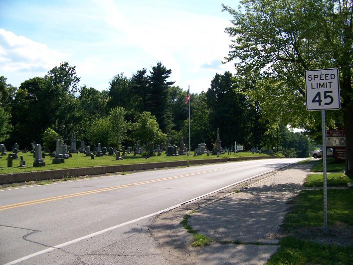
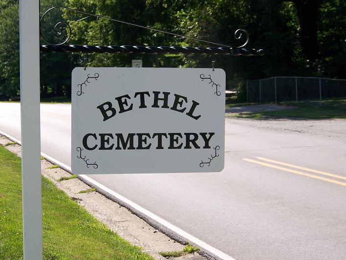
| Description | : | The cemetery is located in Jackson Township on the southeast corner of the intersection of W. Jackson Street (Indiana State Highway 48) and S. Church Street. Indiana Cemetery Locations, Volume 1, published by the Indiana Genealogical Society (02 April 2005), gives the primary cemetery name as Bethel Cemetery. The cemetery is listed in the Cemetery and Burial Grounds Registry of the Indiana Department of Natural Resources (DNR) and in the State Historical Architectural and Archaeological Research Database (SHAARD) with Cemetery Record Number CR-77-107 (Bethel). |
frequently asked questions (FAQ):
-
Where is Bethel Cemetery?
Bethel Cemetery is located at W. Jackson Street (Indiana State Highway 48) Hymera, Sullivan County ,Indiana , 47879USA.
-
Bethel Cemetery cemetery's updated grave count on graveviews.com?
4 memorials
-
Where are the coordinates of the Bethel Cemetery?
Latitude: 39.1861300
Longitude: -87.3059200
Nearby Cemetories:
1. Knights of Pythias Cemetery
Hymera, Sullivan County, USA
Coordinate: 39.1861000, -87.2771988
2. Case Cemetery
Hymera, Sullivan County, USA
Coordinate: 39.1858930, -87.2754280
3. Un-Named Cemetery
Hymera, Sullivan County, USA
Coordinate: 39.2117424, -87.2963943
4. Oak Grove Cemetery
Wilfred, Sullivan County, USA
Coordinate: 39.1872101, -87.3432388
5. Ring Cemetery
Hymera, Sullivan County, USA
Coordinate: 39.1551900, -87.3063760
6. Shiloh Cemetery
Hymera, Sullivan County, USA
Coordinate: 39.2127000, -87.2597700
7. Sugar Grove Cemetery
Hymera, Sullivan County, USA
Coordinate: 39.2378420, -87.3087570
8. Palmers Prairie Cemetery
Jackson Hill, Sullivan County, USA
Coordinate: 39.1464348, -87.3523026
9. Nyes Chapel Cemetery
Farmersburg, Sullivan County, USA
Coordinate: 39.2368813, -87.3341293
10. Claiborne Cemetery
Hymera, Sullivan County, USA
Coordinate: 39.1302299, -87.2928238
11. Mount Pleasant Cemetery
Hymera, Sullivan County, USA
Coordinate: 39.2367070, -87.2690610
12. Shepherd Cemetery
Cass, Sullivan County, USA
Coordinate: 39.1325000, -87.2763000
13. Burris Cemetery
Jackson Hill, Sullivan County, USA
Coordinate: 39.1418991, -87.2506027
14. Old Union Cemetery
Lewis Township, Clay County, USA
Coordinate: 39.1747017, -87.2249985
15. Ebenezer Cemetery
Hymera, Sullivan County, USA
Coordinate: 39.2141991, -87.3835983
16. Good Hope Cemetery
Sullivan, Sullivan County, USA
Coordinate: 39.1279170, -87.3575950
17. Little Flock Primitive Baptist Church Cemetery
Coalmont, Clay County, USA
Coordinate: 39.2144000, -87.2205500
18. Bennett Cemetery
Farmersburg, Sullivan County, USA
Coordinate: 39.2485400, -87.3559860
19. Longs Chapel Cemetery
Sullivan, Sullivan County, USA
Coordinate: 39.1127014, -87.3112411
20. Little Flock Cemetery
Shelburn, Sullivan County, USA
Coordinate: 39.1702995, -87.4085999
21. Oak Grove Cemetery
Bogle Corner, Clay County, USA
Coordinate: 39.1735010, -87.1990440
22. Stephens Cemetery
Lewis, Vigo County, USA
Coordinate: 39.2616997, -87.2549973
23. Mount Olive Cemetery
Pimento, Vigo County, USA
Coordinate: 39.2694473, -87.3343353
24. Friendly Grove Cemetery
Clay County, USA
Coordinate: 39.2358017, -87.2136002