
| Memorials | : | 0 |
| Location | : | Leasburg, Caswell County, USA |
| Coordinate | : | 36.4006996, -79.2487030 |
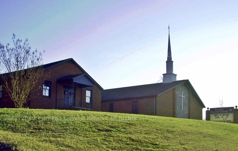
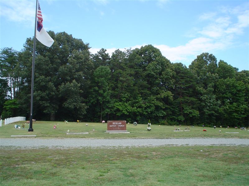
| Description | : | Originally organize in 1834, Beulah Baptist Church has been in several locations. The original meeting location between 1834 and 1861 is near Top Not. The second location and cemetery were located on High Rock School Road. Around 1935 the church relocated to the north side of Hwy 158, in the fork of the intersection with Stephentown Road. In 1961 the church moved directly across the highway to its current location at 1834 US Hwy 158. The first burial in the cemetery was in 1962. Carolina Caswell conducted a photographic survey in May 2012. This cemetery does not have a... Read More |
frequently asked questions (FAQ):
-
Where is Beulah Baptist Church Cemetery?
Beulah Baptist Church Cemetery is located at 1834 US Hwy 158 E Leasburg, Caswell County ,North Carolina ,USA.
-
Beulah Baptist Church Cemetery cemetery's updated grave count on graveviews.com?
0 memorials
-
Where are the coordinates of the Beulah Baptist Church Cemetery?
Latitude: 36.4006996
Longitude: -79.2487030
Nearby Cemetories:
1. Burch-Everett Family Cemetery
Yanceyville, Caswell County, USA
Coordinate: 36.4010200, -79.2620200
2. Pleasant Grove Presbyterian Church Cemetery
Topnot, Caswell County, USA
Coordinate: 36.3880370, -79.2697370
3. Vestal Family Cemetery
Caswell County, USA
Coordinate: 36.3871564, -79.2699657
4. Union United Methodist Church Cemetery
Pleasant Grove, Caswell County, USA
Coordinate: 36.3924250, -79.2213710
5. Providence Missionary Baptist Church Cemetery
Pleasant Grove, Caswell County, USA
Coordinate: 36.3918120, -79.2796130
6. Beulah Church Meeting House Cemetery
Topnot, Caswell County, USA
Coordinate: 36.3720490, -79.2519430
7. Stephens Cemetery
Pleasant Grove, Caswell County, USA
Coordinate: 36.4241830, -79.2242840
8. High Rock Missionary Baptist Church Cemetery
Pleasant Grove, Caswell County, USA
Coordinate: 36.4345250, -79.2289460
9. Beulah Missionary Baptist Church Cemetery
Hamer, Caswell County, USA
Coordinate: 36.4381760, -79.2356940
10. Beulah Baptist Church Cemetery
Leasburg, Caswell County, USA
Coordinate: 36.3661156, -79.2235031
11. Family Cemetery on Willie McCain Road
Topnot, Caswell County, USA
Coordinate: 36.3603900, -79.2439200
12. Peterson Family Cemetery
Hamer, Caswell County, USA
Coordinate: 36.4379990, -79.2702090
13. Comer Family Cemetery
Leasburg, Caswell County, USA
Coordinate: 36.4314000, -79.2088400
14. Williamson Family Cemetery at Melrose
Yanceyville, Caswell County, USA
Coordinate: 36.4279400, -79.2945700
15. Family Cemetery at Forest Home
Yanceyville, Caswell County, USA
Coordinate: 36.4200900, -79.3013000
16. Smith Family Cemetery
Hightowers, Caswell County, USA
Coordinate: 36.3570300, -79.2261300
17. Poteat Family Cemetery at Forest Home
Yanceyville, Caswell County, USA
Coordinate: 36.4186580, -79.3043800
18. Family Cemetery at Melrose
Yanceyville, Caswell County, USA
Coordinate: 36.4348100, -79.2914600
19. Long Family Cemetery
Hamer, Caswell County, USA
Coordinate: 36.4432640, -79.2776920
20. Family Cemetery on NC Hwy 86 near Hightowers
Hightowers, Caswell County, USA
Coordinate: 36.3543300, -79.2698600
21. Fuquay Family Cemetery
Hightowers, Caswell County, USA
Coordinate: 36.3475100, -79.2495400
22. Chandler Family Cemetery
Hamer, Caswell County, USA
Coordinate: 36.4504500, -79.2760900
23. Hamer Missionary Baptist Church Cemetery
Blanch, Caswell County, USA
Coordinate: 36.4532270, -79.2757990
24. Griers Presbyterian Church Cemetery
Hightowers, Caswell County, USA
Coordinate: 36.3473511, -79.2191086