
| Memorials | : | 2 |
| Location | : | Baker County, USA |
| Coordinate | : | 44.9799995, -117.6500015 |
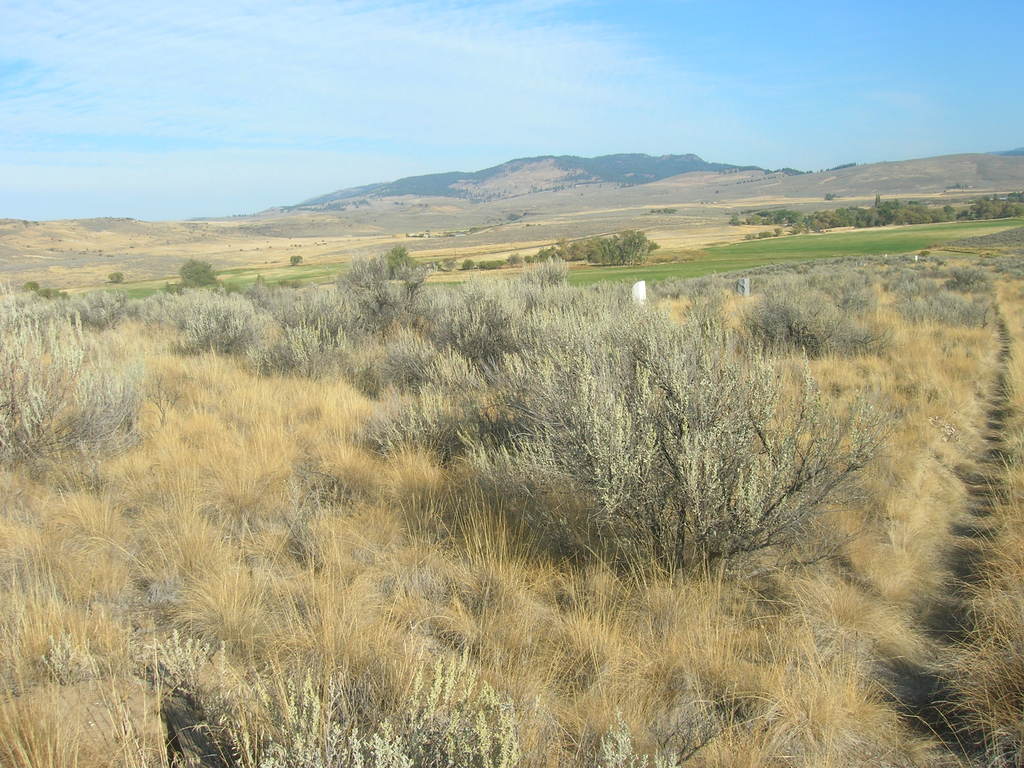
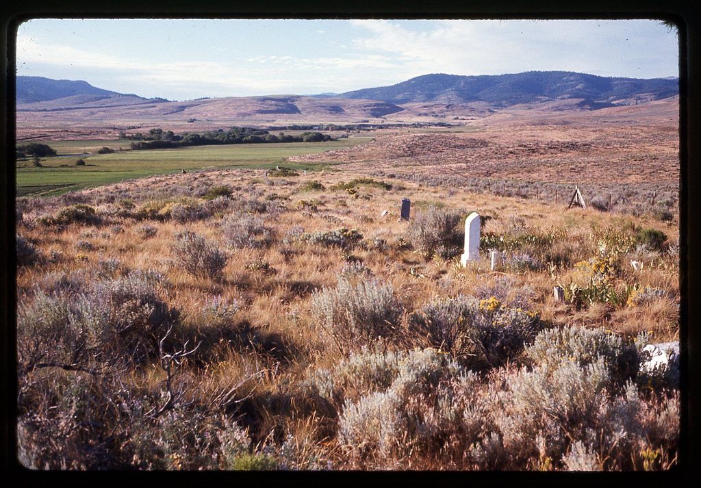
| Description | : | There is a sparsely settled farming community near the northern line of Baker County approximately 20 miles northeast of Baker City. An early pioneer cemetery is located in this area about one-quarter mile off State Highway 203 and about 2 or 3 miles south of Medical Springs. It is on the right-hand side of the highway going toward Union. Other names of cemetery: Medical Springs Cemetery, Pondosa Cemetery & Duncan Cemetery. Strange it may be, the cemetery is located just south of the county line (brown line) while the community of Medical Springs is just north of the line. There... Read More |
frequently asked questions (FAQ):
-
Where is Big Creek Cemetery?
Big Creek Cemetery is located at Baker County ,Oregon ,USA.
-
Big Creek Cemetery cemetery's updated grave count on graveviews.com?
2 memorials
-
Where are the coordinates of the Big Creek Cemetery?
Latitude: 44.9799995
Longitude: -117.6500015
Nearby Cemetories:
1. Dunham Wright Cemetery
Medical Springs, Union County, USA
Coordinate: 45.0169500, -117.6279600
2. Pioneer Cemetery in the Park
Medical Springs, Union County, USA
Coordinate: 45.0694000, -117.6617000
3. Goose Creek Cemetery
Baker County, USA
Coordinate: 44.8443985, -117.4681015
4. North Powder Cemetery
North Powder, Union County, USA
Coordinate: 45.0328200, -117.9140800
5. Love Cemetery
Baker County, USA
Coordinate: 44.8236008, -117.4693985
6. Haines Cemetery
Haines, Baker County, USA
Coordinate: 44.9372177, -117.9490967
7. Chinese Cemetery
Baker City, Baker County, USA
Coordinate: 44.7822710, -117.8074500
8. Saint Francis de Sales Catholic Church Cemetery
Baker City, Baker County, USA
Coordinate: 44.7890015, -117.8349991
9. Mount Hope Cemetery
Baker City, Baker County, USA
Coordinate: 44.7662300, -117.8197900
10. Sparta Cemetery
Baker County, USA
Coordinate: 44.8718987, -117.3257980
11. Rock Creek Cemetery
Haines, Baker County, USA
Coordinate: 44.9053001, -117.9946976
12. Wingville Cemetery
Baker County, USA
Coordinate: 44.8368988, -117.9627991
13. Union Cemetery
Union, Union County, USA
Coordinate: 45.2047005, -117.8574982
14. Thomas Bobbington Grave
Cornucopia, Baker County, USA
Coordinate: 45.0084400, -117.1942700
15. Cove Cemetery
Cove, Union County, USA
Coordinate: 45.2882996, -117.8063965
16. Pleasant Valley Cemetery
Encina, Baker County, USA
Coordinate: 44.6520004, -117.6660004
17. Auburn Cemetery
Baker County, USA
Coordinate: 44.7000008, -117.9599991
18. Durkee Cemetery
Baker County, USA
Coordinate: 44.6104000, -117.4898000
19. Pine Haven Cemetery
Halfway, Baker County, USA
Coordinate: 44.8764000, -117.1042023
20. Eagle Valley Cemetery
Richland, Baker County, USA
Coordinate: 44.7514000, -117.1667023
21. McEwen Cemetery
McEwen, Baker County, USA
Coordinate: 44.7010002, -118.0999985
22. Lower Cove Cemetery
Cove, Union County, USA
Coordinate: 45.3945000, -117.8559000
23. Grandview Cemetery
La Grande, Union County, USA
Coordinate: 45.3060989, -118.0736008
24. Island City Cemetery
Island City, Union County, USA
Coordinate: 45.3292007, -118.0430984