
| Memorials | : | 0 |
| Location | : | Cummingsville, Van Buren County, USA |
| Coordinate | : | 35.8118820, -85.4509890 |
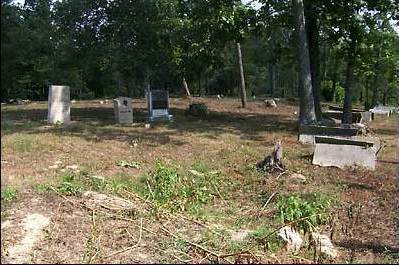
| Description | : | At the cemetery sign on Double Bridges road, pull over on the side of the road (there is no parking area) and proceed through the gate and a short distance up the old road bed to the top of the hill. Big Fork Cemetery began use not long after the Big Fork Baptist Church first opened for services in 1808. The Church, which ceased function around 1860, is no longer visible but if one looks closely you can still see signs of where it once stood. There are approximately 236 graves in the cemetery, with many easily recognizable local surnames,... Read More |
frequently asked questions (FAQ):
-
Where is Big Fork Cemetery?
Big Fork Cemetery is located at Double Bridges Road Cummingsville, Van Buren County ,Tennessee ,USA.
-
Big Fork Cemetery cemetery's updated grave count on graveviews.com?
0 memorials
-
Where are the coordinates of the Big Fork Cemetery?
Latitude: 35.8118820
Longitude: -85.4509890
Nearby Cemetories:
1. Cummingsville Cemetery
Van Buren County, USA
Coordinate: 35.8041992, -85.4617004
2. Haston Cemetery
Van Buren County, USA
Coordinate: 35.7997220, -85.4391670
3. Hodges Cemetery
Cummingsville, Van Buren County, USA
Coordinate: 35.8156013, -85.4768982
4. Gravel Hill Cemetery
Cummingsville, Van Buren County, USA
Coordinate: 35.8041992, -85.4261017
5. Cunningham Cemetery
White County, USA
Coordinate: 35.8277040, -85.4254390
6. Forsyth Cemetery
Cummingsville, Van Buren County, USA
Coordinate: 35.8007070, -85.4202780
7. Yates Cemetery
Van Buren County, USA
Coordinate: 35.7858009, -85.4278030
8. Vance Family Cemetery
Van Buren County, USA
Coordinate: 35.7831992, -85.4303945
9. Cold Hollow Cemetery
Van Buren County, USA
Coordinate: 35.8046870, -85.4950850
10. Hollingsworth Cemetery
Sparkman, Van Buren County, USA
Coordinate: 35.7994003, -85.4960022
11. Frasers Chapel Cemetery
White County, USA
Coordinate: 35.8266983, -85.3983002
12. Carter Drake Family Cemetery
Sweetgum, Van Buren County, USA
Coordinate: 35.7820350, -85.4062600
13. Sparkman Cemetery
Van Buren County, USA
Coordinate: 35.8074600, -85.5113840
14. Greenwood Cemetery
Doyle, White County, USA
Coordinate: 35.8436012, -85.4985962
15. Church of the Nazarene
Doyle, White County, USA
Coordinate: 35.8444440, -85.4980560
16. Bethlehem Cemetery
White County, USA
Coordinate: 35.8591995, -85.4777985
17. Stony Point Cemetery
Van Buren County, USA
Coordinate: 35.8028000, -85.5159000
18. Anderson Cemetery #02
White County, USA
Coordinate: 35.8274994, -85.5156021
19. Cumberland Heights Church of Christ Cemetery
Doyle, White County, USA
Coordinate: 35.8611110, -85.4855560
20. Doyle Cemetery
Doyle, White County, USA
Coordinate: 35.8464012, -85.5111008
21. Simon Dodson Cemetery
Van Buren County, USA
Coordinate: 35.7837778, -85.5176389
22. Spencer Town Cemetery
Spencer, Van Buren County, USA
Coordinate: 35.7494011, -85.4627991
23. Dodson Cemetery
Van Buren County, USA
Coordinate: 35.7832985, -85.5207977
24. Doyle Cemetery
Doyle, White County, USA
Coordinate: 35.8556700, -85.5164200