
| Memorials | : | 0 |
| Location | : | Mount Hermon, Monroe County, USA |
| Coordinate | : | 36.8068861, -85.8229667 |
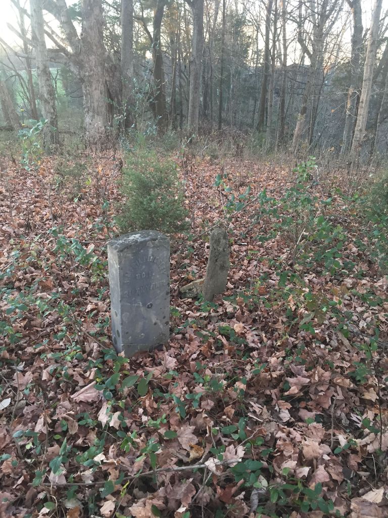
| Description | : | This cemetery is located behind the Mount Hermon Community Center in a wooded area. The only stone that remains (other than a field stone marker and another field stone that is either a corner stone or a headstone) is a military marker for J. M. Billingsley. The story is that the other stones have been removed and are stacked in a cave at the bottom of the hill located on Mennonite land. |
frequently asked questions (FAQ):
-
Where is Billingsley Cemetery?
Billingsley Cemetery is located at Mount Hermon, Monroe County ,Kentucky , 42157USA.
-
Billingsley Cemetery cemetery's updated grave count on graveviews.com?
0 memorials
-
Where are the coordinates of the Billingsley Cemetery?
Latitude: 36.8068861
Longitude: -85.8229667
Nearby Cemetories:
1. Monroe County Mennonite Church Cemetery
Mount Hermon, Monroe County, USA
Coordinate: 36.8081360, -85.8156870
2. Peden Cemetery #3
Freedom, Barren County, USA
Coordinate: 36.8288240, -85.8278780
3. Freedom Cemetery
Barren County, USA
Coordinate: 36.8288994, -85.8274994
4. Biggers Cemetery
Monroe County, USA
Coordinate: 36.8157997, -85.7928009
5. Martin Family Cemetery
Mount Hermon, Monroe County, USA
Coordinate: 36.7887000, -85.8515500
6. Lyon Cemetery
Barren County, USA
Coordinate: 36.8317132, -85.8516380
7. Poplar Log Cemetery
Freedom, Barren County, USA
Coordinate: 36.8419965, -85.8333921
8. Gray-Frazier Cemetery
Mount Hermon, Monroe County, USA
Coordinate: 36.8287730, -85.7837470
9. Payne Cemetery
Tompkinsville, Monroe County, USA
Coordinate: 36.8097000, -85.7703018
10. Atkinson Cemetery
Barren County, USA
Coordinate: 36.8382988, -85.8597031
11. Old Cedar Hill Church Cemetery
Monroe County, USA
Coordinate: 36.7822750, -85.7782920
12. Tyree Cemetery
Monroe County, USA
Coordinate: 36.7696991, -85.7930984
13. Bethlehem Cemetery
Mud Lick, Monroe County, USA
Coordinate: 36.7627650, -85.8098640
14. Old Bowles Burying Ground
Mount Hermon, Monroe County, USA
Coordinate: 36.7956800, -85.7661800
15. Smith Cemetery #7
Etoile, Barren County, USA
Coordinate: 36.8034130, -85.8877820
16. Whaley Family Cemetery
Freedom, Barren County, USA
Coordinate: 36.8458860, -85.8662760
17. Daniels Cemetery
Mud Lick, Monroe County, USA
Coordinate: 36.7562540, -85.8051570
18. McPherson Cemetery
Monroe County, USA
Coordinate: 36.8244019, -85.7561035
19. Peden Cemetery #4
Etoile, Barren County, USA
Coordinate: 36.8145670, -85.8952980
20. Mud Lick Cemetery
Monroe County, USA
Coordinate: 36.7523550, -85.7926750
21. Burgess Cemetery
Barren County, USA
Coordinate: 36.8218994, -85.8968964
22. New Salem-Turner Cemetery
Mud Lick, Monroe County, USA
Coordinate: 36.7459335, -85.8120651
23. County House Cemetery
Tompkinsville, Monroe County, USA
Coordinate: 36.7451750, -85.8283010
24. Flowers Slaves Cemetery
Lamb, Monroe County, USA
Coordinate: 36.7678588, -85.8833338