
| Memorials | : | 0 |
| Location | : | Clayton, Barbour County, USA |
| Coordinate | : | 31.9260998, -85.3858032 |
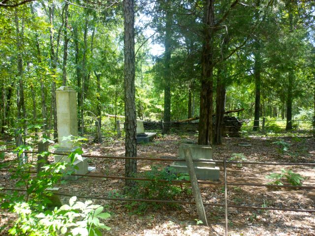
| Description | : | Both Bishop Family members and Blair Family members are buried here. The oldest visible gravestone in this cemetery is James B. Bishop, died 1850. Directions: Driving on Clayton Hwy. (State Road 30) between Clayton and Eufaula, Barbour Co., AL; take County Road 79 North toward White Oak Station. Drive through White Oak Station and turn first left onto County Road 28. Then turn right onto the first dirt road. Continue on this dirt road for approximately. 1 mile. Bishop-Blair Cemetery will be on the left in a wooded area adjacent to a... Read More |
frequently asked questions (FAQ):
-
Where is Bishop-Blair Cemetery?
Bishop-Blair Cemetery is located at Clayton, Barbour County ,Alabama ,USA.
-
Bishop-Blair Cemetery cemetery's updated grave count on graveviews.com?
0 memorials
-
Where are the coordinates of the Bishop-Blair Cemetery?
Latitude: 31.9260998
Longitude: -85.3858032
Nearby Cemetories:
1. White Oak Cemetery
Clayton, Barbour County, USA
Coordinate: 31.9165610, -85.3753460
2. Jacksonville Cemetery
Barbour County, USA
Coordinate: 31.9333000, -85.4253006
3. Tabernacle AME Church Cemetery
Mount Andrew, Barbour County, USA
Coordinate: 31.9148430, -85.3394130
4. Perkins-Evans Cemetery
Barbour County, USA
Coordinate: 31.9102993, -85.3375015
5. Beauchamp Family Cemetery
White Oak, Barbour County, USA
Coordinate: 31.9058333, -85.3363889
6. Mount Olive Cemetery
Clayton, Barbour County, USA
Coordinate: 31.9094009, -85.4375000
7. Rapture City Cemetery
Barbour County, USA
Coordinate: 31.8798130, -85.3429530
8. Mount Serene Cemetery
Barbour County, USA
Coordinate: 31.8792000, -85.3386002
9. Lightner Family Cemetery
Clayton, Barbour County, USA
Coordinate: 31.8769950, -85.4347100
10. Pioneer Cemetery
Clayton, Barbour County, USA
Coordinate: 31.8814490, -85.4482430
11. Shiloh AME Church Cemetery
White Oak, Barbour County, USA
Coordinate: 31.8838780, -85.3209010
12. Clayton City Cemetery
Clayton, Barbour County, USA
Coordinate: 31.8803024, -85.4499817
13. Cunningham Cemetery
Barbour County, USA
Coordinate: 31.8957996, -85.3080978
14. New Mount Silla Baptist Church Cemetery
Barbour County, USA
Coordinate: 31.9925270, -85.4488170
15. Mariana AME Church Cemetery
Clayton, Barbour County, USA
Coordinate: 31.9208700, -85.4879480
16. Union Baptist Church Cemetery
Clayton, Barbour County, USA
Coordinate: 31.8393993, -85.3993988
17. Warren Cemetery
Clayton, Barbour County, USA
Coordinate: 31.8710995, -85.4831009
18. Saint Paul Baptist Church Cemetery
Clayton, Barbour County, USA
Coordinate: 31.8246600, -85.3598800
19. Old Batesville Church Cemetery
Barbour County, USA
Coordinate: 32.0078011, -85.3091965
20. Pleasant Plains Cemetery
Clayton, Barbour County, USA
Coordinate: 31.8318996, -85.4403000
21. Friendship Cemetery
Barbour County, USA
Coordinate: 32.0069008, -85.3050003
22. New Bethel Cemetery
Barbour County, USA
Coordinate: 31.8222008, -85.3401031
23. Mount Mariah Baptist Church Cemetery
Clayton, Barbour County, USA
Coordinate: 31.8110980, -85.4002290
24. Sardis Cemetery
Baker Hill, Barbour County, USA
Coordinate: 31.8677998, -85.2632980