
| Memorials | : | 1 |
| Location | : | Pennington County, USA |
| Coordinate | : | 44.0865000, -103.2263600 |
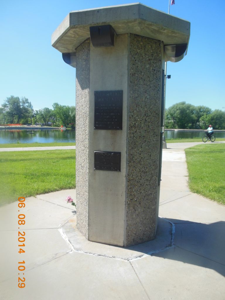
| Description | : | The 1972 Rapid City/Black Hills Flood Those of us who lived through that horrible night will never forget—and we hope that others will be prompted to remember the date of June 9, 1972. The morning of June 9th dawned with a humid and foggy haze covering much of the eastern Black Hills and plains to the east. That hot, humid Friday in early June eventually turned into a night that Black Hills residents would never forget; a night in which over 230 persons would not survive. A large area of very heavy thunderstorms formed throughout the afternoon and evening in the... Read More |
frequently asked questions (FAQ):
-
Where is Black Hills Flood Memorial?
Black Hills Flood Memorial is located at Pennington County ,South Dakota ,USA.
-
Black Hills Flood Memorial cemetery's updated grave count on graveviews.com?
1 memorials
-
Where are the coordinates of the Black Hills Flood Memorial?
Latitude: 44.0865000
Longitude: -103.2263600
Nearby Cemetories:
1. Emmanuel Episcopal Church Memorial Garden
Rapid City, Pennington County, USA
Coordinate: 44.0782000, -103.2310000
2. Mountain View Cemetery
Rapid City, Pennington County, USA
Coordinate: 44.0657997, -103.2596970
3. Mount Calvary Cemetery
Rapid City, Pennington County, USA
Coordinate: 44.0628014, -103.2583008
4. Rapid City Indian School Cemetery
Rapid City, Pennington County, USA
Coordinate: 44.0755970, -103.2719060
5. Evergreen Cemetery
Rapid Valley, Pennington County, USA
Coordinate: 44.0731000, -103.1723000
6. Pine Lawn Memorial Park
Rapid City, Pennington County, USA
Coordinate: 44.0410995, -103.2472000
7. William Coogan Gravesite
Rapid City, Pennington County, USA
Coordinate: 44.0980340, -103.1526090
8. Saint Martin Monastery Cemetery
Rapid City, Pennington County, USA
Coordinate: 44.1036150, -103.3042360
9. Blackhawk Cemetery
Black Hawk, Meade County, USA
Coordinate: 44.1436005, -103.3063965
10. Elk Vale Cemetery
Meade County, USA
Coordinate: 44.2243996, -103.1500015
11. Rockerville Cemetery
Rockerville, Pennington County, USA
Coordinate: 43.9681015, -103.3572006
12. Piedmont Cemetery
Piedmont, Meade County, USA
Coordinate: 44.2425780, -103.3871730
13. Hayward Cemetery
Pennington County, USA
Coordinate: 43.8879500, -103.3511800
14. Nemo Cemetery
Nemo, Lawrence County, USA
Coordinate: 44.1872800, -103.5066410
15. Harney City Cemetery
Harney, Pennington County, USA
Coordinate: 43.8908000, -103.3887800
16. Keystone Cemetery
Keystone, Pennington County, USA
Coordinate: 43.8835983, -103.4147034
17. Highland Park Cemetery
Hermosa, Custer County, USA
Coordinate: 43.8386750, -103.2044510
18. Pleasant Valley Cemetery
Tilford, Meade County, USA
Coordinate: 44.3192500, -103.3531160
19. Larsen Cemetery
Pennington County, USA
Coordinate: 43.9655991, -102.8783035
20. New Underwood Cemetery
New Underwood, Pennington County, USA
Coordinate: 44.0970192, -102.8247604
21. Viewfield Cemetery
Viewfield, Meade County, USA
Coordinate: 44.1925011, -102.8497009
22. Hill City Cemetery
Hill City, Pennington County, USA
Coordinate: 43.9366270, -103.5789730
23. McGillycuddy Monument
Pennington County, USA
Coordinate: 43.8865110, -103.5670850
24. Old Iowa Settlement Cemetery
Pennington County, USA
Coordinate: 43.9949989, -102.8000031