
| Memorials | : | 19 |
| Location | : | Caney, Montgomery County, USA |
| Coordinate | : | 37.0197000, -95.8739800 |
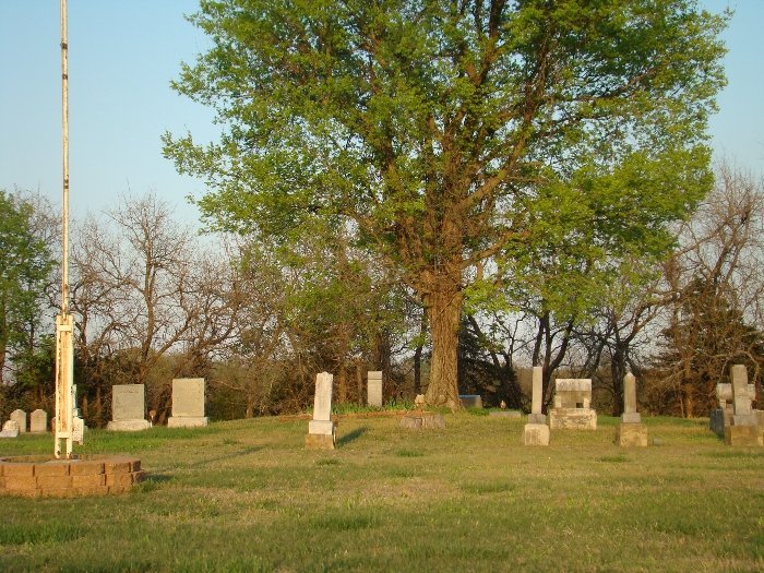
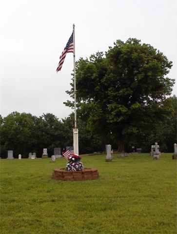
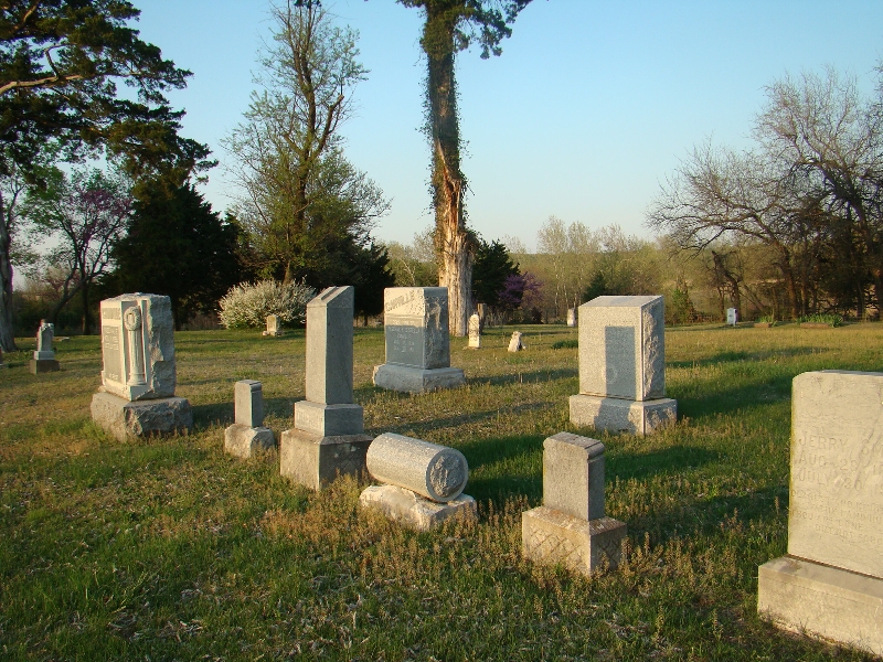
| Description | : | Located on 2100 Road south of 1600 Road. Also south of US 166 Hwy on 2100 Road. This is a small cemetery that began when a wagon train passed and had to bury someone. It was originally called the Wagon Trail Cemetery. Later it became the Black Jack Cemetery which it is called today. There is no fence on the front of the cemetery, most of the stones date the late 1800's and early 1900's. The only recent stone is the burial of Carl Wayne Barnes, SSG US ARMY, in Dec. 2005. The cemetery is kept up... Read More |
frequently asked questions (FAQ):
-
Where is Black Jack Cemetery?
Black Jack Cemetery is located at Caney, Montgomery County ,Kansas ,USA.
-
Black Jack Cemetery cemetery's updated grave count on graveviews.com?
12 memorials
-
Where are the coordinates of the Black Jack Cemetery?
Latitude: 37.0197000
Longitude: -95.8739800
Nearby Cemetories:
1. Trinity Lutheran Cemetery
Tyro, Montgomery County, USA
Coordinate: 37.0266991, -95.8371964
2. Sunnyside Cemetery
Caney, Montgomery County, USA
Coordinate: 37.0181007, -95.9291992
3. Webb Cemetery
Tyro, Montgomery County, USA
Coordinate: 37.0736200, -95.8591100
4. Pioneer Cemetery
Tyro, Montgomery County, USA
Coordinate: 37.0392500, -95.8008000
5. Gorham Cemetery
Caney, Montgomery County, USA
Coordinate: 37.0223200, -95.9646100
6. Swingin' B Ranch Cemetery
Coffeyville, Montgomery County, USA
Coordinate: 37.0072900, -95.7836500
7. Fawn Creek Cemetery
Tyro, Montgomery County, USA
Coordinate: 37.0667000, -95.8016968
8. Havana Cemetery
Havana, Montgomery County, USA
Coordinate: 37.0941760, -95.9417470
9. West Brown Cemetery
Dearing, Montgomery County, USA
Coordinate: 37.0549800, -95.7475000
10. Ireland Cemetery
Niotaze, Chautauqua County, USA
Coordinate: 37.0402412, -96.0102081
11. Fairview Cemetery
Niotaze, Chautauqua County, USA
Coordinate: 37.0574989, -96.0061035
12. Harrisonville Cemetery
Bolton, Montgomery County, USA
Coordinate: 37.1315100, -95.8146800
13. Haynes Cemetery
Niotaze, Chautauqua County, USA
Coordinate: 37.0366096, -96.0247192
14. Busby Cemetery
Copan, Washington County, USA
Coordinate: 36.9044400, -95.9241600
15. Robbins Cemetery
Coffeyville, Montgomery County, USA
Coordinate: 37.0339012, -95.7192001
16. Wann Cemetery
Wann, Nowata County, USA
Coordinate: 36.9030991, -95.8078003
17. Jefferson Cemetery
Montgomery County, USA
Coordinate: 37.1039009, -95.7469025
18. Mooney Cemetery
Niotaze, Chautauqua County, USA
Coordinate: 37.0581207, -96.0434189
19. Otter Creek Cemetery
Chautauqua, Chautauqua County, USA
Coordinate: 37.1021500, -96.0241089
20. Hillsdale Cemetery
Chautauqua County, USA
Coordinate: 37.1472015, -95.9841995
21. Elcado Cemetery
Peru, Chautauqua County, USA
Coordinate: 37.0078011, -96.0736008
22. Labadie Cemetery
Bowring, Osage County, USA
Coordinate: 36.9118780, -96.0237350
23. Steward Cemetery
Nowata County, USA
Coordinate: 36.8944016, -95.7300034
24. Rutland Cemetery
Independence, Montgomery County, USA
Coordinate: 37.1963997, -95.9008026