
| Memorials | : | 2 |
| Location | : | Nesmith, Williamsburg County, USA |
| Coordinate | : | 33.6205300, -79.4456000 |
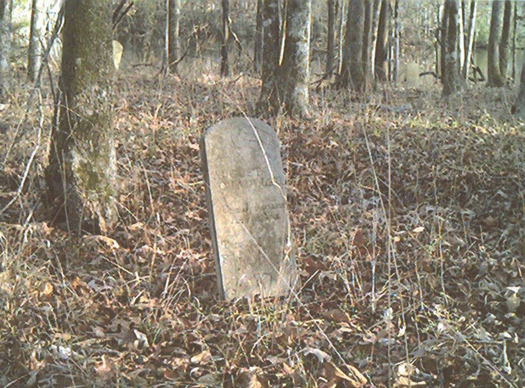
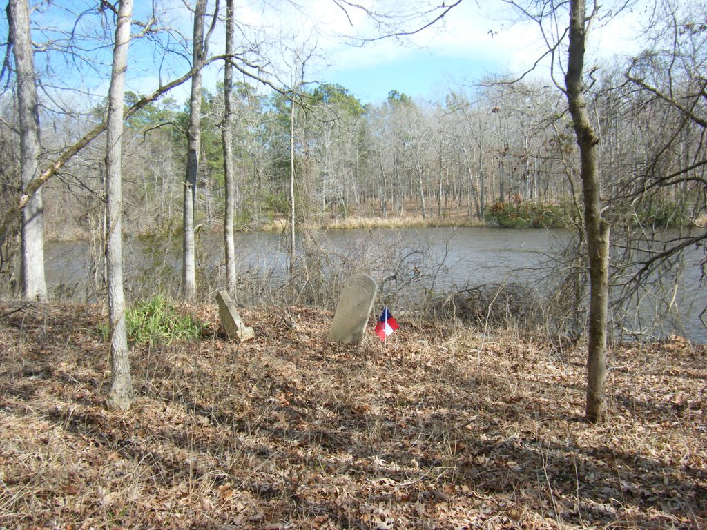
| Description | : | This graveyard has also been referred to as The Millpond,but this leads to confusion as there is another cemetery in the area that goes by the same name. In many death certificates this place is referred to as simply , Morrisville. This is an old African American graveyard a few yards from Black Mingo Baptist Church Cemetery and bordering Jack's Creek. It is on private property of which used to be part of "Old Willtown". There are only a few grave stones, but many unmarked graves. This is not the Slave Graveyard directly behind Black Mingo Baptist Cemetery. This graveyard... Read More |
frequently asked questions (FAQ):
-
Where is Black Mingo Jack's Creek Millpond Graveyard?
Black Mingo Jack's Creek Millpond Graveyard is located at Near Rhems Crossroads Nesmith, Williamsburg County ,South Carolina ,USA.
-
Black Mingo Jack's Creek Millpond Graveyard cemetery's updated grave count on graveviews.com?
2 memorials
-
Where are the coordinates of the Black Mingo Jack's Creek Millpond Graveyard?
Latitude: 33.6205300
Longitude: -79.4456000
Nearby Cemetories:
1. Black Mingo Cemetery
Williamsburg County, USA
Coordinate: 33.6194000, -79.4480972
2. McConnell Cemetery
Nesmith, Williamsburg County, USA
Coordinate: 33.6230980, -79.4480670
3. Greater Mount Ararat Cemetery
Nesmith, Williamsburg County, USA
Coordinate: 33.6142200, -79.4524700
4. Red Hill Cemetery at Burnett Swamp
Nesmith, Williamsburg County, USA
Coordinate: 33.6315490, -79.4619440
5. Red Hill Cemetery
Georgetown County, USA
Coordinate: 33.5958360, -79.4425890
6. Union Methodist Cemetery
Georgetown County, USA
Coordinate: 33.6380997, -79.4242020
7. Saint Lukes AME Church Cemetery
Georgetown County, USA
Coordinate: 33.6213913, -79.4112015
8. Mount Ararat Cemetery
Nesmith, Williamsburg County, USA
Coordinate: 33.6031280, -79.4732440
9. Moore Family Graveyard
Rose Hill, Georgetown County, USA
Coordinate: 33.5925200, -79.4176370
10. Powell Family Cemetery
Hemingway, Williamsburg County, USA
Coordinate: 33.6566530, -79.4323090
11. Saint Johns Church Cemetery
Andrews, Williamsburg County, USA
Coordinate: 33.6055580, -79.4921400
12. Chandler Cemetery
Nesmith, Williamsburg County, USA
Coordinate: 33.6283110, -79.4980350
13. Dorsey Family Cemetery
Nesmith, Williamsburg County, USA
Coordinate: 33.6362000, -79.4956500
14. Pressley Family Cemetery
Nesmith, Williamsburg County, USA
Coordinate: 33.6282700, -79.4984300
15. Rose Hill Cemetery
Georgetown, Georgetown County, USA
Coordinate: 33.5927880, -79.4013580
16. Saint Paul United Methodist Church Cemetery
Nesmith, Williamsburg County, USA
Coordinate: 33.6059270, -79.4992970
17. Cooper's Field Cemetery
Nesmith, Williamsburg County, USA
Coordinate: 33.6325486, -79.5009175
18. Snow Cemetery
Morrisville, Williamsburg County, USA
Coordinate: 33.6051590, -79.5007110
19. Saint James Holiness Church Cemetery
Pleasant Hill, Georgetown County, USA
Coordinate: 33.6570100, -79.4070900
20. Barnes Cemetery
Andrews, Williamsburg County, USA
Coordinate: 33.5716960, -79.4381910
21. Saint Matthew's Churchyard
Georgetown County, USA
Coordinate: 33.6547290, -79.4007740
22. Cribb-Burrows Cemetery
Pleasant Hill, Georgetown County, USA
Coordinate: 33.6615360, -79.4033380
23. Hopewell AME Church Cemetery
Georgetown County, USA
Coordinate: 33.6709870, -79.4153680
24. John Cribb Family Cemetery
Pleasant Hill, Georgetown County, USA
Coordinate: 33.6546380, -79.3913270